Vancouver (BC), Canada – It stretches
from one side of Canada to the other. It reaches from the Pacific to the Atlantic.
It crosses water without bridges. It runs through valleys so steep only mountain
goats and sheep live there. It runs through land so flat one could watch their
dog run away for days. It passes forest so dense one could get lost five feet
from the road.
But most importantly, it passes through every major mountain
range in Western Canada.
n
|
The Trans Canada (Photo: Government of Alberta) |
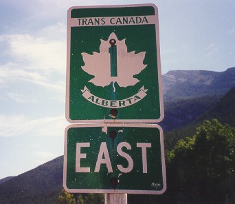
This is the Trans Canada Highway, or for those in the know,
the Trans Canada SnowWay. This snowy ribbon of asphalt ripples and rolls through
the Coast Range, the Cascades, the Shuswap Highlands, the Monashees, the Selkirks
and finally the Rockies. It passes no less than 12 ski hills, several motorized
backcountry ski operations, and countless human powered backcountry destinations.
While there are better known snowriding roadtrips in BC and Alberta - for
example, Highway 3 that hits Fernie, Whitewater, Red Mountain and others -
this trip hits some of the biggest hills and some tiny powder stashes. Besides,
it makes the perfect connection to the Highway 3 trip, creating one of the
best ski road trip loops imaginable.
For the skiing or snowboarding roadtripper, it all begins in
Calgary or Vancouver. Vancouver: neon green grass, cherry blossoms in full
bloom, roller bladers in the park and waves lapping on the beach. It hardly
makes for an auspicious start to a skiing roadtrip, but nonetheless it is
April. The ferry spits the car out in Horseshoe Bay, the western end of the
mainland Canada’s Trans Canada Highway. The Trans Canada at this point is
already 60 plus miles old, having started in Victoria and run up part of Vancouver
Island before jumping across the Strait of Georgia, via ferry, to Horseshoe
Bay.
Above Vancouver, the lights were on at Cypress, Grouse and Seymour.
This trio of commuter ski hills allows Vancouverites to work all day and ski
all night. They are so close to town, 20 minutes from base area to downtown,
that true powder hounds will rip up to the hills first thing on powder days,
get a few turns and then get to work before lunch. These hills are not big,
or high. They occasionally get rain, but they also get tons of snow. Wet weather
blows off the Pacific and slams into cold air blowing out of the interior
of the province. The collision happens right over Vancouver’s North Shore.
These hills are fun playgrounds for a morning, afternoon or evening of snowy
fun, especially considering how close they are to the city.
Driving out of Vancouver on the TCH, the lights of the three
city hills shine bright until the highway turns east down the Fraser Valley.
It’s time to sit back and watch the city slowly disappear. Suburbs give way
to farms, farms give way to forest and, just before Hope, the mighty Fraser
River fills the valley.
Here the Trans Canada takes a turn to the north, hugging the
Fraser River through a canyon before heading east to Kamloops, but snow-loving
folk should head northeast on Highway 5 over the Coquihalla Pass. This high
mountain road not only cuts a faster and straighter line to Kamloops, but
it also tops out in a high pass full of deep snow. The backcountry skiing
here is deep and easily accessible. Most Coast Mountain and Cascade Range
ski tours involve lengthy approaches up logging roads and through the bush
to reach the alpine bowls and winter snows. Here, though, the highway does
all the work. Check out Needle Peak, a nice one-day tour in the Coquihalla
Pass area. Plenty of yo-yoing or the opportunity for a longer trip is possible.
|
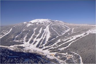
Sun Peaks Resort rises high above the Trans Canada
Driving the TCH through Rogers Pass |

When the knees get weak and the light begins to wane, hit the
road toward Kamloops. Kamloops is the biggest town in the interior of BC.
It is a hub for shopping, living and transportation. From here, highways go
off in almost every direction: south to the Okanagan, west to the coast, north
to Prince George, east toward Calgary and northeast to Jasper and Edmonton.
Like all hubs and towns in western Canada, Kamloops has its own ski hill.
It’s hard to imagine when surveying the almost desert-like surrounds of Kamloops.
There is no snow and everything is desert brown. But there are a few sure
things in BC and mountains are one of them. Just to the northeast, the Shuswap
Highlands roll towards the Monashees. Tucked up a logging road here is Sun
Peaks Resort, only 45 minutes from Kamloops.
Returning to the dry Thompson River Valley and eventually Kamloops,
the expanded TCH awaits to whisk skiers deeper into the interior. The storms
that douse the North Shore and Coquihalla Pass dry out on their way down into
Kamloops. They then sock up again as they funnel up the valleys of the Monashees
and then the Selkirks. This is big snow and big mountain country, and Revelstoke
is its capital.
Heli-skiing, ski touring and cat-skiing companies are all based
out of Revelstoke. It is world renowned for snowmobiling. Without a big population
base it fails to hold a resort ski hill, not that the terrain isn’t there.
Instead, Powder Springs at Mt. McKenzie is where the locals flock. It¹s the
epitome of a Little Area that Rocks where you’ll find two lifts, 10
runs, easily accessible backcountry and tons of snow. What more could anyone
ask for?
This big snow country is most easily accessible to the average,
broke ski bum at Rogers Pass. This is backcountry skiing’s Mecca. Avalanche
guns line the highway, tunnels protect cars and the snowdrifts are reminiscent
of bunkers. It feels more like the Khyber Pass than a ski touring destination.
Rightly so, as this stretch of highway sees a yearly war of man against snow.
It is the most expensive piece of highway to maintain in the world.
Rogers Pass spits cars and trucks out in the Columbia Valley,
near the British Columbia town of Golden. Here, the U-shaped corridor separates
the Rocky Mountains on one side from the Dogtooth Range of the Selkirks on
the other. Huge monoliths of white line either side of the highway. Three
years ago, Whitetooth ski hill was the local hill. When it snowed the hill
was fun, but when it didn¹t the backcountry was a five-minute skin from the
top of the lift. And what a backcountry it was, ridge after ridge, peak after
peak of perfectly pitched powder-catching bowls.
Now all that skiing is accessible by lift. Kicking Horse Mountain
Resort is big, the vertical is huge, the runs wide open, the acreage goes
on forever and there is even more backcountry to explore. Across the valley,
the TCH disappears up a narrow valley towards the namesake of the ski area.
Up the Kicking Horse Canyon the TCH climbs again for its final rise.
The pass was named by the first European to visit the area.
His unruly horse gave him a swift kick to the … well, it kicked him, and
the name took. From Kicking Horse Pass it’s all downhill to Québec
and the Maritimes.
From Field on, there are endless opportunities for ski touring.
The high elevation and cold weather make for dry snowpacks and late season
snow. Ski touring destinations leave from the highway to all kinds of runs,
including some that overlook the Lake Louise ski hill in Alberta.
|
The front face of Lake Louise (Photo: Marc Guido)
Sunshine Village (Photo: Marc Guido)
Stunning views line the Trans Canada
Steep bowls line Castle Mountain’s south face. (Photo:
Looking down into the town of Fernie |


Lake Louise is a behemoth of a mountain. It reigns supreme as
one of the largest ski hills in North America and holds the title for best
views. In every direction on a clear day, 11,000-foot summits of rock, snow
and ice rise. Four thousand-foot walls of rock are everywhere. When it snows,
it falls as diamonds of dust that hang in the air with every turn. The infamous
backbowls are wide open, steep and deep. Its neighboring hill, Sunshine Village
gets more snow. But its runs lack the fall line aesthetics of Lake Louise.
Sunshine also has great views, dominated by Mt. Assiniboine,
the Matterhorn of the Rockies. It too has steep terrain, namely Delirium Dive.
Delirium was a closed bowl of steep chutes, rocks and cornices until a few
years ago. The ski patrol opened the bowl, but to enter riders have to have
a beacon, probe, shovel, partner and the knowledge to use it all. The terrain
is patrolled, but when it’s this steep, not even the patrol can control it.
By now, the TCH is beginning to feel the effects of five mountain
ranges. The air has been wrung dry of all that Pacific moisture. By the time
the highway passes Banff there is little snow on the ground. Above Banff is
the heaven of Mt. Norquay. Groomers spill off its Mystic Ridge area. The Lone
Pine Chair calls to mogul lovers from high above town. The views atop this
little area look over Banff and Canmore and out almost to the prairies.
By now the SnowWay is beginning to brown out, but there are
two more mountains to hit. Nakiska and Fortress are hidden in the Kananaskis.
Nakiska held the 1988 Olympic alpine skiing events. Its arsenal
of snowmaking allows it to open weeks before any other resort to provide training
for Canada¹s alpine skiers, and that solid base allows for skiing well into
the spring. This is the spot to hit when the upslope winds begin. Storms blowing
off the prairies hit the usually dry Rocky Mountain foothills. The moist airmass
cools, condenses and dumps. The foothills get nailed, Nakiska takes the storm
head on, Fortress gets pounded and Sunshine and Lake Louise get a trace. When
this happens, skiers in the know head to Nakiska’s open runs or drive a little
further to the powder filled trees of Fortress.
Fortress’ three mountain sides allow for good powder skiing
no matter what the weather is doing. The thinned trees catch copious quantities
of snow and the small hill remains empty even after big dumps.
Backtracking to the Trans Canada, the trip is almost over. The
prairies spread out in front, the Rockies shrink behind. This could be an
ending or a beginning. It could be half way. Take a right here, and Castle
Mountain, Fernie and the rest of Highway 3 is just two hours away.
Coasting into Calgary there is one more chance for turns. Ironically
this hill is the closest to the Trans Canada Highway of all the hills, yet
the mountains are no longer visible. Canada Olympic Park has everything from
90-meter ski jumps to a bobsled track. It also has two ski lifts and an international
sized half pipe. Local riders will ride here all night just as they do in
Vancouver. Taking a lift to the top reveals Alberta. Prairies on one side,
oil wells in the distance, cattle grazing in the woods and the TCH leading
to the mountains on the other. And there, just over the mountains, the clouds
begin to build as yet another storm has crossed BC. In its wake, a new blanket
of snow covers every mountain from the North Shore to the Kananskis. And who
knows … maybe it will hit Canada Olympic Park, too. Whether or not it does
matters little. The Trans Canada SnowWay is primed for another road trip of
epic proportions.