Western Weather 2015-16

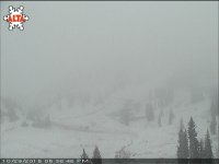
Tons of rain in the front range for 2 days in a row and some small but needed dumps in the mountains (mostly 3-6" or less), but also cold enough to blow snow the past couple days at the highest resorts (above ~11K feet altitude)...

Late by a month but finally getting a decent start in Colorado.
 
Yeah, we got a dusting again at elevation this week in Utah, but it was melting as I looked at the webcam.
 
Starting to look more impressive than expected. Still supposed to warm up a bit this weekend which will melt most of it I suspect.

lvd snow.jpg


lvd snow2.jpg
 
EMSC":3j1cdvqw said:
Starting to look more impressive than expected. Still supposed to warm up a bit this weekend which will melt most of it I suspect.

Until it gets cold and stays that way, that's probably a good thing as we don't need another year with a sketchy depth hoar layer.
 
Tony Crocker":11v30ar3 said:
admin":11v30ar3 said:
sketchy depth hoar layer.
That's standard operating procedure in Colorado. :stir:

That's about an 80-90% accurate assessment.

We do occasionally get a year without such sketchiness. I am somewhat hopeful that this will be one of those years given the lack of snow till now. Even if it warms up (mid- 60's here in the flat-lands so ~50ish @ base of many mtns), some of the north facing won't melt from a 6-8" or more snowfall. So hope that it doesn't get too warm, and 2 possible storms next week could help prevent a big hoar layer, etc... Only time will tell.
 
Not melting isn't the problem. All it takes is a week or two of very cold temperatures with no new snow in November or December and the brittle layer will form on the thin base being put down now.
 
Tony Crocker":326o6gj3 said:
Not melting isn't the problem. All it takes is a week or two of very cold temperatures with no new snow in November or December and the brittle layer will form on the thin base being put down now.

=D> Very true.

Which is why you want these early snows to melt out. Once it starts falling on a regular basis, you want it to start doing so on bare ground. In dry areas like the Wasatch, what these early storms are good for is saturating the ground before it freezes.
 
jamesdeluxe":3m783r03 said:
Admin":3m783r03 said:
=D> Very true.
You seemed surprised to agree with him. 8)

You mean that you didn't feel the earth shift on its axis about a half a degree?

My surprise is more that he actually retained something about snowpack analysis and avalanche awareness. Now I just need to start seeing some real-world application. :lol:
 
admin":llb3h79g said:
My surprise is more that he actually retained something about snowpack analysis and avalanche awareness. Now I just need to start seeing some real-world application. :lol:
Admin seems to forget that my first trip after retiring in 2010 was to the 5-day International Snow Science Workshop in Squaw Valley. And no, I'm not claiming that qualifies as in-the-field training.
 
Tony Crocker":aba0gvv5 said:
admin":aba0gvv5 said:
My surprise is more that he actually retained something about snowpack analysis and avalanche awareness. Now I just need to start seeing some real-world application. :lol:
Admin seems to forget that my first trip after retiring in 2010 was to the 5-day International Snow Science Workshop in Squaw Valley. And no, I'm not claiming that qualifies as in-the-field training.

As evidenced by your lack of situational awareness when I bring you out of bounds. Or your trip to Zermatt. :shock:
 
The next week is looking mighty promising around here:http://forecast.weather.gov/MapClick.php?lat=40.576625&lon=-111.641024&site=bou&smap=1&marine=0&unit=0&lg=en

Tonight
A 50 percent chance of snow showers. Mostly cloudy, with a low around 25. North wind 11 to 15 mph. Total nighttime snow accumulation of 1 to 2 inches possible.
Friday
Mostly sunny, with a high near 31. North wind 6 to 13 mph.
Friday Night
Mostly cloudy, with a low around 27. West wind around 9 mph.
Saturday
Partly sunny, with a high near 38. West southwest wind 7 to 9 mph.
Saturday Night
Partly cloudy, with a low around 32. South southwest wind 11 to 14 mph.
Sunday
Partly sunny, with a high near 41.
Sunday Night
A 30 percent chance of snow. Cloudy, with a low around 33. New snow accumulation of less than a half inch possible.
Monday
Snow. Cloudy, with a high near 38.
Monday Night
Snow. Cloudy, with a low around 24.
Tuesday
Snow likely. Cloudy, with a high near 31.
Tuesday Night
A chance of snow showers. Cloudy, with a low around 18.
Wednesday
A chance of snow showers. Cloudy, with a high near 27.
Wednesday Night
A chance of snow showers. Cloudy, with a low around 16.
Thursday
A chance of snow showers. Cloudy, with a high near 27.
 
Not sure that 1-3 inches moves the needle much. As noted in another thread it's better for snow stability for the season to stay dry and then start off with a big bang.
 
Tony Crocker":2280j3g9 said:
Not sure that 1-3 inches moves the needle much. As noted in another thread it's better for snow stability for the season to stay dry and then start off with a big bang.

That's only if it stays cold and dry. With this prolonged cold and wet pattern, this may be the start we need. [-o<
 
It's a beautiful day from the Salt Lake Valley today.
 

Attachments

  • 20151031_153454~01.jpg
    20151031_153454~01.jpg
    83.4 KB · Views: 10,161
Back
Top