How do you find a hike within 10 miles of the edge of an urban area of 1.5 million, on the Saturday of July 4th weekend, that is absolutely devoid of any other people? You pick one with a trailhead that's at the end of a rough 4x4 trail:
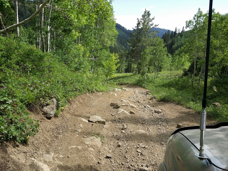
FR-198 in American Fork Canyon
I've been spending an inordinate amount of time in American Fork this summer -- four times in the past two weeks, in fact, including a 4x4 trail run to Forest Lake two weeks ago, and a hike to Silver Lake last weekend:

Jake retrieves a stick from Silver Lake

Silver Lake Flat Reservoir
On Thursday night Skidog and I headed up there with his 5-year-old daughter and my dog for an overnight camp at Dutchman Flat, near the ghost town of Forest City:

Our camp
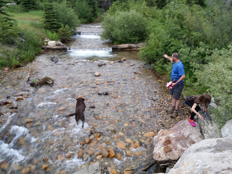
Playing in the American Fork River
Today, AmyZ and I decided to try something different. Many folks know that dogs are illegal in Little Cottonwood Canyon due to its status as a watershed, so I've never been able to take Jake along when hiking in Alta. However, that doesn't prevent someone from bringing a dog up to the canyon's ridgeline, as long as the dog doesn't descend into LCC itself. On a topo map I found FR-198, a dead-end jeep trail that runs from the floor of AF Canyon to a point about 1,800 vertical feet below the top of Alta's Supreme Lift. AF Canyon isn't watershed. If I could get my truck to the top of the road it would be barely over two miles to reach Point Supreme.
My three-day recreation permit from Thursday night was still valid, so we bypassed the fee booth as we drove up the canyon to Tibble Fork Reservoir, where I once again aired down my tires for the bumpy dirt road ahead. About 8 miles or so up canyon the trail to Mineral Basin splits up from FR-85, the main road up the canyon floor, and shortly thereafter the trail up FR-198 splits right off the Mineral Basin trail.
The road up Alta Dry Fork was bumpy and rocky, but not terribly difficult. I only hit the front skid plate once, and that was on the descent. Along the road we passed one other Tacoma, two ATVs and two dirt bikes, and in short order we found ourselves as the only vehicle at the trailhead gate at the end of the road.

At the trailhead
The trail starts off very steeply for the first hundred yards or so before quickly mellowing. Despite the altitute ranging from 8,800-10,700 feet the blazing sun was unbearably hot, and this south-facing aspect offers few trees for shade. It was in the mid-90s in the Salt Lake Valley today, and it felt like every bit of that up there even though the thermometer argued that it was somewhat cooler.
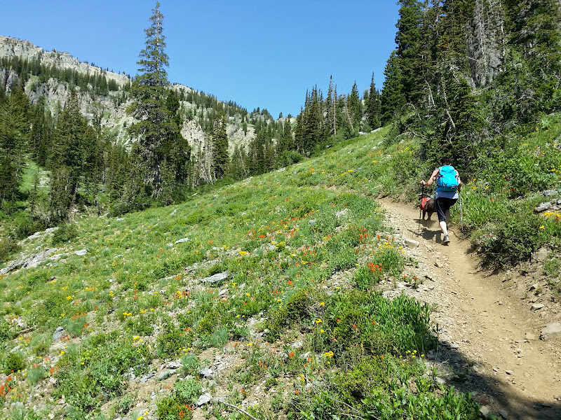
AmyZ and Jake head up

Looking back down Alta Dry Fork during the hike
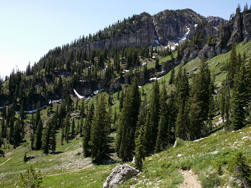
Snow on the ridge separating Alta Dry Fork from Mineral Basin

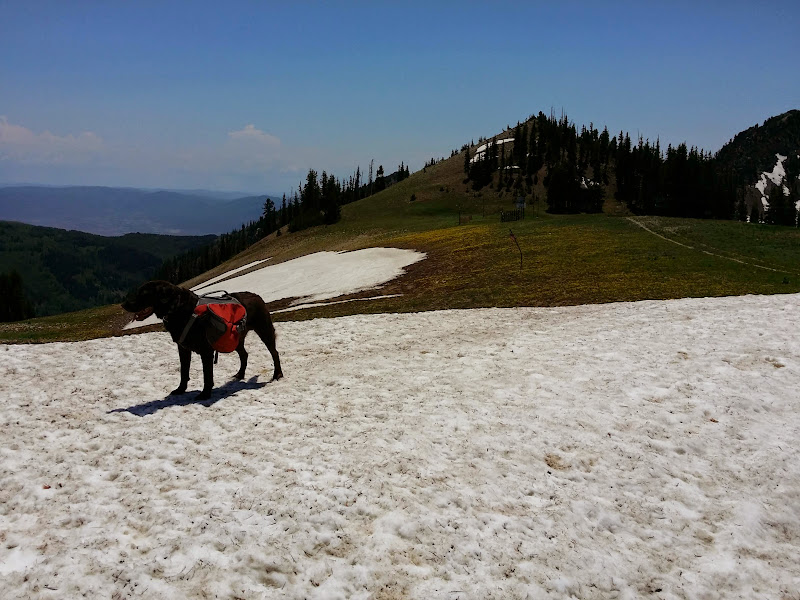
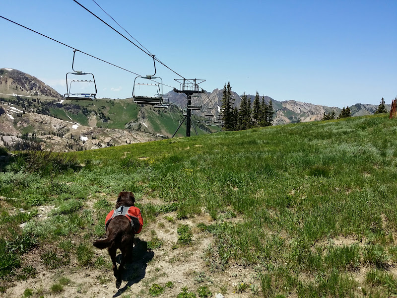
The bullwheel of Alta's Supreme Lift is visible along the low point of the ridgeline
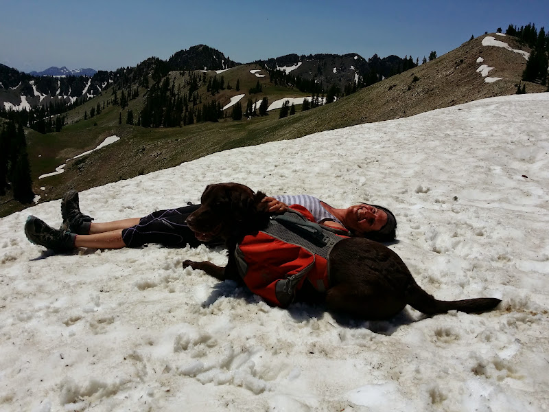
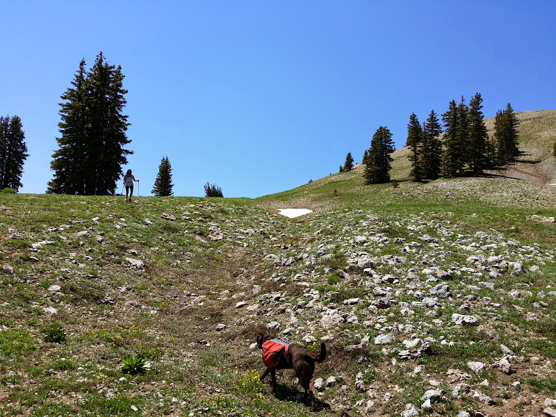
It was so hot, in fact, that both AmyZ and Jake saw every patch of snow as an opportunity to cool off
We made the ridgeline, then followed the winter traverse to the top of Supreme, where we hung out in the shade of the patrol shack to eat lunch.
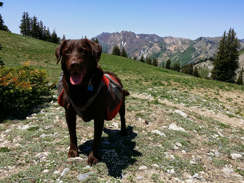
Jake's first-ever photo "in Alta." That's Snowshoe Hill in Catherine's Area in the background. He can now wear his Alta collar with pride!
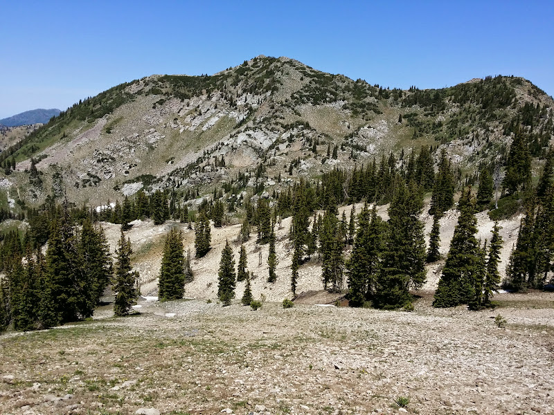
Anyone who's ever followed me in Catherine's knows the Sunset run well.

The Spiny Chutes
At the top of Supreme
At the top of Supreme

Retrieving a ski patrol caution disc at the top of Supreme
After lunch we decided to avoid the top of the return trail in favor of heading overland down behind the lift to rejoin the trail father down.
Going trail-less
And before long we were back at the truck
The only people we saw during the entire hike were at the top of Catherine's Area. They had come up from the Alta side and were headed for Sunset Peak. We never saw a single other soul on our entire ascent or descent from the truck to the ridgeline, nor did we see anyone at all during our entire vehicle descent of the road in Alta Dry Fork. Given how crowded the lower part of American Fork Canyon was with campers, fishermen, picnickers, ATV'ers, dirt bikers and the like, that was absolutely shocking to me.
Here's a Google Map (topo) with our GPS track on it in red:
https://mapsengine.google.com/map/edit? ... akm8Df6oqc
FR-198 in American Fork Canyon
I've been spending an inordinate amount of time in American Fork this summer -- four times in the past two weeks, in fact, including a 4x4 trail run to Forest Lake two weeks ago, and a hike to Silver Lake last weekend:
Jake retrieves a stick from Silver Lake
Silver Lake Flat Reservoir
On Thursday night Skidog and I headed up there with his 5-year-old daughter and my dog for an overnight camp at Dutchman Flat, near the ghost town of Forest City:
Our camp
Playing in the American Fork River
Today, AmyZ and I decided to try something different. Many folks know that dogs are illegal in Little Cottonwood Canyon due to its status as a watershed, so I've never been able to take Jake along when hiking in Alta. However, that doesn't prevent someone from bringing a dog up to the canyon's ridgeline, as long as the dog doesn't descend into LCC itself. On a topo map I found FR-198, a dead-end jeep trail that runs from the floor of AF Canyon to a point about 1,800 vertical feet below the top of Alta's Supreme Lift. AF Canyon isn't watershed. If I could get my truck to the top of the road it would be barely over two miles to reach Point Supreme.
My three-day recreation permit from Thursday night was still valid, so we bypassed the fee booth as we drove up the canyon to Tibble Fork Reservoir, where I once again aired down my tires for the bumpy dirt road ahead. About 8 miles or so up canyon the trail to Mineral Basin splits up from FR-85, the main road up the canyon floor, and shortly thereafter the trail up FR-198 splits right off the Mineral Basin trail.
The road up Alta Dry Fork was bumpy and rocky, but not terribly difficult. I only hit the front skid plate once, and that was on the descent. Along the road we passed one other Tacoma, two ATVs and two dirt bikes, and in short order we found ourselves as the only vehicle at the trailhead gate at the end of the road.
At the trailhead
The trail starts off very steeply for the first hundred yards or so before quickly mellowing. Despite the altitute ranging from 8,800-10,700 feet the blazing sun was unbearably hot, and this south-facing aspect offers few trees for shade. It was in the mid-90s in the Salt Lake Valley today, and it felt like every bit of that up there even though the thermometer argued that it was somewhat cooler.
AmyZ and Jake head up
Looking back down Alta Dry Fork during the hike
Snow on the ridge separating Alta Dry Fork from Mineral Basin
The bullwheel of Alta's Supreme Lift is visible along the low point of the ridgeline
It was so hot, in fact, that both AmyZ and Jake saw every patch of snow as an opportunity to cool off
We made the ridgeline, then followed the winter traverse to the top of Supreme, where we hung out in the shade of the patrol shack to eat lunch.
Jake's first-ever photo "in Alta." That's Snowshoe Hill in Catherine's Area in the background. He can now wear his Alta collar with pride!
Anyone who's ever followed me in Catherine's knows the Sunset run well.
The Spiny Chutes
At the top of Supreme
At the top of Supreme
Retrieving a ski patrol caution disc at the top of Supreme
After lunch we decided to avoid the top of the return trail in favor of heading overland down behind the lift to rejoin the trail father down.
Going trail-less
And before long we were back at the truck
The only people we saw during the entire hike were at the top of Catherine's Area. They had come up from the Alta side and were headed for Sunset Peak. We never saw a single other soul on our entire ascent or descent from the truck to the ridgeline, nor did we see anyone at all during our entire vehicle descent of the road in Alta Dry Fork. Given how crowded the lower part of American Fork Canyon was with campers, fishermen, picnickers, ATV'ers, dirt bikers and the like, that was absolutely shocking to me.
Here's a Google Map (topo) with our GPS track on it in red:
https://mapsengine.google.com/map/edit? ... akm8Df6oqc