J.Spin
New member
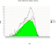
Larger versions of the pictures and data plots from the day can be seen by clicking on the images below, or using the link at the end of the report:
On Saturday morning we picked up a quick squall at that house that dropped 0.7 inches of upslope fluff and brought us to 2.9 inches of accumulation for our second valley snowfall event of the season. It freshened up the yard and did a decent job of erasing the boys’ sledding tracks from the previous evening, but it was pretty small potatoes compared to what had been going on in the higher elevations. Only a portion of the local ski areas were actually reporting snow totals, but as is often the case, Jay Peak was leading the pack with 16 new inches in the past 48 hours. That storm really looked like it had favored the northernmost parts of the state, and with Jay’s lift serviced skiing taking place only in the Stateside area, it seemed like a good chance to earn some turns on the Tram side.
I left the house around mid morning, with Mom and the boys just heading out for some more sledding in the yard. I was somewhat excited about the trip because it would be my first chance to explore the route from Waterbury to Jay Peak, and while for the most part I was expecting a straight shot up Route 100, there were a couple of options near the end of the route that might make it interesting. Combining the new route with the fact that it was still snowing at a decent clip was probably going to make for a bit of stressful driving, but then again I was in the Subaru passing through some potentially lightly-traveled roads, so it might also mean some fun driving.
The first half of my trip took me up to Morrisville, a route that I’m very familiar with, but beyond that it was into the wilds of Hyde Park, Eden, and Lowell, which I’ve visited much less frequently. Up through Morrisville, there was decent snowfall coming down, but the temperature was just a bit below freezing, the treated roads were just wet, and the snow wasn’t accumulating. Eden put an end to that. While Eden doesn’t have any huge peaks, the whole area is at a relatively high elevation of 1,000’ or more, and boy do they get the snow. They’d already received a good 6 to 8 inches of snow, putting their accumulation on par with some of the mountain areas, and the snow was coming down hard enough that even Route 100 was getting slushy. When I hit Eden Notch at around 1,500’, the increased intensity of the snowfall and the notable accumulation of snow on the road had me wondering what in the world was going on at Jay Peak. Finally, as I descended from the Notch, I got a slight reprieve in the road conditions. That lasted for just a bit until I followed a sign for Jay Peak that took me onto a couple of rather secondary roads (North Hill Road/Cross Road). The roads had seen a lot less attention than Route 100 so they had quite a bit of snow on them, but there weren’t any major hills and before I knew it I popped out in the four corners in the Village of Jay. From there it was just a quick trip up Route 242 to the resort.
The snowfall had re-intensified as I’d ascended to the resort. In the tram parking lot it was really coming down and was accompanied by some of that Jay Peak wind. My car thermometer read 23 F, which was actually quite a comfortable temperature as long as the wind wasn’t going to be an issue. There were about a dozen other cars in the tram parking lot, comprised of what appeared to be a few people visiting the ski shop and some picking up their season passes. I had brought my Betacarves and appropriate skins in case the snow wasn’t deep enough to comfortably use my CMH fats, but it was quickly obvious that no rock skis were needed. Jay Peak had received a ton of new snow.
I geared up and headed past the lodge to check out the snow. I could immediately see that Jay peak had received a really healthy dose in the previous couple of days. I stuck my calibrated ski pole in the snow and the first reading I got was 21 inches. OK, that was a drift, but when I actually got going out into the are of more representative snowpack above the lodge, my measurements consistently delivered numbers between 13 and 15 inches of loose snow. I quickly searched around for a skin track to take upward, but unfortunately found none. So, I made my own. I headed up the lift line of the Metro Quad, a location which nicely shielded me from the wind. When I’d occasionally assess my progress up the lift line, it felt like I was going nowhere. I figured I was just tired from a busy week, but as I neared the upper station of the lift, I realized why my progress felt slow. I probed the snow depth about 3/4 of the way to the top of the Metro Quad, and found that the 13-15 inches of snow I’d started out in had already grown to 18-20 inches. I was now blazing a pretty deep trench through the powder, and as the pitch had increased near the top of the lift line, the slow going had been more obvious. I heard voices above and to the right of me, which sounded like a group of riders on the trails above the Metro Quad. At that point I was actually hopeful that someone else was touring in the tram area, because above the top station of the Metro Quad, the terrain was about to get steeper still, and even a single-pass skin track would be a big help in making better time.


I finally crested the unloading area of the Metro Quad, and although I didn’t see the riders I’d heard (they appeared to have traversed across at the top of the Metro Quad and headed off toward the Stateside area) at least there were some tracks. One traverse/skin track cut across the mountain, and I briefly checked both sides to see which end headed up. It turned out to be the more northerly end of the track that headed upwards, and unfortunately it wasn’t a skin track, but simply a downtrack from the riders. I could see that the riders had descended on the “Racer” trail, which was quite steep even though it’s only rated as a blue. I suspect it would be a black diamond trail at many ski areas. There were about four tracks on the trail, and the steep turns in the deep snow looked sublime. The trail was far steeper than I would typically choose for skinning, but a track is a track, and even with the steep pitch it was going to be easier than any alternative I could see. I locked up my highest heel lifters and headed up.
Using the downtracks really helped me increase my pace of skinning. I picked the most appropriate crisscrossing combination of tracks for my use, and the apexes of the turns in which the riders had pressured the snow were the most helpful. Between the turns, where the unweighting had taken place, the climbing was typically more difficult for a few steps. Even with the full-width skins on the CMH fats I would occasionally slip a little on the combination of steep pitch and loose snow. The snow depth continued to increase as I ascended, and on Racer my probing revealed depths of 20-24 inches, and sometimes even deeper. The measurement marks on my ski pole actually only go up to 23 inches, which is just the length of tape that I stuck on there when I made it. I guess I’ll have to extend those measurements for skiing in these parts. When I’d left home that morning, Jay Peak was still reporting just 16 inches of new snow in the previous 48 hours, and they eventually added an additional 6 on the day I was there for a total of 22. So as far as the claims of over reporting snowfall that are often made of the mountain, I once again fail to see it in action first hand.
I crested the top of Racer and got to watch a group of skiers coming down the steep part of Upper Exhibition. Their turns looked great, although the powder looked to ski a bit heavier than what I would have suspected after hiking up in it. I continued my upward trek by taking Green Mountain boys, which wasn’t quite as steep as Racer and made for easier going. Beyond that point I actually started to get into some wind scoured terrain, which made the going much easier. I continued on up for another 10 minutes or so in the area of the Green Mountain Flyer lift line using the Upper Goat Run and Upper Exhibition trails, but found mostly scoured or wind-packed snow, so once I hit the point where the lift line flattened out (~3,200’) I decided to head down.
After skiing a bit of packed snow on the mellower parts of Upper Exhibition, I cut right onto Lower Goat Run and immediately hit pay dirt in terms of powder. It was bottomless and deep, even if it wasn’t Vermont “Champlain Powder” light. But it is mid November so it’s probably not time to get too picky yet. I cut left onto Lower River Quai, which I’d seen was untracked when I was heading up, and then continued down Interstate right back to the tram base area. The route wasn’t quite as steep as the runs like Racer and Exhibition, but it was just me, a big untracked swath of powder, and dozens and dozens of powder turns. ‘Twas certainly a decent reward for a bit of skinning. If I’d had more time and wanted to make a few laps (especially since my skin track was in place) the sweet spot of the tour to hit would be that ~500 vertical feet of steep terrain above the top of the Metro Quad on trails like Upper Exhibition, Racer, and Green Mountain Boys.


The snowfall had really tapered off by the time I headed home, and out past the village of Jay, I could see that the mountain was even emerging from its cloud. I managed to take the Route 101 option that I had initially planned to use, so I got some of the flavor of the route without the North Hill Road/Cross Road shortcut. In terms of vertical for the tour, the Avocet recorded a descent of 1,430’ and the Suunto recorded a descent of 1,447’ for a difference of 1.2%, with the GPS recording a descent of 1,404’


Larger versions of the pictures and data plots from the day can be found at:
http://www.jandeproductions.com/2007/17NOV07.html
J.Spin
On Saturday morning we picked up a quick squall at that house that dropped 0.7 inches of upslope fluff and brought us to 2.9 inches of accumulation for our second valley snowfall event of the season. It freshened up the yard and did a decent job of erasing the boys’ sledding tracks from the previous evening, but it was pretty small potatoes compared to what had been going on in the higher elevations. Only a portion of the local ski areas were actually reporting snow totals, but as is often the case, Jay Peak was leading the pack with 16 new inches in the past 48 hours. That storm really looked like it had favored the northernmost parts of the state, and with Jay’s lift serviced skiing taking place only in the Stateside area, it seemed like a good chance to earn some turns on the Tram side.
I left the house around mid morning, with Mom and the boys just heading out for some more sledding in the yard. I was somewhat excited about the trip because it would be my first chance to explore the route from Waterbury to Jay Peak, and while for the most part I was expecting a straight shot up Route 100, there were a couple of options near the end of the route that might make it interesting. Combining the new route with the fact that it was still snowing at a decent clip was probably going to make for a bit of stressful driving, but then again I was in the Subaru passing through some potentially lightly-traveled roads, so it might also mean some fun driving.
The first half of my trip took me up to Morrisville, a route that I’m very familiar with, but beyond that it was into the wilds of Hyde Park, Eden, and Lowell, which I’ve visited much less frequently. Up through Morrisville, there was decent snowfall coming down, but the temperature was just a bit below freezing, the treated roads were just wet, and the snow wasn’t accumulating. Eden put an end to that. While Eden doesn’t have any huge peaks, the whole area is at a relatively high elevation of 1,000’ or more, and boy do they get the snow. They’d already received a good 6 to 8 inches of snow, putting their accumulation on par with some of the mountain areas, and the snow was coming down hard enough that even Route 100 was getting slushy. When I hit Eden Notch at around 1,500’, the increased intensity of the snowfall and the notable accumulation of snow on the road had me wondering what in the world was going on at Jay Peak. Finally, as I descended from the Notch, I got a slight reprieve in the road conditions. That lasted for just a bit until I followed a sign for Jay Peak that took me onto a couple of rather secondary roads (North Hill Road/Cross Road). The roads had seen a lot less attention than Route 100 so they had quite a bit of snow on them, but there weren’t any major hills and before I knew it I popped out in the four corners in the Village of Jay. From there it was just a quick trip up Route 242 to the resort.
The snowfall had re-intensified as I’d ascended to the resort. In the tram parking lot it was really coming down and was accompanied by some of that Jay Peak wind. My car thermometer read 23 F, which was actually quite a comfortable temperature as long as the wind wasn’t going to be an issue. There were about a dozen other cars in the tram parking lot, comprised of what appeared to be a few people visiting the ski shop and some picking up their season passes. I had brought my Betacarves and appropriate skins in case the snow wasn’t deep enough to comfortably use my CMH fats, but it was quickly obvious that no rock skis were needed. Jay Peak had received a ton of new snow.
I geared up and headed past the lodge to check out the snow. I could immediately see that Jay peak had received a really healthy dose in the previous couple of days. I stuck my calibrated ski pole in the snow and the first reading I got was 21 inches. OK, that was a drift, but when I actually got going out into the are of more representative snowpack above the lodge, my measurements consistently delivered numbers between 13 and 15 inches of loose snow. I quickly searched around for a skin track to take upward, but unfortunately found none. So, I made my own. I headed up the lift line of the Metro Quad, a location which nicely shielded me from the wind. When I’d occasionally assess my progress up the lift line, it felt like I was going nowhere. I figured I was just tired from a busy week, but as I neared the upper station of the lift, I realized why my progress felt slow. I probed the snow depth about 3/4 of the way to the top of the Metro Quad, and found that the 13-15 inches of snow I’d started out in had already grown to 18-20 inches. I was now blazing a pretty deep trench through the powder, and as the pitch had increased near the top of the lift line, the slow going had been more obvious. I heard voices above and to the right of me, which sounded like a group of riders on the trails above the Metro Quad. At that point I was actually hopeful that someone else was touring in the tram area, because above the top station of the Metro Quad, the terrain was about to get steeper still, and even a single-pass skin track would be a big help in making better time.
I finally crested the unloading area of the Metro Quad, and although I didn’t see the riders I’d heard (they appeared to have traversed across at the top of the Metro Quad and headed off toward the Stateside area) at least there were some tracks. One traverse/skin track cut across the mountain, and I briefly checked both sides to see which end headed up. It turned out to be the more northerly end of the track that headed upwards, and unfortunately it wasn’t a skin track, but simply a downtrack from the riders. I could see that the riders had descended on the “Racer” trail, which was quite steep even though it’s only rated as a blue. I suspect it would be a black diamond trail at many ski areas. There were about four tracks on the trail, and the steep turns in the deep snow looked sublime. The trail was far steeper than I would typically choose for skinning, but a track is a track, and even with the steep pitch it was going to be easier than any alternative I could see. I locked up my highest heel lifters and headed up.
Using the downtracks really helped me increase my pace of skinning. I picked the most appropriate crisscrossing combination of tracks for my use, and the apexes of the turns in which the riders had pressured the snow were the most helpful. Between the turns, where the unweighting had taken place, the climbing was typically more difficult for a few steps. Even with the full-width skins on the CMH fats I would occasionally slip a little on the combination of steep pitch and loose snow. The snow depth continued to increase as I ascended, and on Racer my probing revealed depths of 20-24 inches, and sometimes even deeper. The measurement marks on my ski pole actually only go up to 23 inches, which is just the length of tape that I stuck on there when I made it. I guess I’ll have to extend those measurements for skiing in these parts. When I’d left home that morning, Jay Peak was still reporting just 16 inches of new snow in the previous 48 hours, and they eventually added an additional 6 on the day I was there for a total of 22. So as far as the claims of over reporting snowfall that are often made of the mountain, I once again fail to see it in action first hand.
I crested the top of Racer and got to watch a group of skiers coming down the steep part of Upper Exhibition. Their turns looked great, although the powder looked to ski a bit heavier than what I would have suspected after hiking up in it. I continued my upward trek by taking Green Mountain boys, which wasn’t quite as steep as Racer and made for easier going. Beyond that point I actually started to get into some wind scoured terrain, which made the going much easier. I continued on up for another 10 minutes or so in the area of the Green Mountain Flyer lift line using the Upper Goat Run and Upper Exhibition trails, but found mostly scoured or wind-packed snow, so once I hit the point where the lift line flattened out (~3,200’) I decided to head down.
After skiing a bit of packed snow on the mellower parts of Upper Exhibition, I cut right onto Lower Goat Run and immediately hit pay dirt in terms of powder. It was bottomless and deep, even if it wasn’t Vermont “Champlain Powder” light. But it is mid November so it’s probably not time to get too picky yet. I cut left onto Lower River Quai, which I’d seen was untracked when I was heading up, and then continued down Interstate right back to the tram base area. The route wasn’t quite as steep as the runs like Racer and Exhibition, but it was just me, a big untracked swath of powder, and dozens and dozens of powder turns. ‘Twas certainly a decent reward for a bit of skinning. If I’d had more time and wanted to make a few laps (especially since my skin track was in place) the sweet spot of the tour to hit would be that ~500 vertical feet of steep terrain above the top of the Metro Quad on trails like Upper Exhibition, Racer, and Green Mountain Boys.
The snowfall had really tapered off by the time I headed home, and out past the village of Jay, I could see that the mountain was even emerging from its cloud. I managed to take the Route 101 option that I had initially planned to use, so I got some of the flavor of the route without the North Hill Road/Cross Road shortcut. In terms of vertical for the tour, the Avocet recorded a descent of 1,430’ and the Suunto recorded a descent of 1,447’ for a difference of 1.2%, with the GPS recording a descent of 1,404’
Larger versions of the pictures and data plots from the day can be found at:
http://www.jandeproductions.com/2007/17NOV07.html
J.Spin


") .
.