Keeping it real and honest at the 1/3rd mark

joegm

New member
this is the snowsource.com summary page assessment for today's date.....just putting this up for perspective and to be able to cut through what is real and what is perception from 1) the ski resort marketing stuff that is about to kick into gear and 2) the usual end of the season assessment discussion on the board O:)

"Arctic cold and high winds are putting a damper on what would otherwise be some pretty nice powder skiing in Northern Vermont. Jay Peak has received 14" since Thursday, but the new snow is low density and windblown. In fact, despite over a foot new, the snowpack around the base of Jay stands at only 2 feet; meager for this time of year. Currently, the deepest snow at ski area base elevations is 2-3 feet in a band stretching from Wildcat to just north of Sunday River to Saddleback/Sugarloaf and points northeast"


and this is the opening paragraph from josh fox at the MRG weather blog

"We have hit a dry spell in terms of our natural snowfall. We have been in the midst of a chilly regime and this regime has allowed us to avoid the rain and ice for much of the month. According to the observations at the Montpelier-Barre airport, only 0.90 of liquid has fallen if you melt all the snow and sleet. Mad River's elevation has ensured that precipitation amounts have been a bit healthier on the mountain but still well below average. Although we do have some snow to talk about for the upcoming week it will not be enough to dilute the cold and dry personality that January 2009 has now attained."


as always , backing out those who can go on a dime and chase snow, i would say it has been nothing special so far .....we'll see how it plays out
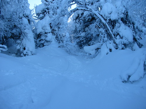
 
The snow pack in the C. Adirondacks is sick

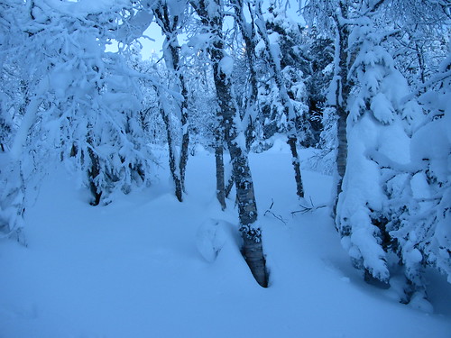
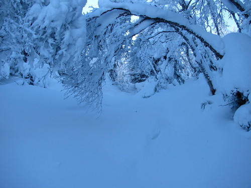
pics from yesterday
3223635323_fd3a61624b.jpg


3223628437_ceb5b2cb74.jpg


3223602499_ab87fbf3e1.jpg
 
No question about it. In the East, to get big dumps, you have to be on the edge. To some extent, if it is snowing in NJ then it's too cold and fronts are too far south for coastal lows to bury the Adks, Vt, etc.

But it is of course a risk. It doesn't take much fluctuation for NCP to fall.

It takes some real magic for a perfect winter.

On the other hand, we haven't lost any snow since 12/26 or so.

What I like is...cold rain in NJ, sleet in the Hudson Valley and snow north of Albany. Maybe next week.

Sweet pics Skimore.
 
What I like is...cold rain in NJ, sleet in the Hudson Valley and snow north of Albany. Maybe next week.

What i like is.. rain in Southern NJ , Sleet from Staten Island to Ft lee and Snow to the Catskills...
Let me explain... I love to see it snow . I want to be in the middle of the storm and I ski 90% of my days in the Catskills..
 
jasoncapecod":38vnmv6y said:
What i like is.. rain in Southern NJ , Sleet from Staten Island to Ft lee and Snow to the Catskills...
Let me explain... I love to see it snow . I want to be in the middle of the storm and I ski 90% of my days in the Catskills..

Sounds like the same weather theory, with a different favorite place to ski. :bow:
 
This is the perversity of eastern weather. If you're getting a lot of storms usually some of them are going to be rain. 2001 was the happy exception in New England, continuously stormy and nearly all snow. Before Patrick chimes in, I'll readily concede that last season was like that for Quebec.

When I came east for NASJA in 2003, the season had been somewhat as joegm describes. Consistently cold, so surfaces were decent most of the time even though snowfall was below average. The warmup hit right when I arrived mid-March. So I got a couple of good days. But since the bases were not that high, much of the snowpack collapsed with just 2 weeks of warm weather.

So I think joegm is right to fear a short spring season if the storm pace doesn't pick up to build a deeper base. But JSpin's detail updates and some of the data I collect show at least average season-to-date snowfall in northern and central Vermont.
 
Come on Tony how can weather be perverse? It's a natural phenomenon.

You're the guy who says that any forecast past 5 days is BS. So we are talking about 3 weeks out of the winter being cold and snowing less.

If it was 50 degrees, there would be no snowmaking, and the base would be melting. Seems to me that the last stuff to melt are those snowmaking trails that have been pounded.

I can't remember a January where all the trees were open the whole month.

Things aren't so bad.
 
The Tug ain't doing so bad
cam_2.jpg


and
IN THE MOST PERSISTENT BANDS ADDITIONAL SIGNIFICANT ACCUMULATIONS
CAN BE EXPECTED WITH 2 TO 3 INCHES PER HOUR IN THE HEART OF THE
BAND. BARNES CORNERS IN LEWIS COUNTY REPORTED A STORM TOTAL OF 33
INCHES AS OF 930 PM SUNDAY EVENING. STORM TOTALS WILL LIKELY RANGE
FROM 3 TO 4 FEET OVER MUCH OF THE TUG HILL AREA BY TUESDAY
MORNING. THE SNOWFALL WILL CONTINUE TO CAUSE MAJOR TRAVEL PROBLEMS
ON INTERSTATE 81 AS WELL AS THE SECONDARY ROADS IN THE REGION.
 
It is hard to believe that there can still be so much lake effect snow after all this cold. We flew over Lake Erie on Friday and it sure had a lot of ice on it. I know Ontario is deeper and colder, but it amazes me after all the chilly temps we've had in the east that so much more snow can still fall off the lake.

Skimore, hope you had a nice tour...sure looks like you found some nice snow.
 
When you live in California, it's a fairly safe assumption that when you get precipitation, temperature declines. When I see the opposite in the Northeast I consider that perverse from a skier's perspective. I have daily records from the Mansfield stake since 1982. Often I'll see a month of data when temps only get over freezing one or two days. Yet often as not there will be rain on those days.

From the FTO reports I've been reading I'm more in agreement with Harvey44 than joegm about the Northeast season so far. But joegm's concerns did play out in the one year I skied there mid-season, fortunately after I went home.
 
So I think joegm is right to fear a short spring season if the storm pace doesn't pick up to build a deeper base

I disagree , with the cold temps some to the areas have built up impressive snowmaking bases. 40inchs base of man made will sure out last , the same base of natural.
 
Not sure if this is real or honest, but it is NWS:

AREA FORECAST DISCUSSION
NATIONAL WEATHER SERVICE ALBANY NY
627 AM EST MON JAN 26 2009

.SYNOPSIS...
OUR COLD WEATHER WILL CONTINUE. A SIGNIFICANT SNOW STORM IS POSSIBLE MID WEEK AS A LOW PRESSURE SYSTEM APPROACHES FROM THE MISSISSIPPI VALLEY.

EDIT: Hey Jason..right now this one looks more like your ideal than mine.
 
My local mountain is reporting a two to five foot base (and I believe it, looking at the depths around the poles for the chairlifts) and I would say that 98% of that base is man made snow. With the consistently cold weather this January, they have been able to make a ton of man made snow, plus some smaller natural snow storms. With all the cold weather, that two to five foot base is a chunk of solid ice, for the most part. It will take a lot of warm, sunny weather to melt that base down to the ground. I think they should be ok through the end of March, even they don't make that much additional snow. I skied yesterday morning - cold (minus 10 at 8:15 AM), but the surface was groomed, crunchy snow; nice to ski on.
 
No, the skiing conditions were actually quite good. Everything had been groomed out the night before and the surface was pretty much frozen corduroy which is not bad to ski on. It was very fast and you could definitely cut an edge into the snow when turning. Admittedly, not exactly powder skiing but better than skiing on sheer ice.
 
Back
Top