Laurentian Snow Report 2016/17

Anthony

New member
Slow start in the Laurentians this year, better than last year but that doesn't mean much. Started the season off at Jay Peak VT (which is skiing fine) while waiting for the Laurentians to fill in. Currently snow depths on the ground are averaging about 1.5 ' with no base. snow making is providing the season as natural snow trails have a thin cover with grass and rocks poking thru. Skied some natural trails with 106 mm's and going easy on the edging. Still managed to dig into the ground. Not sure how Tremblant can open up their glades and be at almost 90% open, it has to be thin.
The onslaught of vacation skiers will hit the trails tomorrow just in time for the freezing rain that is in the forecast.

Freezing rain warning in effect for:

Mont-Tremblant - Sainte-Agathe area
Sainte-Adèle - Saint-Sauveur area
Freezing rain will affect Western Quebec beginning late this morning. This area will gradually move eastward and will reach greater Montréal this afternoon then the Mauricie, the Eastern Townships and Quebec city areas this evening.

This freezing rain will occur for several hours and will cause ice accretion ranging from 5 to 10 millimetres.
 
Overall the Northeast was doing very well as of mid-December. But it's just uncanny how often it rains at Christmas to $%^& up the holiday week. Not too long ago it happened something like 7 years in a row.

As much as I tend to avoid that week for skiing anyway it's a REALLY bad idea to advance book that week in the Northeast.
 
The morning after a night of freezing rain and straight pouring rain has soaked the snow. Temperatures have already started to fall off and will drop below freezing before the end of the day. Snow should freeze up rock solid. Mad River Glen in VT did the smart thing today by closing the lifts and banning hiking to let the mountain dry out and freeze up on its own rather than have skier traffic compress the snow and make the freeze up even worse. Thankfully got some time in at Jay this year before this.
 
Tony Crocker":2i7ye1ym said:
Overall the Northeast was doing very well as of mid-December. But it's just uncanny how often it rains at Christmas to $%^& up the holiday week. Not too long ago it happened something like 7 years in a row.

As much as I tend to avoid that week for skiing anyway it's a REALLY bad idea to advance book that week in the Northeast.


Truer words have never been spoken (or written) ! Although that statement pretty much applies to almost any week in the Northeast.
 
Measured almost 1 inch of ice coating the snow today. Conditions haven't been this bad since the 1998 ice storm. 1 inch of of ice incasing the previous ski tracks is something that is going to require a lot of new snow to cover up. A few groomers were open today on crushed ice
 
berkshireskier":1k1rsh3a said:
Although that statement pretty much applies to almost any week in the Northeast.
For Northern Vermont the core of the season from late January through early March has about a 1/4 chance of any given week having poor skiing. For Christmas Week the odds of poor skiing are more than 50%.

Keep in mind NoVt is the most reliable sub-region of the Northeast. Odds are less favorable elsewhere.
 
Tony Crocker":whmgip7j said:
berkshireskier":whmgip7j said:
Although that statement pretty much applies to almost any week in the Northeast.
For Northern Vermont the core of the season from late January through early March has about a 1/4 chance of any given week having poor skiing. For Christmas Week the odds of poor skiing are more than 50%.

Keep in mind NoVt is the most reliable sub-region of the Northeast. Odds are less favorable elsewhere.

Those stats do not surprise me at all. The only reliable fact about ski conditions in the Northeast is their unreliability. Can be great, at times; can be terrible, sometimes. IMHO, impossible to predict with any high confidence factor.
 
6 inches of new snow on top of the ice crust and a thin base made for sub par skiing on natural snow trails. A improvement over the non existent skiing but still a way to go . Groomers built up by snow guns and the new snow are skiing fine . Anthony jr , bailed on the Laurentians yesterday and headed to Jay where the new snow is being measured in feet.
 
Anthony":sjcn51v2 said:
Anthony jr , bailed on the Laurentians yesterday and headed to Jay where the new snow is being measured in feet.
That's what I would be doing most of the time if I lived in the Montreal area. Natural snowfall drops precipitously once you go north of Mont Sutton.
 
The latest weather system that was a mix of rain/freezing rain/snow was all snow in the Laurentians as just far enough north to make a difference . About 1.5 feet of new snow was recorded over the last 7 days. The base now at a elevation of 1600 ft is just under 3 feet. Places like Tremblant should be skiing fine with by now packed powder. Time to break out the skins for powder descents on the 600 vertical hills.
 
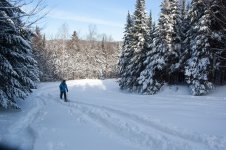
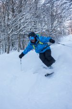
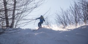
Enough of a base and new snow to bring out the skins . Skiing was good yesterday with fresh snow available days after the last storm if you hiked for it. Laurentian powder! Sketchy long range near forecast in store for eastern skiing with rain on the way mid week followed by the usual freeze up.
 

Attachments

  • DSC_6610.jpg
    DSC_6610.jpg
    1.6 MB · Views: 21,737
  • DSC_6670.jpg
    DSC_6670.jpg
    1.8 MB · Views: 21,730
  • DSC_6611.jpg
    DSC_6611.jpg
    1.5 MB · Views: 21,748
This week, soaking rains followed by a quick freeze up has frozen up the un groomed with frozen tracks and fallen tree branches. Granular groomers are it again until it snows.
 
Time for a update ,well into winter and significant new snow this week . Over a foot received and a few more inches in the forecast with no rain or freezing rain. Snowpack at 1600 feet in elevation at 100 cm (just over 3 feet ).
 
Most of the Northeast had an outstanding fist half of February: 4 feet in most of New England and 2+ feet at Le Massif.
 
I just completed my mid-month report: http://bestsnow.net/seas17.htm

Both East and West (average of 7 regions) are at 129% of normal snowfall. This would tie 2010-11 as highest overall snowfall season on record if it continues through the end of the season, which is of course unlikely. Average snowfall the rest of the season would still put 2016-17 in the top 5. This reinforces my opinion that 2016-17 will set a record for US skier visits.
 
The eastern report mentions the rain and this cannot be dismissed as despite above average snow ,the temps have been way above average with almost weekly rain/thaw episodes then a freeze up. Just last week a good layer of ice coated the landscape. Next warm up is scheduled to roll in by Sunday with soaring temps. So the snow depth is there but the quality is hit and miss depending on the current temps.
 
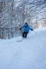
Good snow conditions today but temps warmed up above freezing and snow in the direct sunlight started to convert from powder into sticky snow. No doubt will be the same in all eastern regions as a warm week in the forecast.
 

Attachments

  • _DSC5412.jpg
    _DSC5412.jpg
    3.7 MB · Views: 13,909
Back
Top