Day no5.
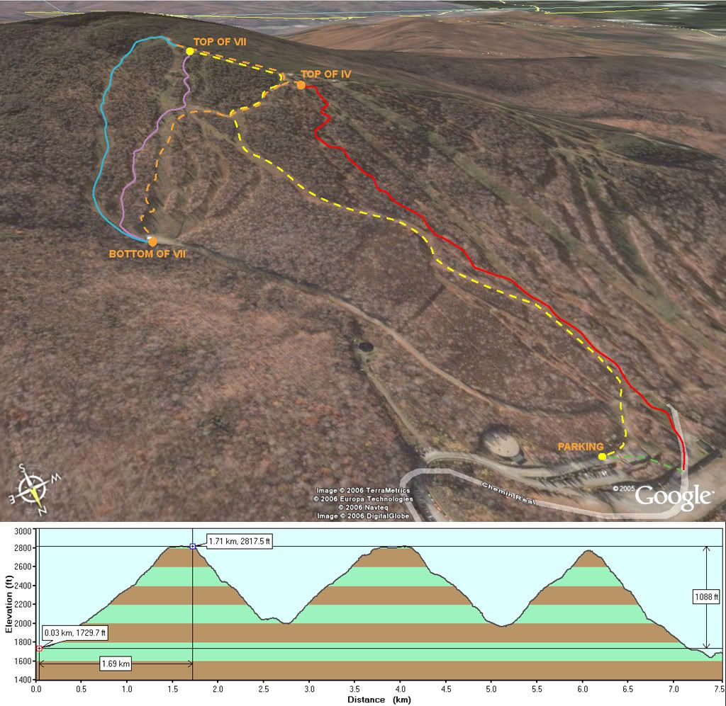
Vertical gain: 3231 ft
After the day we had at Jay, i had to get some more. Sutton was far from being fully open... so they had excellent coverage!
We climbed from the parking lot (yellow) and did 3 runs. The first run (purple) was down a steep pitch with mixed cover... THere was snow but not enough to really lean into... So we switched to the trail next to chair no7. That trail was deep and sweet! Knee deep snow all over... nothing to hit... GREAT!
We met with the AT guys we saw earlier. We decided to follow in there skin track (orange). Spliboard are harder to climb with because they are so flexible... it's hard to get a good grip when traversing... We made it to the top again and went down the trail on the far left of the mountain (blue). By far the best run of the day! Smooth and wide open and needless to say, deeper then anything else available! You could really lean into it and not be afraid to it stuff...
We climbed again (orange) following the skin pack to the top for our last run. The last one was fun... but i decided to drop a small cliff under the chair... MISTAKE! I did a huge core shot on my new splitboard! I'll have to fix it at the shop... The board isn't damaged bad... Just took off some base along the edge... but not delam... pisses me off... but what else can i do! I'll fix it and it will look brand new again! The run was however fun... Lots of snow and little drops all over... precious!
Enjoy the movie:
.... to be updated...
")