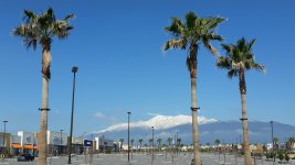
In late March Adam began considering touring options in SoCal with the lifts shut down. 9,399 foot Mt. Baden-Powell is one possible spring objective. He scouted the road access March 28 as I did April 1. The distance view of the north face of Baden-Powell looks enticing:

The switchback trail on the map from Route 2 to Mt. Baden-Powell starts at Vincent Gap, which is at 6,535 feet.

It's steep, so a rigorous climb with skis, and snow cover in spring is often inadequate for skinning at lower elevation.
Both of us found Route 2 gated 2 1/2 miles short of Vincent Gap.

So both of us walked the hour to Vincent Gap.

Notice the steep hillside with patchy snow rising to the left from the parking lot. That's where the Baden-Powell trail starts. Notice also the Caltrans car on the road. The driver turned a sign around and opened the road a few minutes later. I arrived at 2PM but if I had been an hour later I could have driven to Vincent Gap and reconned the road beyond its closed gate. :twisted:
Between Big Pines and Vincent Gap is the Blue Ridge scenic overlook at 7,300 feet.

There are quite a few people there for a Wednesday afternoon though the weather was very nice. The east face of Baden-Powell is in the background. On the map Blue Ridge is at the intersection of Route 2 (yellow) and a fire road drivable in summer that goes east past the top of both West and East sides of Mountain High.
Here's the bottom of Mt. High East as I drove out April 1.

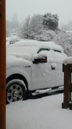
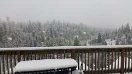
This week's weather reset winter. It was the biggest snowstorm of the season in the San Gabriel mountains and the biggest storm in April since 1999. Mountain High latest updated Thursday morning with 34 inches storm total but it snowed all day Thursday with Big Bear reporting 6 more inches.
So I had a new plan which I ran by Adam and one of his friends: Drive to Blue Ridge and skin the easy fire road to the top of Mt. High East. There were two potential problems. That much new snow might close the road past Big Pines and the snow might become difficult with predicted sun Saturday.
Adam and I decided on Saturday since he was working Friday (he can work from home) and that allowed more time to clear the road. All week long the Caltrans website and phone said Route 2 remained open "5 miles west of Big Pines." Nonetheless Adam found the road closed when he arrived at 7:30AM. I arrived 15 minutes later and we drive to the gated road at the base of Mt. High West, where an employee said the public was not allowed anywhere there.
Mt. High East's stepchild status means that no one is there to enforce restrictions.

Notice tracks from Friday in Olympic Bowl. There's also a skin track at far right on Goldrush, so that where we decided to go.

View toward Cajon Pass about halfway up:

I have not done this in a long time so I was slow. It took me two hours to skin the 1,170 vertical feet. Adam got up there 45 minutes ahead of me.

As it was 10:30 the snow was already heavy in the sun so we were not tempted to climb the last 500 vertical to the top.

I just missed getting a picture of the snowboarders making those tracks.
We are going to put the first tracks on Sundance/Wildcard.


My DPS Wailer112 skis kept me out of trouble but there was still some effort making clean turns. The shady patches far skier's right were more powdery. I had to take a couple of rest breaks and never had the camera out when Adam was skiing.
Our tracks on the last pitch of Sundance:

With the road closed, Adam's friend was right. Friday would have been the better day. But any ski day is a victory under the current COVID-19 circumstances.
The switchback trail on the map from Route 2 to Mt. Baden-Powell starts at Vincent Gap, which is at 6,535 feet.
It's steep, so a rigorous climb with skis, and snow cover in spring is often inadequate for skinning at lower elevation.
Both of us found Route 2 gated 2 1/2 miles short of Vincent Gap.
So both of us walked the hour to Vincent Gap.
Notice the steep hillside with patchy snow rising to the left from the parking lot. That's where the Baden-Powell trail starts. Notice also the Caltrans car on the road. The driver turned a sign around and opened the road a few minutes later. I arrived at 2PM but if I had been an hour later I could have driven to Vincent Gap and reconned the road beyond its closed gate. :twisted:
Between Big Pines and Vincent Gap is the Blue Ridge scenic overlook at 7,300 feet.
There are quite a few people there for a Wednesday afternoon though the weather was very nice. The east face of Baden-Powell is in the background. On the map Blue Ridge is at the intersection of Route 2 (yellow) and a fire road drivable in summer that goes east past the top of both West and East sides of Mountain High.
Here's the bottom of Mt. High East as I drove out April 1.
This week's weather reset winter. It was the biggest snowstorm of the season in the San Gabriel mountains and the biggest storm in April since 1999. Mountain High latest updated Thursday morning with 34 inches storm total but it snowed all day Thursday with Big Bear reporting 6 more inches.
So I had a new plan which I ran by Adam and one of his friends: Drive to Blue Ridge and skin the easy fire road to the top of Mt. High East. There were two potential problems. That much new snow might close the road past Big Pines and the snow might become difficult with predicted sun Saturday.
Adam and I decided on Saturday since he was working Friday (he can work from home) and that allowed more time to clear the road. All week long the Caltrans website and phone said Route 2 remained open "5 miles west of Big Pines." Nonetheless Adam found the road closed when he arrived at 7:30AM. I arrived 15 minutes later and we drive to the gated road at the base of Mt. High West, where an employee said the public was not allowed anywhere there.
Mt. High East's stepchild status means that no one is there to enforce restrictions.
Notice tracks from Friday in Olympic Bowl. There's also a skin track at far right on Goldrush, so that where we decided to go.
View toward Cajon Pass about halfway up:
I have not done this in a long time so I was slow. It took me two hours to skin the 1,170 vertical feet. Adam got up there 45 minutes ahead of me.
As it was 10:30 the snow was already heavy in the sun so we were not tempted to climb the last 500 vertical to the top.
I just missed getting a picture of the snowboarders making those tracks.
We are going to put the first tracks on Sundance/Wildcard.
My DPS Wailer112 skis kept me out of trouble but there was still some effort making clean turns. The shady patches far skier's right were more powdery. I had to take a couple of rest breaks and never had the camera out when Adam was skiing.
Our tracks on the last pitch of Sundance:
With the road closed, Adam's friend was right. Friday would have been the better day. But any ski day is a victory under the current COVID-19 circumstances.