This incoming Alps storm looks like a bit of a bust, except for the Maritime Alps. WePowder is a bit more optimistic for the French Alps and the Aosta Valley, but who knows. These Mediterranean lows are termed "cut-off" because they lack obvious steering currents/Jet Stream winds. Like some of the hurricanes in the Caribbean Basin.
As one can see from "My Favorites", I have little interest in the French Maritime Alps, but enjoyed ViaLattea over the years - Sauze d'Oulx, Sestriere, and especially the French resort Montgenèvre.
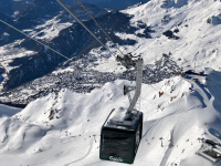
PA#4: Powder for Piemonte
16 January 2026
· 3 replies
It took a few days of patience with some confusing model runs for the Southwestern Alps, but we can finally pull the trigger: PowderAlert #4 is a GO.
All signs point towards a proper dump in Piemonte, where 40–80 cm looks very realistic, with locally even more. The French Southern Alps will also score, though with lower totals and a slightly higher snowline. In this forecast, we’ll zoom in on:
- Snowfall with two main focus areas
- The weather after the snowfall
- The current situation: snowpack and avalanche risks
- Where’s the sweet spot?
Weather over the coming days
A change in the weather already became apparent yesterday in the Western Alps, with strongly increasing winds along the western Alpine main ridge and drifting powder still widely available after PA#3. The driving force behind this pattern change is a low-pressure system that will move from Ireland towards Spain over the next 24 hours. On its eastern flank, a southern flow sets up, bringing precipitation to the French Southern Alps and Piemonte.
Pressure pattern Saturday night; source WxCharts MetDesk
Expected snowfall in the French Southern Alps
This morning, cloud cover is already widespread in the French Southern Alps, but visibility remains good up to the highest peaks. As the day progresses, cloud cover thickens and precipitation will start during the afternoon. Snowfall will continue into the early morning hours tomorrow, with snow falling above 1400–1700 m.
Orographic uplift in the far southern resorts may deliver 30–50 cm of fresh snow. Further north, the Écrins will also see snowfall. Amounts there remain somewhat uncertain, but 10–30 cm is certainly possible, with strong local variations. Conditions gradually dry out tomorrow.
Prolonged snowfall in Piemonte
The weather pattern in Piemonte today is similar to that on the French side of the main ridge. Here too, precipitation sets in later today. The key differences compared to the French Alps are the duration of snowfall and the lower snowline. Snowfall in Piemonte may persist until Tuesday morning, as the flow gradually turns from southeast to east and a classic Retour d’Est develops.
On Sunday, precipitation will temporarily ease, while Monday may bring a second, more active push. Exact timing and intensity remain somewhat uncertain, but the focus is clearly on southern Piemonte. Here, 50–100 cm of fresh snow is possible. Further north towards the Monte Rosa area and west into Aosta Valley, totals will decrease. For now, we’re assuming 15–30 cm for the Monte Rosa region. The snowline stays nicely low, generally between 800 and 1200 m, depending on intensity. Trees will be your friend.
Weather after the snowfall
After the precipitation clears, several dry days with moderate temperatures follow. High pressure over northeastern Europe becomes dominant, bringing a moderate easterly flow. This setup should preserve snow quality quite well, with generally good visibility. Temperatures around 2000 m will hover near -2°C.
The starting point: snowpack and avalanche risks
The previous PowderAlert wasn’t just about big snowfall totals, but also about a thin and, above all, unstable base. This resulted in a prolonged period of high avalanche danger and numerous avalanches, sometimes with serious consequences. So how does the situation look this time?
Snowpack
The key difference compared to the previous PA is that this time a decent base is present almost everywhere. In the French Southern Alps the base is still relatively thin, but the Écrins did receive snowfall last week. Piemonte, on the other hand, retained a solid base from PA#2 around Christmas, and areas close to the main ridge picked up additional snow last week. On the Italian side, the base is therefore often 70 cm or more.
Avalanche risks
A significant dump is always a factor that demands caution when assessing avalanche risk — especially in Piemonte, where the largest amounts are expected. In addition, the unfavourable underlying snow layers still play a role, as does wind transport from recent days.
Wind transporting snow on the main ridge in France this Thursday
All in all, the snowpack — particularly in areas close to the main ridge — remains delicate, even already unstable prior to the new snowfall. Along the main ridge, avalanche danger may once again rise to high. In the southernmost parts of Piemonte, conditions are slightly less problematic, but even there the underlying layers and wind influence remain important factors. Keep a close eye on the official avalanche bulletins, e.g.
for Piemonte
Where’s the sweet spot?
For PA#4, Piemonte is the place to be. A thicker base, low snowline and serious snowfall totals — especially below tree line — tick most of the right boxes (don’t forget the old snow layer issue and wind slabs). The zone south of the highway between Turin and the Modane tunnel looks to be the sweet spot for fresh powder. From Sunday onwards, there should be plenty of quality powder to score here, but please keep your route choices conservative and smart.
Got your eyes on the Écrins or the Monte Rosa massif? Keep your options flexible for now. We’ll drop a PA#4 update tomorrow with the latest insights for those regions.


")


")