Is that chair damaged by being underwater?Wet storm this week with fluctuating snow levels. Rain to at least 9K at times. Picture is 7800' base of Kirkwood.
View attachment 33144
You are using an out of date browser. It may not display this or other websites correctly.
You should upgrade or use an alternative browser.
You should upgrade or use an alternative browser.
Western Weather 2017-18 and Later
- Thread starter Admin
- Start date
There are 3 forks of the American River, which drain everything west of the Sierra Crest between I-80 (the road to Reno) and US50 (the road to South Lake Tahoe. The American River is dammed at Folsom Lake and ends at Sacramento.where does the Tahoe region watershed eventually end up?
Sacramento in the 19th century had extreme flood risk and was completely underwater for some time after the famous January 1862 storms. The state capital was moved to San Francisco for most of 1862.
East of the Sierra crest drains into Lake Tahoe itself, then down the Truckee River through Reno and eventually into the Great Basin's Pyramid Lake.
South of Tahoe and west of the Crest are the Mokelumne (Kirkwood), Stanislaus (Bear Valley), Tuolumne and Merced (Yosemite NP) Rivers. The San Joaquin drains the backside of Mammoth down to Fresno, with the Kings (Kings Canyon NP) south of that. The western half of Sequoia NP drains into the Kaweah.
The eastern half of Sequoia NP is the highest part of the Sierra by Mt. Whitney. The Kern River forms there and runs south for ~75 miles before draining west through Bakersfield into what used to be Lake Tulare. Most years all of that water is consumed by Bakersfield and Central Valley farms. In 1969, 1983 and 1997 there were concentrated storms that resulted in Lake Tulare temporarily reforming, flooding the farms that have been developed there.
I have done whitewater rafting on most of the west side Sierra rivers mentioned above.
If so, there wouldn't be any functional chairlifts in the Northeast.Is that chair damaged by being underwater?
 The biggest threat to lifts in this type of storm is mudslides. I recall some lift damage in the Portes du Soleil in May 2015. A cursory Google search mentions one a month later in Bariloche. During the New Year's 1997 storm (one of those that reformed Lake Tulare) mudslides definitely damaged several buildings in Squaw Valley but I don't recall any damaged lifts.
The recent storm was modest vs. New Year's 1997, when it rained to 12,000 feet for three days and during the following two days still rained below 7,500 feet.
Last edited:
I have never seen a northeast chair underwater like that in the northeast or anywhere. That lift looks to be in a depression of some kind, it looks to be in 2 feet of standing water. Maybe, because of rain in the northeast, they plan for it.If so, there wouldn't be any functional chairlifts in the Northeast.
The depression was probably created by the 5 foot base of snow Kirkwood had in mid-December. Here's what you can have if you can't adjust the height of a chairlift loading station.That lift looks to be in a depression of some kind
The above pic is the original Mammoth chair 1 built in 1955. It was fixed, so Dave McCoy put it at a typical midwinter snowpack height, which averages 11 feet at Main Lodge, so this is what you got in the early season. After realizing the inconvenience, every other chairlift at Mammoth has a height-adjustable loading station. I recall that ramp because chair 1 was not upgraded until 1988.
Areas that rarely get deep snowpacks may have fixed chairs at ground level, and in a big year you will ski down into a trench to load. I've seen this in SoCal and I suspect Harvey has in the Northeast. If you get heavy rain in that scenario you will probably see some standing water as at Kirkwood.
Last edited:
Likewise. Just ignore theI have never seen a chair underwater like that in the northeast or anywhere.

It's not a . That Kirkwood picture is a puddle compared to Avoriaz in 2015.

Rain on snow is a complex event with many possibilities in ski area context.
1) Washing away the snow is not that common. It takes a lot of rain over a thin snowpack.
2) Usually the rain goes through the snow into the ground. Snow depth may decline due to compression, but it's very good for solidifying any buried weak layers in terms of future avalanche risk.
3) If the ground beneath the snowpack gets saturated, it may undermine the snowpack from below, usually in valleys/gullies. I observed this in 1980 at Snow Valley after 5 inches of rain upon a ~3 foot snowpack.
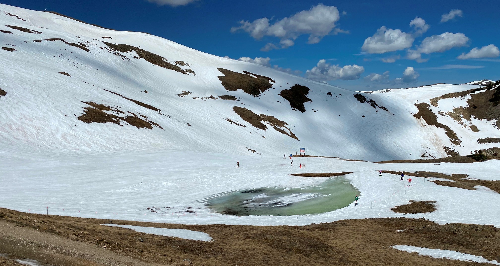
4) Deep snowpacks have a subfreezing internal layer or frozen ground below. In flat areas ponds may form on the surface when the water can't drain through to the ground. This can occur with late spring heat as well as rain. This is how you get natural pond skims like I had at Mammoth in June 1982. Lake Reveal at A-Basin is perhaps the most well known example.
. That Kirkwood picture is a puddle compared to Avoriaz in 2015.Rain on snow is a complex event with many possibilities in ski area context.
1) Washing away the snow is not that common. It takes a lot of rain over a thin snowpack.
2) Usually the rain goes through the snow into the ground. Snow depth may decline due to compression, but it's very good for solidifying any buried weak layers in terms of future avalanche risk.
3) If the ground beneath the snowpack gets saturated, it may undermine the snowpack from below, usually in valleys/gullies. I observed this in 1980 at Snow Valley after 5 inches of rain upon a ~3 foot snowpack.
4) Deep snowpacks have a subfreezing internal layer or frozen ground below. In flat areas ponds may form on the surface when the water can't drain through to the ground. This can occur with late spring heat as well as rain. This is how you get natural pond skims like I had at Mammoth in June 1982. Lake Reveal at A-Basin is perhaps the most well known example.
Last edited:
EMSC
Well-known member
Mechanically, not likely. Electrical components can very much be damaged. If it's only a little bit (eg couple feet), perhaps nothing much, but if it hits the electronics usually mounted on the wall in the liftie shack it could destroy all of it. That stuff is not easy to replace right now and in theory could easily shut a lift for the year if destroyed. See what happened due to arson of a lift shack at Kimberly in Canada last season...Is that chair damaged by being underwater?
I wonder if the electrical components in Avoriaz were high enough off the ground.
Here's the Killington base lodge after Hurricane Irene in 2011:

Major flood erosion is visible in the lower left of the pic above, but AFAIK the lifts were positioned in locations to avoid that.
Here's the Killington base lodge after Hurricane Irene in 2011:
Major flood erosion is visible in the lower left of the pic above, but AFAIK the lifts were positioned in locations to avoid that.
Last edited:
tseeb
Well-known member
Both Alta and Snowbird and road to get there were closed AFAIK today, New Year's Day 2023, due to avalanche danger from wet snow.
San Jose, California's first civil settlement, was also the first capital. https://www.kcra.com/article/on-thi...al-it-hasnt-been-the-states-only-one/39228917 says capital was moved due to Capitol building burning, but I thought floods were also involved. "In 1849 the first city named state capital was San Jose. It remained so until 1851, as a matter of fact. The state constitution even declared San Jose the capital once it was ratified. But the two-story building — the state Capitol building (note the "ol" for building and "al" for city) was destroyed by fire in 1853. "
I've seen and think I've posted pictures of similar flooding at base of chair 1 at Kirkwood. I plan to be there tomorrow as I need to check on cabin at South Lake Tahoe where power was out for some time and friends of family who had never been there before left today. Not sure if they got out before rockslide closed US-50 2.2 miles E of 4K elevation Kyburz. Kirkwood hoped to open chair 10 (The Wall) today but were not able to. Chairs 2, 3 and 4 also did not open. Heavenly did not open NV or gondola (due to power problems) and only opened to middle level of CA.
This is exactly what I was asking about.Mechanically, not likely. Electrical components can very much be damaged. If it's only a little bit (eg couple feet), perhaps nothing much, but if it hits the electronics usually mounted on the wall in the liftie shack it could destroy all of it. That stuff is not easy to replace right now and in theory could easily shut a lift for the year if destroyed. See what happened due to arson of a lift shack at Kimberly in Canada last season...
Talk to Plattekill about how hard it is to replace a controller. Double chair struck by lightning in May, just finally repaired. All about supply chain issues.
How much of the delay was because they were trying to source a controller for a 50-year-old chair whose manufacturer (Hall Lifts) went out of business decades ago? Or did they find a non-OEM part that worked?Double chair struck by lightning in May, just finally repaired. All about supply chain issues.
tseeb
Well-known member
Chair 1 at Kirkwood re-opened on 1/3. Kirkwood, where I skied 1/2 and 1/3, is doing much better than Heavenly who has yet to re-open Nevada side after power outage due to heavy, wet snow causing lines to go down, some from falling trees. Vail COO for their Tahoe resorts Tom Fortune has been posting informative but somewhat optimistic updates on Heavenly Mountain Facebook page. This is from last night:
"As of right now the power has been restored to the Gondola and the Nevada side of Heavenly.
The lift operations crew has been busy preparing ramps and mazes and tomorrow morning we plan to open Stagecoach, Boulder, and the Gondola for mountain access. We feel really good about tomorrow’s opening. Given the fact that lifts and buildings have been without power for over 3 days, we could find issues from power surges on lift drives, APU’s and things we just don’t know about yet. The Lift Maintenance team will be turning everything on and we will communicate if we find any issues as soon as we know. We still have some rime ice on Dipper, Comet, and Olympic to deal with which will be at the top of our to-do list.
Sky Express also opened this afternoon after 2 days of removing rime ice. Some of our veterans said this was the worst they have seen the ice in 30 years.
With that, we have more storms coming along with high winds, and while the Nevada side should be in good shape from an access standpoint, we could very well see some wind holds over the next several days."
I will try to get post from my two days at Kirkwood up soon, but I'm up early to try to get to Northstar before 8 to get good parking and ski with Truckee snowboarding friend who turned around due to crowds when he last tried to go there.
Alta Collins (415 inches) and Mammoth (378 inches) have more season-to-date snowfall as of Jan. 17 than in any prior year through the end of January.
Picture of Cornice at Mammoth January 12 illustrates why it was so named:

Since 1982 Cornice is usually groomed with a winch cat. I have seen intense snowfall overwhelm the grooming capacity twice before, in April 2006 and February 2017.
Picture of Cornice at Mammoth January 12 illustrates why it was so named:
Since 1982 Cornice is usually groomed with a winch cat. I have seen intense snowfall overwhelm the grooming capacity twice before, in April 2006 and February 2017.
Last edited:
The January snow drought rears its head again!Alta Collins (415 inches)
The January snow drought rears its head again!
MarcC:1onko8xc said:if there's one time period I don't recommend to visitors, it's from about Jan 5 to Jan 25, or thereabouts.
136.5 inches total Jan. 5-25, 2023. But there were serious dry spells Jan. 7-8, Jan. 12-13 and Jan. 20-21.

Alta Collins' 472 inches through January has blown away the prior record of 380 inches in 1992-93. If Alta has average snowfall the rest of the season it will barely break the record of 724 inches in 2010-11.
Last edited:
EMSC
Well-known member
Not that the numbers are nearly as good as states further west (Steamboat >150% for example), but definitely above average, especially compared to many recent seasons.
Denver Post Article....
Snowy Jan in Colo
Denver Post Article....
Snowy Jan in Colo
Breck and Loveland are not above average. Steamboat is the only one of the northern and central areas over 120% but its 151% is tops in CO. Four of the southern and western areas are in the 130-140% range.
January was indeed excellent. Most of CO was no better than average as of Jan. 1.
January was indeed excellent. Most of CO was no better than average as of Jan. 1.
snowave
Active member
It sure did up here in the PNW. Most of the action obviously stayed south of us. Quite a few very small storms this past month on top of a solid base, so not too many complaints on the overall conditions. Long range continues to show relatively dry weather for a good chunk of the month. The SW may get active again in about a week or two.The January snow drought rears its head again!
Can't remember if we explained the back story earlier --It sure did up here in the PNW. Most of the action obviously stayed south of us.
The "January drought" references a disagreement between Tony and the LCC crew (formerly well represented on FTO) in which the latter insisted from personal experience that if there's any period during which powder-hungry destination visitors should avoid travelling to the Wasatch, it's a three-week stretch in January with a high incidence of no snow. Of course, Tony had a battery of statistics to disprove their claim.
The Alta crew claimed that this was yet another case of someone who lived far away trying to tell locals "not to believe their lying eyes." Always entertaining as I had at least a handful of seasons in which I went to SLC in January and got skunked.