I second r.c.'s suggestion, you should consider Goodman's book required reading. TRs on websites are no substitute. Though Goodman's book is becoming dated, and there are some minor flaws (his map shows the location of Pipeline in the wrong drainage), it is the "bible" of New England back country skiing and riding.
I also agree with Sled, and there are a couple reasons I'd recommend you check out Gulf of Slides (GOS) before Great Gulf.
All the hazards that exist in Tucks are found in both the Great Gulf and Gulf of Slides, of course. As the early-to-mid season avalanche hazards diminish, the dangers of undermined snow and ice fall increase.
Gulf of Slides is more remote than Tucks, but similar in that you climb up what you are about to ski.
In the Gulf of Slides gullies, if snow conditions are worse than what you expected, your exit plan is simply to descend the way you came up, back to Pinkham.
Airplane Gully is in some respects even more remote than GOS, in that help from first responders (USFS snow rangers, MWVSP, and AMC crew) is further away.
In the Great Gulf gullies, you drop in from the top. If the conditions are worse than what you expected, the exit plan requires a climb up very steep snow/ice back to the top. As the widest and longest, Airplane is best known, but there are several other similar skiable runs in the Great Gulf, most notably Pipeline. The hazards for skiers retreating up a steep gully can be tragic. If you are not already familiar with the details of the fatality in Pipeline during March 2004, you should read the account in "Accidents in North American Mountaineering - 2004", or other accounts.
Last last season, one fellow ended up stuck (face down?) in a brook in Airplane Gully, when the snow under him collapsed. When I arrived, he was still badly shook up, and was praising the rescue efforts of two other skiers, who saw the accident and pulled him out (please correct the details, if any of you involved are reading this).
The greatest challenge to skiing the Great Gulf is not the ski descent; it's the ascent back out. I always bring my crampons for the ascent; the conventional wisdom is that you should also carry an ice axe.
After laying out all the precautions, now you still want to know how to get there?
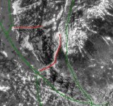
First, get the maps! Although the most recent edition of 1989 does not show any of the trail relocations of the last 17 years, the most detailed map is still the 1:20,000 scale "Mount Washington and the heart of the Presidential Range" prepared by Brad Washburn for the AMC and OBS. The most up-to-date and accurate trail locations are shown on the 2003 edition of the 1:47,500 scale "Presidential Range" map, from the series of maps prepared by Larry Garland for the AMC's "White Mountain Guide", although less detail is shown at this scale. I carry both. The 1:24,000 scale (7.5 minute) USGS topographic quad maps covering Mt Washington are hopelessly obsolete, useless except for historical reference by map collectors.
Before the Auto Road opens in mid-May, my favorite approach is via the Jewell Trail. Via the Jewell Trail, it is approximately 4 miles and 3000' vertical feet to the top of Airplane Gully at Clay Col. Washburn gives the elevations at the Cog base station as 2269' feet, and at Clay Col as 5391' feet.
Take the Base Station Road off US 302, at Fabyans, across from Bretton Woods Ski Area. Park at the Cog Railway's base station at the top of the hill, not the "new" USFS parking lot, which is a quarter mile or more down the hill (a small parking fee is sometimes collected by the Cog RR staff, ). Walk around the base station building to the side facing the mountain, where Old Peppersass and several other steam engine relics rest. Cross the cog tracks there, and you will find a footbridge leads across the waters of the Ammonoosuc River to the Jewell Trail.
The trail climbs steeply up the far banking of the Ammonoosuc, and soon reaches a trail junction at the top of a rise. Turn right at the trail junction; the trail connector branching left leads to the "new" USFS parking lot down the hill. After turning right at this junction, you descend into the Clay Brook drainage, and cross on a small footbridge, then begin ascending the north bank of the stream.
At about 3500', a switchback in the trail leads through thinner woods and an area of blowdowns with an outlook to the Cog base station below, the Waumbek Tank and Cog tracks across Burt Ravine, and views of Mt Monroe and Monroe Brook to the south. Shortly past this outlook, a sharp switchback leads away from the Clay Brook drainage, and there are no more views until you reach treeline.
When you reach treeline around 4500' feet, review the weather before ascending further. Most weather patterns approach from the West and North, and you should have a clear view towards Vermont of any cloud fronts approaching from that direction.
Several hundred feet above treeline on the western slope of Mt. Clay, the Jewell Trail ends at the trail junction with the Gulfside Trail (AT). Turn right (south) on the Gulfside, and follow it towards the summit of Mt Washington.
Crossing the flats of Clay Col on the GulfsideTrail, you continue straight through the trail junction, where the Clay Loop trail rejoins the Gulfside from your left, and continue heading South towards Mt Washington.
As you approach the next trail junction with the Westside Trail, look for a prominent boulder on your left, which is the landmark for locating the top of Airplane Gully. Once you have spotted the rock, leave the Gulfside Trail and walk towards the Gulf on the rocks, snow, or ice; carefully avoid stepping on any of the fragile alpine plants. In the immediate vicinity of Airplane Gully, the col is showing signs of damage and erosion caused by careless foot traffic.
If you are not sure you see the landmark , continue to the Westside Trail junction; there, the boulder should be clearly visible downhill, slightly to the North. The Washburn map shows the actual boulder, just above (North of) the "G" in the "Gulfside Trail" label at the Westside Trail junction.
Once at the boulder, if you walk about 20 feet south towards the Mt Washington summit, you should just about fall into Airplane Gully.
Here's an old TR of mine with some pictures of the Jewell Trail hike:
http://www.firsttracksonline.com/discus2/messages/2508/3878.html
Beware that some people prefer to hike up the Cog Railway tracks as a faster and more direct ascent route to Great Gulf. It is not for the faint of heart, or those with short legs. I would strongly recommend against it. I've done it twice, and each time swore I'd never do it again. I'll say no more.
Also beware that the Auto Road allows a shorter, easier hike to access Great Gulf, but the hazards are just the same when you drop in from the top after a 3/4 mile hike down as a 4 mile hike up.
Of course, if you hit it in perfect weather, with great snow conditions for climbing back up as well as skiing down, Airplane is one of the best runs you will ever have!