Eastern Molehills and Retro Areas

There is no Lake Effect at Platekill. Zero.
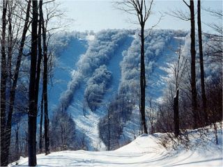
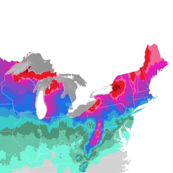
Did you ever ski Plattekill on a powder day? Or compare snowfall from a major snowstorm between Plattekill and nearby ski resorts?

I finished a ski safari in mid-February with a few hours at Windham (using Ikon) and stayed overnight as close to Plattekill as practical. Snowed overnight. Powder turns the next day, which was the Friday of Pres. Day week. Pretty sure it was more snow than at Hunter, Windham, or Belleayre.

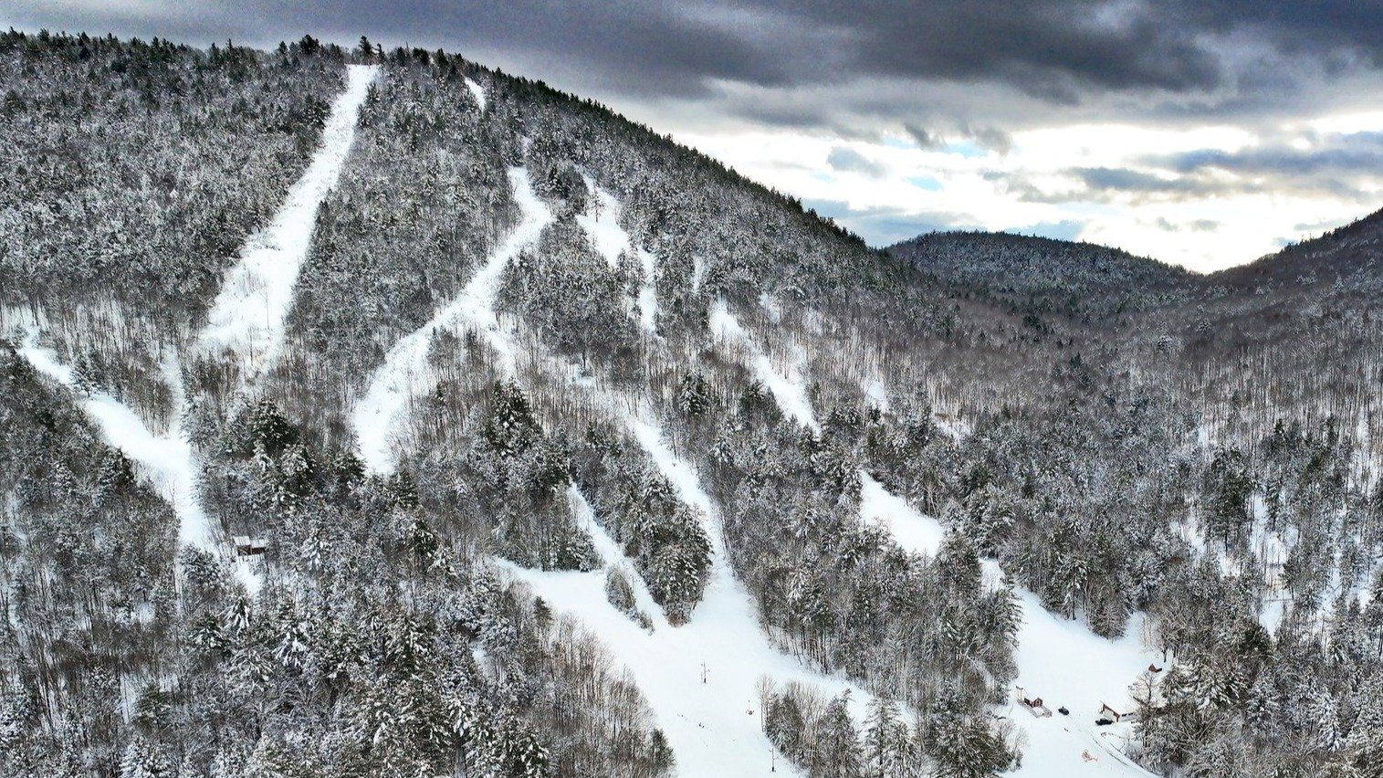
Grand Gorge, 13 miles from Plattekill, February 25, 2022, 7am
Plattekill snow Feb2022 - 1.jpeg


Plattekill lodge, February 25, 2022, 9am
Plattekill snow Feb2022 - 2.jpeg
 
compare snowfall from a major snowstorm between Plattekill and nearby ski resorts?
It doesn't matter what the moisture source is. Plattekill is on the NW edge of the Catskills, first mountain of that elevation with some orographic uplift. It should exceed the other Catskill areas.
 
There is no Lake Effect at Platekill. Zero.

I lived in Upstate NY and on the Hudson River. Look - Lake Effect rarely hits Binghamton.


The Lake Effect idea began when new owners needed something to market. And inflate snow numbers. And insanity.
I say this with peace and love and no disrespect
Bullshit
I have seen on radar streamers coming off of Lake Ontario directly affecting the western cats
 
There is no Lake Effect at Plattekill. Zero.
That was my conclusion, now free to say that since corroborated by someone who has lived in the region.
Bullshit. I have seen on radar streamers coming off of Lake Ontario directly affecting the western cats
Harvey and Jason have posted or linked to many NOAA radar maps of those Lake Ontario streamers on NY Ski Forum over the years. The "There is no Lake Effect at Plattekill. Zero." claim is up there with "the 2020 election was rigged." :icon-lol:

Speaking of "the election was rigged," here's former Admin mentioning lake effect in 2004 with the map below: not west coast atmospheric-river level, but it's there.

1760525580642.png
 
I can't spot Plattekill precisely on this map but the western Cats are clearly impacted by Lake Ontario.

Not sure what the official difference is between "lake effect" and "lake enhanced" but, it's obvious that the more north and west you go in the Cats, the greater the impact of Ontario.


I've seen Gore get lake effect (it's rare), I've even seen NJ getting lake effect, and Cape Cod!

On the other side, Plattekill often gets a little less from a nor'easter (vs Belle), but then after the storm passes, Plattekill benefits from the northwest flow.
 
Last edited:
According to the map, it appears that half of the western Cats snowfall is lake effect-related? Look at the bullseye on West Virginia.
I suspect that West Virginia has enough elevation and perhaps some other unique geography that provides orthographic enhancement. It's rather far from the great lakes, with no other mtns to the west.
 
For an example of what can happen in WV, here's the forecast for Pres. Day week last season. Brad Panovich has been doing video forecasts for SkiSoutheast for years. Doesn't get to ski much in NC, but does take a ski vacation out west at least once a season.

Brad is the chief meteorologist at a TV station is Charlotte. He's from northern Ohio. Early on in his career, he was the first Chief Meteorologist in Traverse City, Michigan. Plenty of lake effect there!

Posted February 13, 2025
 
I suspect that West Virginia has enough elevation and perhaps some other unique geography that provides orthographic enhancement. It's rather far from the great lakes, with no other mtns to the west.
This is at least 90% orographic uplift being on the western side of a mountain range. The bigger the mountains, the more the effect. WV and the Catskills are big in regional context. They also have a SW to NE orientation which means typical west-to-east weather systems will hit them somewhat perpendicular. This is illustrated by the map link posted above.
1760525580642-png.47800

The high snow band is oriented exactly west-to-east and Lake Ontario is north of it! The localized 11-14 is orographic enhancement in the Catskills.

My Google Earth grazing showed the Adirondacks as having a west-to-east orientation, which will cut down on that orographic uplift most of the time.

I read these same discussions about Great Salt Lake effect and Steenburgh says it's less than 10% impact on Wasatch snowfall.
 
Last edited:
How's that possible, not enough fetch?
In general yes. The maximum fetch was (less now as the Salt Lake is shrinking) 80 miles on a NW to SE flow. If you extend that NW-SE line it hits the Wasatch at the base of LCC. Google Earth shows that maximum is now 66 miles, and the direct west-to-east fetch that you see off the back of Snowbasin is only 22 miles.
 
Not exactly the best fit for the thread title, but . . .

I've noticed more 3-pack and 4-pack deals being offered for the 2025-26 season. In the northeast, PGRI had the Mission Affordable 4-pack for Ragged for quite a while. That's still happening even though Ragged was just sold to a local group. Cannon is having a flash sale online for transferable 3 packs for $199 Nov 8-11.

I expect there to be 3/4 day multi-packs and 1-day deals for New England at Snowbound Expo in Boston next weekend.
 
Snowbound Expo in Boston next weekend
NASJA Annual Meeting and Professional Development

LOCATION

Hyatt Place, Boston Seaport, 295 Northern Ave, Boston, MA 02210

DATE AND TIME

11/13/25 2:30pm - 11/13/25 4:30pm US/Eastern

Annual meeting Covering Live Professional Snowsports Events: From the Media Center and Beyond

I was fortunate to join NASJA in 1999 when "Annual Meeting" meant a subsidized 4 days in late March/early April at major western ski resort. I attended nine of those, including the last one at Mammoth in 2013.
 
Look at the bullseye on West Virginia.
Not as much as the bulleyes ahead of the Frankenstorm October 2012 (ie. Hurricane Sandy). Look at the forecast maps in my post.

 
Last edited:
According to the map, it appears that half of the western Cats snowfall is lake effect-related? Look at the bullseye on West Virginia.
Zack of OpenSnow does the Daily Snow for the "mid-Atlantic," which actually goes from NC/TN north into western NY. He made reference to "lake effect" in today's forecast for the next week.

Screenshot 2025-11-10 at 4.06.46 PM.png

". . .
Forecast on Monday, November 10, and Tuesday, November 11:

The storm system that moved through on Sunday has brought strong northwest flow into the Eastern US, which is bringing widespread below normal temperatures. This flow, along with backside moisture, is bringing snow showers along the Appalachians.

On Monday, snow showers will be on and off throughout the Appalachians, which will bring light snow accumulations of 1 - 6 inches. Stronger northwest winds will develop on Monday night, which will develop several lake effect snow bands off Lake Erie and Lake Ontario into the northern Mid-Atlantic. Lake effect snow bands will continue into Tuesday and become strong to intense at times, especially in the morning. Several areas of snow will also reach central Pennsylvania to northern PA, but will be lighter with fewer impacts.

On Tuesday, a few areas of snow showers will affect the higher terrain of the western Mid-Atlantic, but snow showers will have dissipated in North Carolina. Below is a look at the HRRR model's depiction of precipitation type and intensity from Monday morning, November 10 through Tuesday evening, November 11.

Lake effect snow showers will dissipate Tuesday evening as the next storm system changes the wind direction across the northern Mid-Atlantic. This weak storm system will transition the northwest flow to westerly flow and transition lake effect snow to a couple of scattered rain and snow showers with minimal effects.
. . ."
 
Back
Top