You are using an out of date browser. It may not display this or other websites correctly.
You should upgrade or use an alternative browser.
You should upgrade or use an alternative browser.
Fire Smoke From Canada
- Thread starter jamesdeluxe
- Start date


Is that a good idea?
Not to pile on, but 200 is bad. Not recommended.Jim please don't do that again!
I missed this article a few days ago:

 www.nytimes.com
Most Forest Fires in Canada Are Simply Impossible to Put Out
Half of Canada’s wildfires are in remote areas with no road access. Impossible to fight, they are often left to burn.
www.nytimes.com
I cant get past the paywall to read the details, but the headline is accurate. Remoteness cant be compared to anywhere in the lower 48. Maybe similar to remote Alaska. Most are in the wilderness, hundreds of miles from the nearest roads.I missed this article a few days ago:
Most Forest Fires in Canada Are Simply Impossible to Put Out
Half of Canada’s wildfires are in remote areas with no road access. Impossible to fight, they are often left to burn.

I had a general idea from the start that most of Canada’s forest is in such remote areas that human influence either starting them or putting them out is minimal.
The surprise from my reference in post #15 is that these natural fires were more common in the 1700’s Little Ice Age. Why? It may have been colder but it was also drier, particularly at high latitudes.
The surprise from my reference in post #15 is that these natural fires were more common in the 1700’s Little Ice Age. Why? It may have been colder but it was also drier, particularly at high latitudes.
Remoteness cant be compared to anywhere in the lower 48. Maybe similar to remote Alaska. Most are in the wilderness, hundreds of miles from the nearest roads.
Understood. It's just interesting to watch people and government leaders raging against Canada for polluting our air even when, as you note, there's nothing that can be done on a practical basis. When I was living in Nice, the Chernobyl radioactive cloud flew directly over us and authorities told citizens to rinse their produce before eating; I kid you not. The French government was allegedly calling on NATO to do something.most of Canada’s forest is in such remote areas that human influence either starting them or putting them out is minimal.

If we are going to start punishing for pollution, US is at the top of the list.raging against Canada for polluting
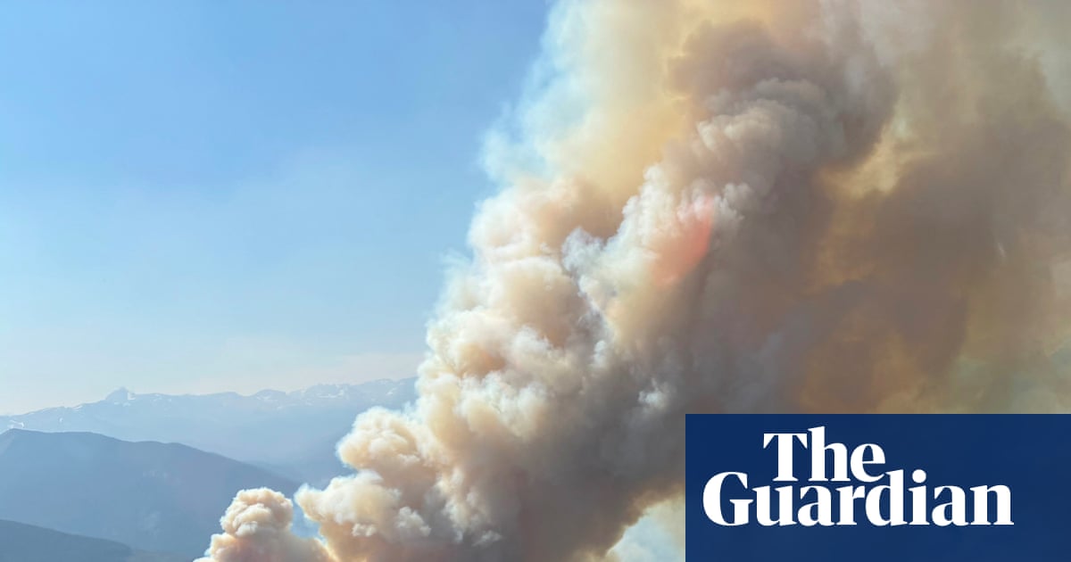
Update:
 www.theguardian.com
Canada’s worst wildfire season fuels calls for national agency to tackle threat
More than 900 fires burning in only G7 country without national emergency agency to coordinate response
www.theguardian.com
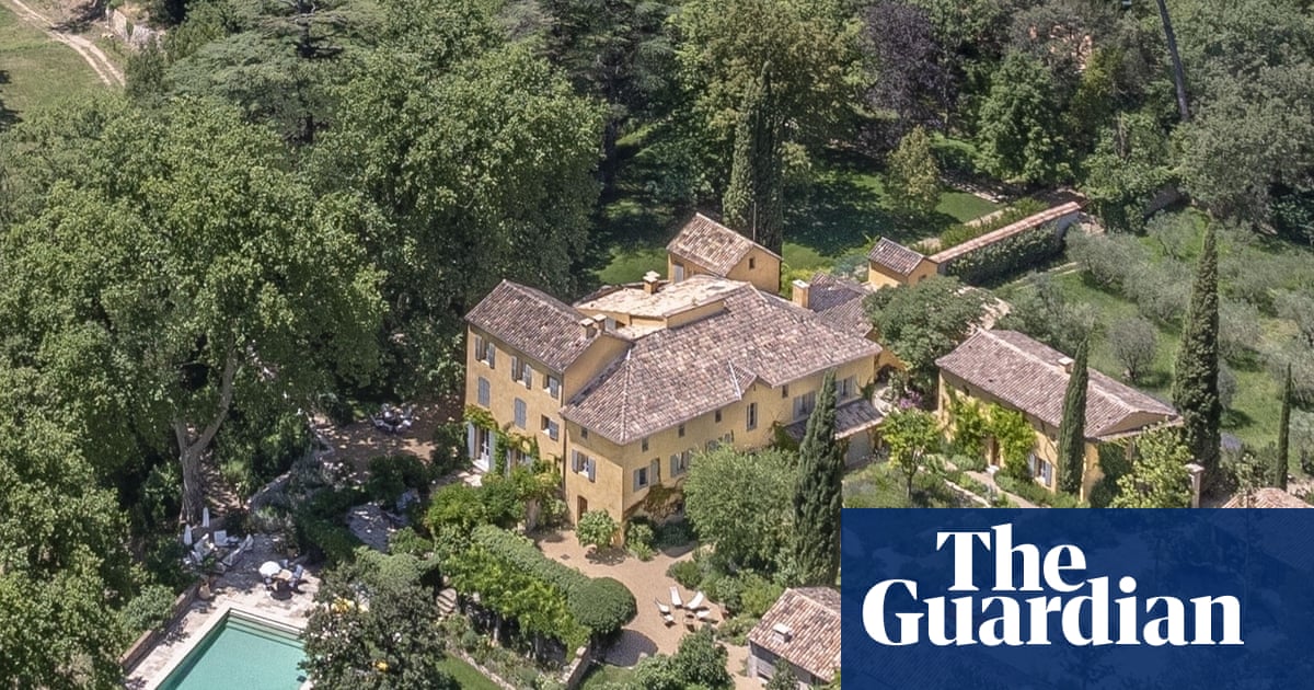
Meanwhile in France -- George could easily afford his own private fire brigade but (to his credit) doesn't want to rub his wealth in other citizens' faces while they're losing their homes.
 www.theguardian.com
George and Amal Clooney evacuate from French house: ‘We do not know whether our beautiful home will survive’
In a letter to the local mayor, the actor added that ‘whatever happens, they remain fully part of this community’ and will ‘contribute to its rebuilding’
www.theguardian.com
The potential for more smoke where I live above the 150-level next week (forecast at the bottom). Hopefully this prediction won't verify.

The smoke that inundated the upper Midwest and Mid-Atlantic during the week of July 12, 2026, came from a 300+ mile line of fires burning in largely roadless boreal forests riddled with lakes, rivers, creeks, and wetlands from far northern Minnesota to well north of Lake Nipigon in Northwestern Ontario. (All of Ontario north of the Minnesota border is generally considered “Northwestern Ontario.")
Significant fires blew up that week, and are still smoldering, in the Boundary Waters Canoe Area Wilderness (https://en.wikipedia.org/wiki/Boundary_Waters_Canoe_Area_Wilderness), Quetico Provincial Park (https://en.wikipedia.org/wiki/Quetico_Provincial_Park), crown lands north of the Quetico-Superior region and the five-million-acre Wabakimi complex of provincial parks and protected waterways north of Lake Nipigon (https://en.wikipedia.org/wiki/Wabakimi_Provincial_Park).
For the past 34 years, my wife and I, later with our daughter, have spent the lion's share of our summer vacation time paddling and portaging through these forests. In fact, we are intimately familiar with much of country that burned in July. Some places very special to us will not look the same to us for the remainder of our lives. However, fire is a natural and important part of the life cycle of these forests and species such as jack pine and black spruce depend upon fire to reproduce.
These forests, in their natural state, are a patchwork of old growth, various stages of post-fire regeneration, and recent burns.

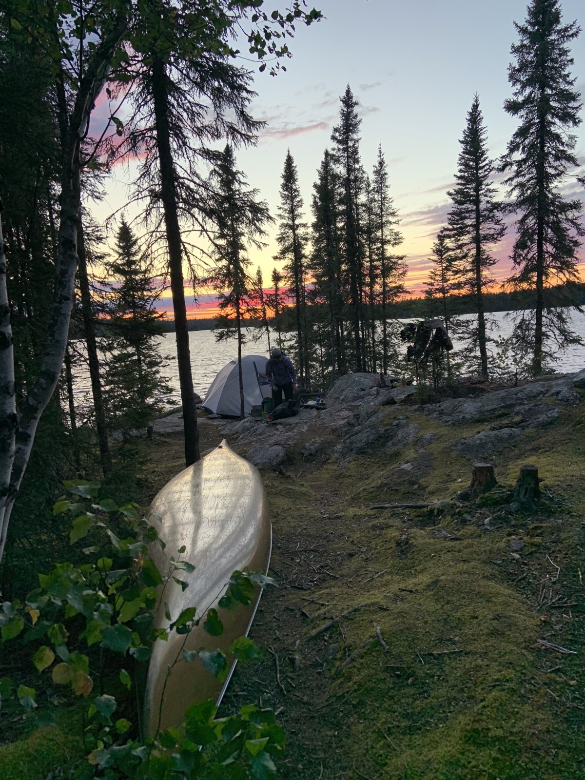


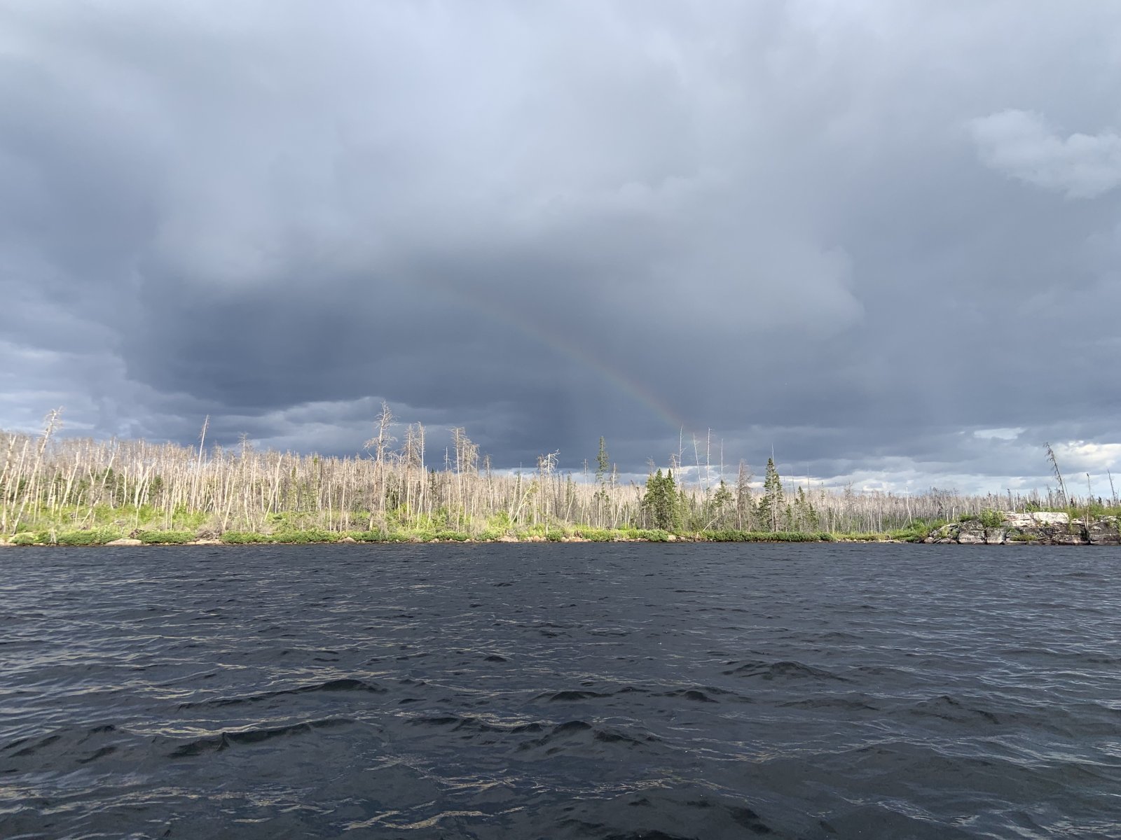


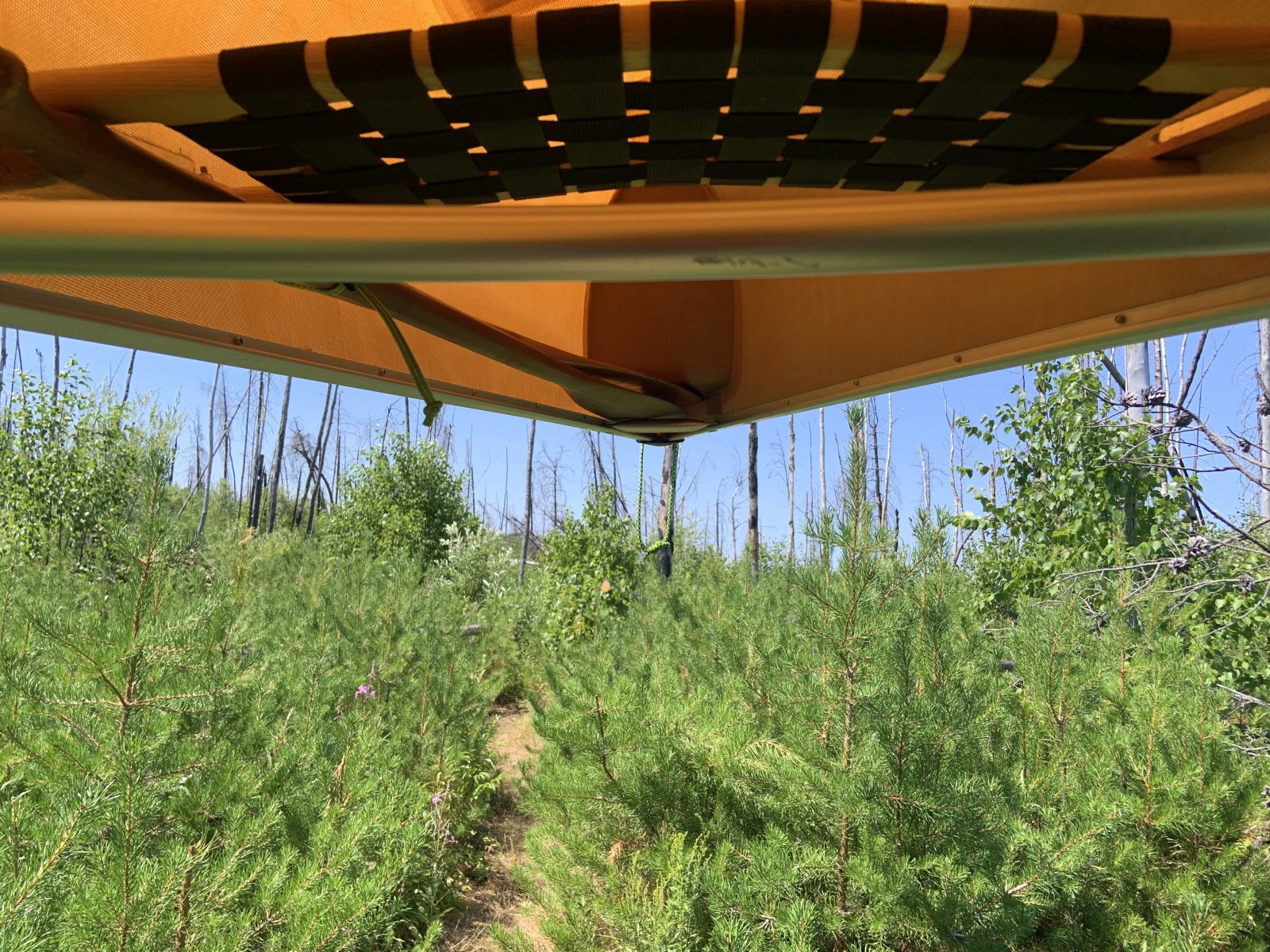
Nonetheless, what happened the week of July 12, was more or less unprecedented, and, although I'm not an ecologist or firefighter, IMHO could not have been predicted, prevented, or quickly controlled.
Generally, these forests have two fire seasons. The first is in the spring, after snow melt and before green up, and generally has not produced many large fires. The second has historically started in late summer and has run into the middle of fall. July 12 is very early for large fires. Climate change has, on average, extended both seasons.
The snowpack was decent this past winter, and fire activity was below average through June. However, June was much drier than average. The week of July 5 brought a series of dry lightning storms across the region that ignited numerous small fires deep in these roadless wildernesses. Not unusual. However, the weather the week of July 12 was quite unusual with moderate but gusty winds and a record-setting, super-dry heat dome (for just one example it was a record-shattering 100F in Grand Portage, a stone's throw from the Canadian border, ON LAKE SUPERIOR - which must be one of the world's greatest natural air conditioners that time of year) that resulted in "flash drought" across the region and small fires absolute exploded.
Below are the US/Canada FIRMS (Fire Information for Resource Management System) thermal anomaly maps for July 12-15:
7/12/2026

7/13/2026
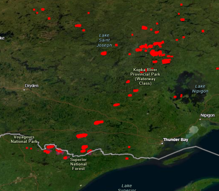
7/14/2026

7/15/2026
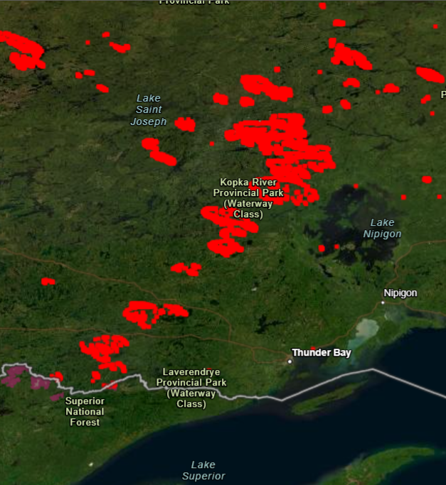
Note the explosive growth.
For a sense of scale, the distance between the southwestern to the northeastern ends of the line of fires is greater than 300 miles. The largest blob of fires on the map, northeast of KRPP, is the Thunder Bay 036 fire. At its peak, it alone, approached 800k acres in size, roughly 1/7 the size of New Jersey. It burned through two First Nations Villages and forced the evacuation of several others and the town of Armstrong. The Wabakimi complex is almost entirely roadless, but the CN does run through it. This terrifying viral footage was shot there on July 13, 2026:
As others have said, I think it's difficult for many North Americans, especially Americans, to grasp just how roadless much of Canada's boreal forests are. Google AI says the furthest one can get from a road in the lower 48 is about 21 miles in a remote corner of Yellowstone. We routinely exceed that on our Canadian canoe trips. Our daughter has gotten as far as 140 miles from the nearest road on the border of the NWT and Nunavut.
Just consider the southernmost third of Northwestern Ontario alone:

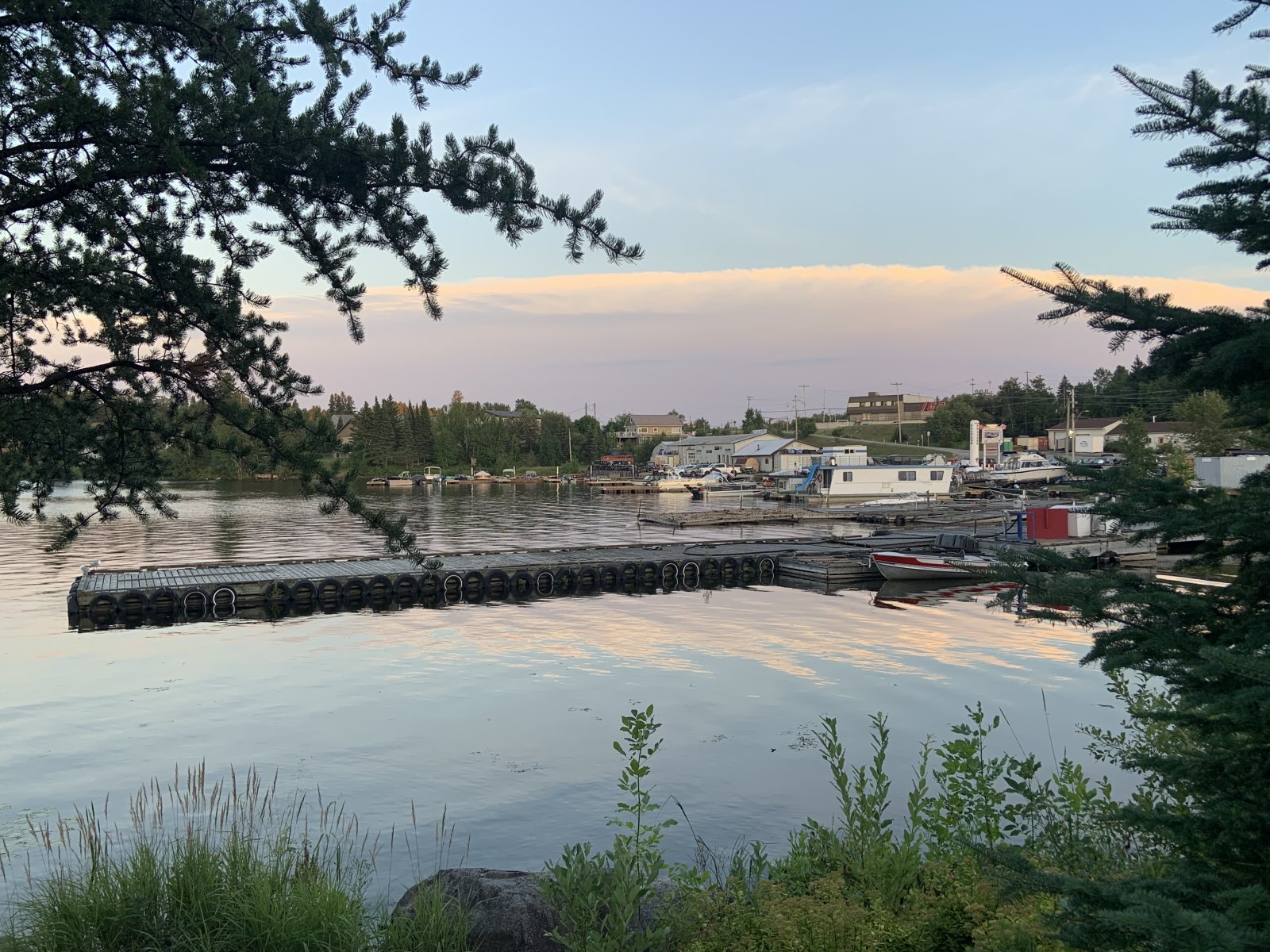
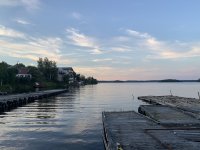
On the map above, the roads essentially end in Armstrong, New Osnaburgh, and Red Lake. The First Nations communities north of there are dependent upon air and winter ice roads for transport. We were just in the gold mining town of Red Lake two weeks ago. It has one stop light. Walking around the waterfront after dinner, we counted four air service companies, indicating the importance of float and STOL aircraft to the region. In fact, the unassuming bay in the pictures below was evidently the busiest airport in the world as measured by takeoffs and landings in 1935 and 36 with planes on floats or skis depending upon the season.

Significant fires blew up that week, and are still smoldering, in the Boundary Waters Canoe Area Wilderness (https://en.wikipedia.org/wiki/Boundary_Waters_Canoe_Area_Wilderness), Quetico Provincial Park (https://en.wikipedia.org/wiki/Quetico_Provincial_Park), crown lands north of the Quetico-Superior region and the five-million-acre Wabakimi complex of provincial parks and protected waterways north of Lake Nipigon (https://en.wikipedia.org/wiki/Wabakimi_Provincial_Park).
For the past 34 years, my wife and I, later with our daughter, have spent the lion's share of our summer vacation time paddling and portaging through these forests. In fact, we are intimately familiar with much of country that burned in July. Some places very special to us will not look the same to us for the remainder of our lives. However, fire is a natural and important part of the life cycle of these forests and species such as jack pine and black spruce depend upon fire to reproduce.
These forests, in their natural state, are a patchwork of old growth, various stages of post-fire regeneration, and recent burns.
Nonetheless, what happened the week of July 12, was more or less unprecedented, and, although I'm not an ecologist or firefighter, IMHO could not have been predicted, prevented, or quickly controlled.
Generally, these forests have two fire seasons. The first is in the spring, after snow melt and before green up, and generally has not produced many large fires. The second has historically started in late summer and has run into the middle of fall. July 12 is very early for large fires. Climate change has, on average, extended both seasons.
The snowpack was decent this past winter, and fire activity was below average through June. However, June was much drier than average. The week of July 5 brought a series of dry lightning storms across the region that ignited numerous small fires deep in these roadless wildernesses. Not unusual. However, the weather the week of July 12 was quite unusual with moderate but gusty winds and a record-setting, super-dry heat dome (for just one example it was a record-shattering 100F in Grand Portage, a stone's throw from the Canadian border, ON LAKE SUPERIOR - which must be one of the world's greatest natural air conditioners that time of year) that resulted in "flash drought" across the region and small fires absolute exploded.
Below are the US/Canada FIRMS (Fire Information for Resource Management System) thermal anomaly maps for July 12-15:
7/12/2026
7/13/2026
7/14/2026
7/15/2026
Note the explosive growth.
For a sense of scale, the distance between the southwestern to the northeastern ends of the line of fires is greater than 300 miles. The largest blob of fires on the map, northeast of KRPP, is the Thunder Bay 036 fire. At its peak, it alone, approached 800k acres in size, roughly 1/7 the size of New Jersey. It burned through two First Nations Villages and forced the evacuation of several others and the town of Armstrong. The Wabakimi complex is almost entirely roadless, but the CN does run through it. This terrifying viral footage was shot there on July 13, 2026:
As others have said, I think it's difficult for many North Americans, especially Americans, to grasp just how roadless much of Canada's boreal forests are. Google AI says the furthest one can get from a road in the lower 48 is about 21 miles in a remote corner of Yellowstone. We routinely exceed that on our Canadian canoe trips. Our daughter has gotten as far as 140 miles from the nearest road on the border of the NWT and Nunavut.
Just consider the southernmost third of Northwestern Ontario alone:
On the map above, the roads essentially end in Armstrong, New Osnaburgh, and Red Lake. The First Nations communities north of there are dependent upon air and winter ice roads for transport. We were just in the gold mining town of Red Lake two weeks ago. It has one stop light. Walking around the waterfront after dinner, we counted four air service companies, indicating the importance of float and STOL aircraft to the region. In fact, the unassuming bay in the pictures below was evidently the busiest airport in the world as measured by takeoffs and landings in 1935 and 36 with planes on floats or skis depending upon the season.
Attachments


EMSC
Well-known member
That's getting pretty remote.Google AI says the furthest one can get from a road in the lower 48 is about 21 miles in a remote corner of Yellowstone. We routinely exceed that on our Canadian canoe trips. Our daughter has gotten as far as 140 miles from the nearest road on the border of the NWT and Nunavut.
Best I can do is recall back to my days as a teen doing a canoeing trip through Algonquin Park. I did a loop of ~65-ish miles with plenty of portages from lake to lake for more than a week. But looking at a map of that area it looks like I was probably never more than ~20-25miles from some sort of road at maximum.
As per Gemini. There are section of the Canadian boreal forest 400-500 km from the nearest road in northern Ontario and NE Manitoba. Apparently in this area there is a road free wilderness the size of Germany. That quite a contrast from the most remote part of the USA being 21 miles from a road. As per Trump, all we need to do is rake it a little more,