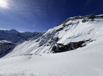
Jungfrau, Switzerland (Mürren–Schilthorn, Grindelwald–Wengen, Grindelwald–First): March 26-28, 2026

ChrisC

Well-known member
Skiing

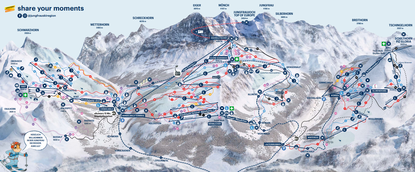
The Jungfrau Ski Region has three main ski areas, all covered by the full Jungfrau Ski Pass, but they are not all lift-connected.
  1. Mürren–Schilthorn. On the opposite side of the Lauterbrunnen Valley: This is the highest and most challenging of the three, reaching 2,970 meters, with the best expert terrain and the most interesting off-piste possibilities.
  2. Grindelwald–Wengen. Sometimes called Kleine Scheidegg, it's the largest interconnected area located directly beneath the Eiger, Mönch, and Jungfrau.
  3. Grindelwald–First. A separate mountain above Grindelwald, but it isn't connected to Kleine Scheidegg by lifts, so you need a bus. First is sunnier and has more open freeride terrain, but it's more exposed to wind.
Perhaps the biggest ski pass decision is whether to buy a Jungfraujoch add-on. The Jungfraujoch is a high mountain saddle between the Jungfrau and Mönch, reached by a cogwheel railway running through the Eiger and Mönch. Its “Top of Europe” complex sits at 3,454 meters (11,332 feet), making it Europe’s highest railway station.

If you purchase a valid multi-day (3+) ski pass, you qualify for the discounted Jungfraujoch “Top Ticket,” priced at CHF 63 round trip. Otherwise, the Jungfraujoch ticket is CHF 200-225. I have never visited because other Alpine resorts include similar experiences in their lift ticket price (e.g., Zermatt includes Gornergrat Railway or Matterhorn-Glacier Paradise simply as part of a ski ticket at 92 CHF).


Lodging

There are various lodging bases:
  • Wengen: A charming, car-free village with direct access to Männlichen, Kleine Scheidegg, and the Grindelwald–Wengen ski area. It has limited nightlife and requires travel to reach Mürren or Grindelwald-First.
  • Mürren: A scenic, car-free village offering the region’s highest and steepest skiing with excellent access to the Schilthorn sector. The ski area is relatively small, wind-sensitive, and isolated from Wengen and Grindelwald.
  • Grindelwald: The largest and most convenient resort base, with access to Grindelwald-First and the Eiger Express toward Eigergletscher. The village is spread out, busy, and less intimate than Wengen or Mürren.
  • Lauterbrunnen: A central valley base with convenient transportation to both Wengen and Mürren. It has no direct skiing and requires a train, bus, or cable car journey each morning.
  • Interlaken: A lively town with the region’s widest range of hotels, restaurants, shops, and transportation connections. It is far from the ski lifts and requires a daily commute.
Over the years, I've stayed in Interlaken (summer), Grindelwald, and now Mürren on this trip. Personally, I think Mürren and Wengen are the most unique since they are perched on hillsides or cliffs and are car-free, but all are scenic.

The biggest downside is that your location might limit where you ski because of the effort required. For example, Mürren is the highest ski area with the most snowfall and fewest crowds, but someone staying in Grindelwald is less likely to make the trip. And vice versa if you stay in Mürren and want to check out First. Almost all the Jungfrau sectors deserve at least a half day, but if one has to pick, Grindelwald-Wengen and Mürren-Schilthorn are my favorites

Jungfrau Railways will invest CHF 70 million to build a new direct S3 / "Triline" gondola system from Grindelwald station via a new route to the First summit, eliminating the bus ride.

(Note: Grindelwald will soon have two S3 Gondola systems in perhaps one of the world's most scenic alpine environments. Perhaps 'Save Our Canyons' should take note and not use an aesthetics argument against a Little Cottonwood Canyon gondola.)


Jungfrau Piste Map
1787234288405.png


Murren

A few years ago, I only skied Murren in a more cursory way as a half-day add-on to the larger Grindelwald-Wengen (Kleine Scheidegg) complex. I wrongly assumed that it was more rolling (yet interesting) intermediate terrain similar to Grindelwald-First or Grindelwald-Wengen. Despite hiking the area in the summer as well, I underestimated the area. Therefore, a return was warranted. Also, for my partner, I think a Zermatt-Jungfrau via train best typifies Switzerland. (The Glacier Express to St. Moritz was vetoed (too much train time), and Verbier).

To me, Mürren is more akin to a smaller-scale Engleberg or Andermatt-Gemsstock. It has roughly the same:
  • Vertical (Mürren 1628 m to Schilthorn/Piz Gloira 2970 m), which is roughly 4500 ft - possibly more if one can ski to Winteregg, Gimmelwald, or Lauterbrunnen.
  • High snowfall. Snowpack increases rapidly as one enters the front range of the Alps from Interlaken - or even Lauterbrunnen. The same Nordstau and W/NW storms that dump in Engelberg hit the area. They run into a wall of nearly 3600m/12k ft in the Bernese-Oberland Alps from the 500m/1.8k ft lowlands of Interlaken.
  • Big Off-Piste lines: Totenkopf/Grauseewli, Tschingelchrache. Almost anything into the Blumental drainage (under Birg Cable Car) or Schiltal drainage (south of Birg and Schilthorn Cable Cars). See map below: Routes 25, 26, 27.
  • General steepness
  • Under-the-Radar. Less powder competition than at other big-name resorts.
It comes up a little short, since:
  • Size. Just not quite as large.
  • Orientation. The mountain is oriented E-W, meaning some areas have a southern exposure (looker's left).

Murren Piste Map

1787237793925.png


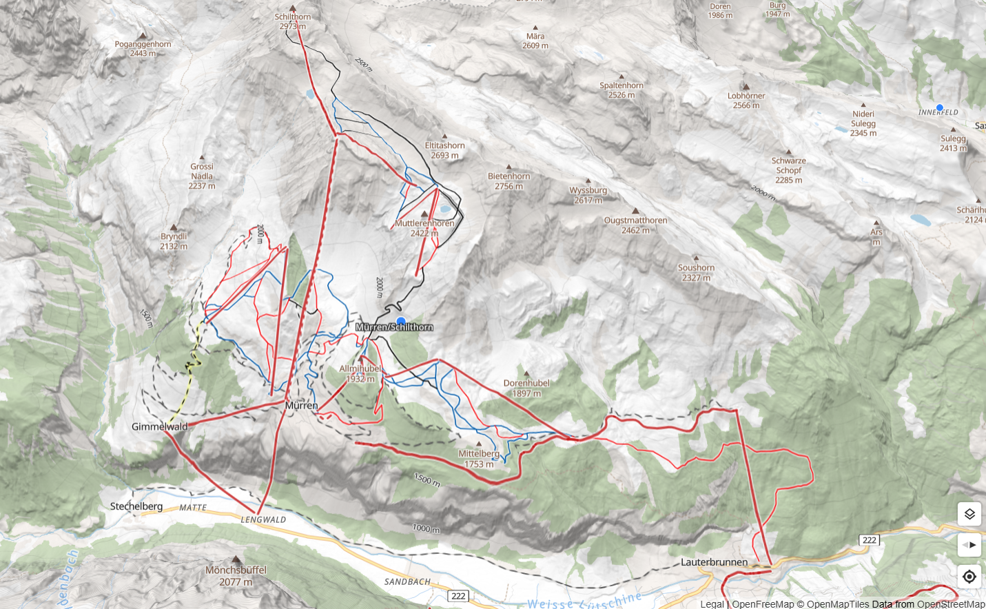
Mürren Topographical Map for accuracy - freeride navigation
Link: Murren at Openskimap
1787249423321.png


Partial list of Backcountry Skiing Routes in Grindelwald, Wengen and Mürren
LINK

1787286653519.png


Freeride Guide Jungfrau Region map

Best Lines that are lift accessible and returnable: 25, 26, 27

1787274807664.png


IMG_9716.jpeg


IMG_9718.jpeg


Mürren - Arrival by Train from Zermatt

We arrived by train during a break in the Nordstau storm forecast to hit the Jungfrau region that evening.

The journey is complex but manageable. Having visited Mürren twice before, I knew exactly what to expect.
The route involves five transfers and six segments, taking 3.5 hours in total. This is because both Zermatt and Mürren are car-free villages.
However, once you reach Interlaken, it's basically just sightseeing. Ski & luggage storage areas are available the entire way.

Zermatt → Visp → Spiez → Interlaken Ost → Lauterbrunnen → Grütschalp → Mürren BLM
  • Zermatt–Visp: Matterhorn Gotthard Bahn
  • Visp–Spiez: SBB InterCity
  • Spiez–Interlaken Ost: BLS/SBB
  • Interlaken Ost–Lauterbrunnen: Berner Oberland Bahn
  • Lauterbrunnen–Grütschalp: Cable car
  • Grütschalp–Mürren BLM: Mountain railway
Mürren BLM is the arrival station for Hotel Edelweiss, approximately a five-minute walk away.

Even with a car, you'd still complete 3 segments: (Zermatt → Tasch) and (Lauterbrunnen → Grütschalp → Mürren BLM). Plus driving. Plus parking garages. Again, a car is not necessarily easier.


Afternoon View of the Lauterbrunnen Valley from the Mürrenbahn (150p Cable Car). Lauterbrunnen --> Grutschalp
Storm break; snow levels are lowering.
IMG_4838.jpg


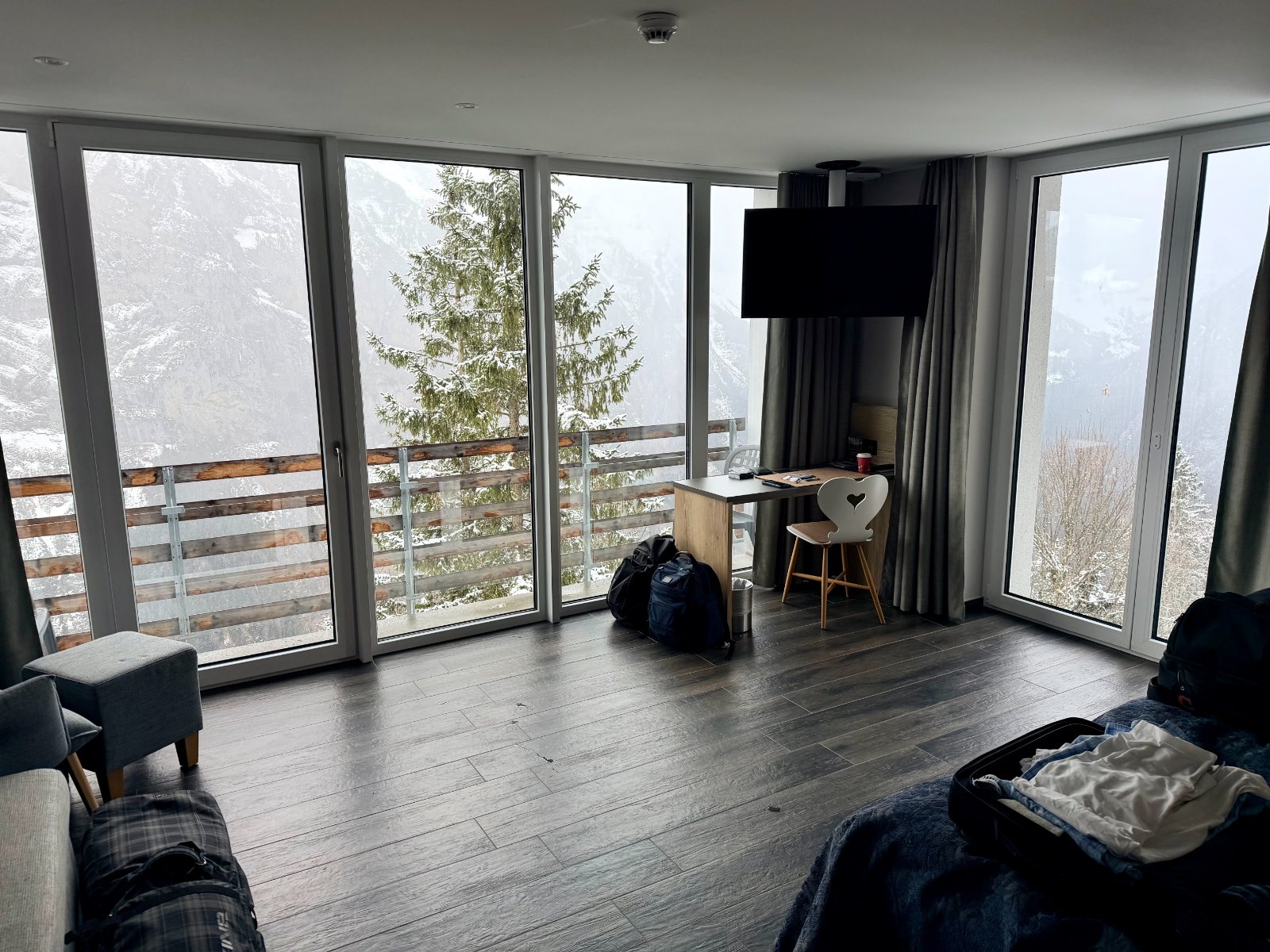
Typically, I don't pay much attention to where I stay, but the Hotel Edelweiss in Mürren is a notable exception. Their third addition was built directly into the cliffside, hanging above the Lauterbrunnen Valley.

From the room, we had a perfect "bullseye" view of the Mönch, with the Eiger and Jungfrau peaks just visible through the clouds. The structure reminded me of the architecture at Snowbird’s Cliff Lodge.

IMG_4855.jpg

IMG_4922.jpg

IMG_4856.jpg
IMG_4858.jpg


We recently took a sunset ride on the new Stechelberg–Mürren cable car, which is included in our rail pass as a transit-only lift. Opened in December 2024, this project marks the first completed phase of the extensive Schilthornbahn 20XX reconstruction. We look forward to riding the remaining two segments—from Mürren to Birg and onward to the Schilthorn summit—during our ski days.

This direct, non-stop aerial tramway climbs from the Lauterbrunnen Valley floor to Mürren in just four minutes. Its design is truly unique, featuring an 11-meter suspension arm and a roof-based entry/exit system at the Stechelberg station to accommodate its extreme 159.4% gradient, which currently ranks as the steepest in the world.

Key specs include:
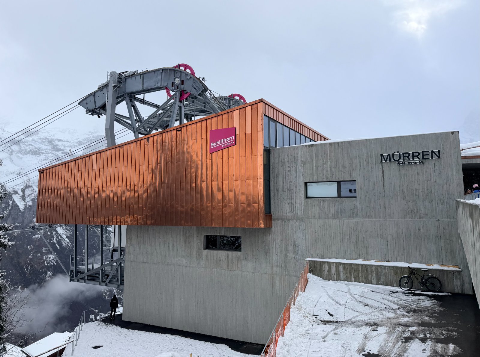
  • Route: Stechelberg to Mürren
  • Vertical Rise: 775 m / 2,543 ft
  • Length: Approx. 1,194 m / 3,917 ft
  • Capacity: 85 passengers per cabin; approx. 800 passengers per hour
  • Operations: Fully automated with integrated freight containers for luggage and supplies

IMG_4862.jpg
IMG_4865.jpg


Heading down
IMG_4869.jpg


Back Up - Round Trip
IMG_4887.jpg
IMG_4894.jpg


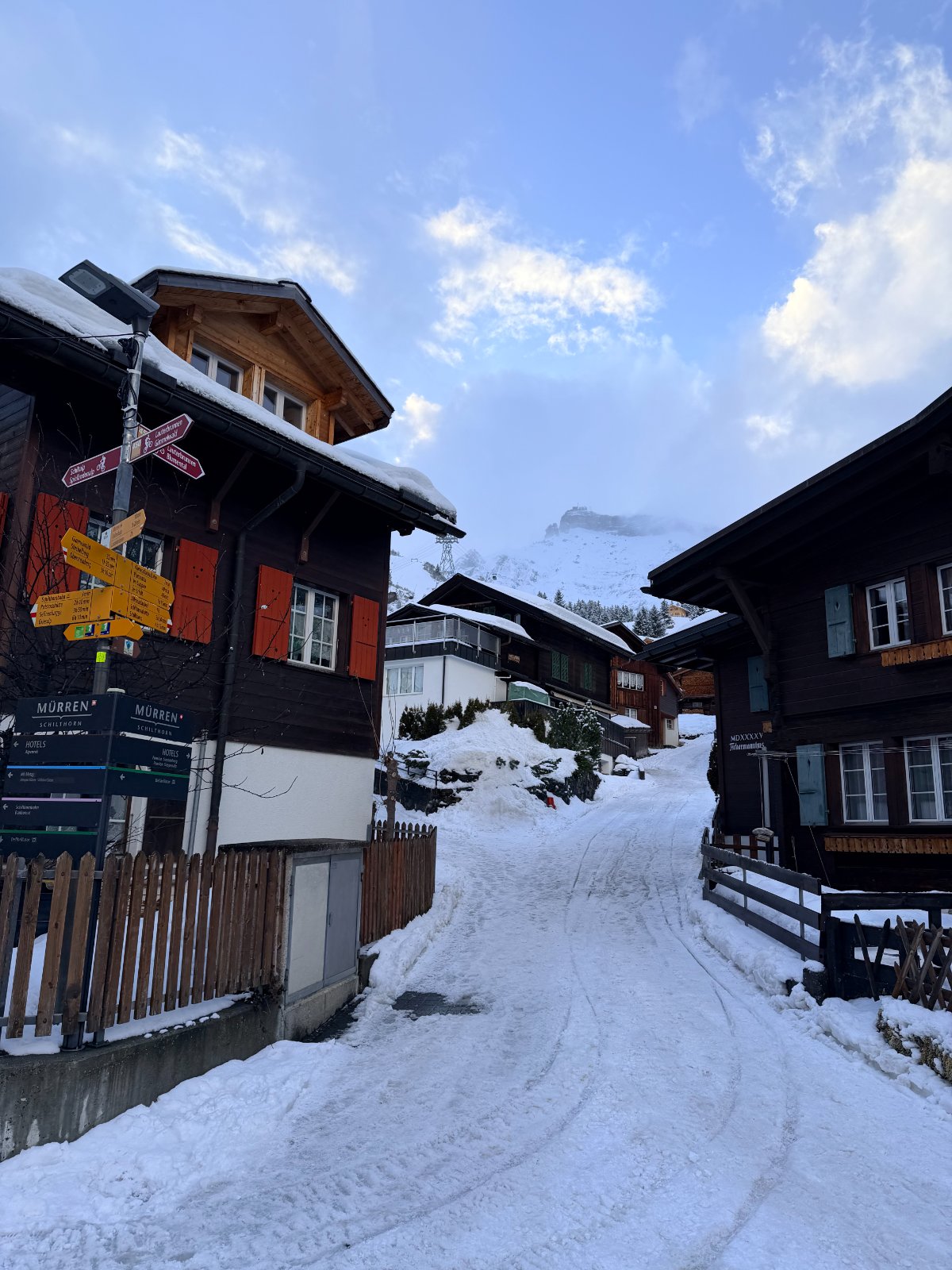
Murren Village

IMG_4897.jpg


Allmendhubelbahn (Funicular)
You can also go sledding/sledding off this lift!

The Allmendhubelbahn is a short funicular running from central Mürren at approximately 1,650 m to Allmendhubel at 1,907 m. It gains about 257 vertical meters in only four to five minutes.

The principal sledding route is the Bob Run:
  • Start: Allmendhubel upper station
  • Finish: Allmendhubelbahn lower station in Mürren
  • Distance: Approximately 3 km / 1.9 miles
  • Vertical descent: Approximately 270 m / 886 ft
  • Difficulty: Easy to moderate
  • Route: Allmendhubel → Blumental → forest → Mürren
  • Typical descent: Roughly 15–25 minutes, depending on conditions and stops

IMG_4872.jpg

IMG_4900.jpg
IMG_4909.jpg
IMG_4911.jpg


Most lodging in Mürren includes access to the Sports Center
IMG_4912.jpg


Hotel Mürren Palace
Perched at 1,650 meters (5,413 feet) above sea level on the highest point of the Mürren mountain terrace, it has stood since 1874 and is recognized as Switzerland's oldest palace hotel.

We ate here later in the evening.
IMG_4914.jpg
IMG_4918.jpg
IMG_4934.jpg


Some minor league Apres-Ski
IMG_4935.jpg
 
Last edited:
You’re like a human Alps tourist brochure. Looks great but I think my wife would be disappointed if I went to such an iconic location without her.
 
Morning. Around 30cm/12in new snow. Varied based upon altitude and some wind-loading.

Lifts opened progressively throughout the day:
  • 8-9 AM - Lower Mountain. Schiltgrat, Winteregg, Allmendhubelbahn.
  • 11 AM - Mid Mountain. Cable Car: Murren-Birg, Riggli, Kandahar, Muttleren.
  • 1 PM - Upper Mountain. Cable Car: Birg-Schilthorn.

Eiger, Mönch (middle), Jungfrau. About Perfect.
IMG_4938.jpg


Schiltgrat Lift. Birg Station above.
IMG_4948.jpg


Blumental Basin
IMG_4956.jpg


Lots of easy-access powder to the south (below) or north sides of Schiltgrat Lift.
IMG_4978.jpg


Love the working farms
IMG_4983.jpg


Skiing laps into Mürren
IMG_4995.jpg


Looking over to Muttleren Lift.
IMG_5003.jpg


One of the big freeride lines extends below the lift to the left through chutes. At one point, this was pisted.
I am descending the north side of Schilthorn Lift into Blumental.
IMG_5012.jpg
IMG_5016.jpg


Amazing huts scattered around Mürren
IMG_5028(1).jpg


Repeating powder laps.
IMG_5033.jpg


Powder Panic competition at Mürren
IMG_5034.jpg
IMG_5036.jpg


Murren again
IMG_5042.jpg
IMG_5046.jpg


Started by skiing directly into Blumental through either woods, chutes, or some faces.
IMG_5063.jpg
IMG_5066.jpg
IMG_5068.jpg


Blumental laps from Schiltgrat
The Wall = Trees area. Blumental = open faces to the looker's right.
IMG_5072.jpg
IMG_5076.jpg


Blumental Panorama
Reminded me of Engelberg. Trubsee mid-mountain zone under Titlis. However, everything is not skiable.
IMG_5081.jpg
IMG_5084.jpg


Went to do a few laps off Winteregg Lift via the Funicular
IMG_5085.jpg
IMG_5086.jpg


Lots of easy powder Maulerhubel lift
IMG_5088.jpg


Off-piste that became available at around 11 AM below Kandahar lift. Referred to as "Hogs Back"?
IMG_5090.jpg


Eiger (left) and Monch (right)
IMG_5097.jpg


Winteregg
Easy low angle powder laps
IMG_5107.jpg
IMG_5115.jpg
IMG_5116.jpg
 

Attachments

  • IMG_4947.jpg
    IMG_4947.jpg
    388.4 KB · Views: 13
  • IMG_4953.jpg
    IMG_4953.jpg
    325.7 KB · Views: 15
Last edited:
Looks great but I think my wife would be disappointed if I went to such an iconic location without her.

But it's located in German-speaking Switzerland. ;)

St. Anton/Arlberg would be a Top 3 Alps ski destination.

Jungfrau is one of the best Alps tourist destinations. I would not plan a ski trip around it; it's more of an addition to another destination. It's like the Dolomites, where summer can be equally enjoyable and busier.

Also, January to Mid-February is prime time for the Jungfrau since it is at a relatively low altitude.

For March, I had a backup plan to ski at Saas Fee or St. Moritz if a cold or stormy pattern didn't materialize. Also, I chose Mürren because it is higher and colder than the rest of the Jungfrau.
 
Last edited:
But it's located in German-speaking Switzerland. ;)

St. Anton/Arlberg would be a Top 3 Alps ski destination.

Jungfrau is one of the best Alps tourist destinations. I would not plan a ski trip around it; it's more of an addition to another destination. It's like the Dolomites, where summer can be equally enjoyable and busier.

Also, January to Mid-February is prime time for the Jungfrau since it is at a relatively low altitude.

For March, I had a backup plan to ski at Saas Fee or St. Moritz if a cold or stormy pattern didn't materialize. Also, I chose Mürren because it is higher and colder than the rest of the Jungfrau.
Lodging and course with Snoworks is booked. Will decide on side destination and therefore arrival/departure airport in the next few days.
 
Also, I chose Mürren because it is higher and colder than the rest of the Jungfrau.
Schilthorn is higher and colder than the rest of the Jungfrau ski terrain. But the terrain around Murren itself had the worst boilerplate that we encountered in our 3 days in the Jungfrau. Off piste anywhere lower than the Riggli chair was unthinkable. I'll hazard a guess that ChrisC scheduled his Murren visit on relatively short notice with confidence in conditions. :eusa-clap:
 
I'm sure that run at the top of Schilthorn is just fine in March most of the time. Caveat emptor on the rest of the Jungfrau skiing unless you make the call on short notice like ChrisC did, just as we had outstanding conditions in Avoriaz/Chatel at the end of March this year.
 
The first stage of the Schilthorn cable car (Murren-Birg) opened around 11 am. It was relatively easy to do laps while checking it online or visually.

Upon opening, there was no skier crush of aggressive powder addicts. The tourists and sightseers outnumbered the skiers. They seemed a bit intimidated by geared-up skiers covered in the new snow.

A nice set of lifts around the Birg Station (labeled 2 below) serves a variety of advanced-to-expert pistes and freeride terrain.

1787316511005.png


Riggli Lift terrain.
Definitely some strong winds at altitude and avalanches.
IMG_5150.jpg


Schilthorn
One can see some wind striations.
IMG_5154.jpg


I did not really get to take photos of individual powder runs. Some skiers gathered at Birg for rope drop, and I didn't have a patient partner who would get easily lost and ski whatever looks interesting - regardless of whether you end up in Mürren or a mid-mountain lift.

Riggi and Muttleren lifts and terrain.
IMG_5192.jpg


Easy to find lines.
The competition was from the sun vs. other skiers.
IMG_5204.jpg
IMG_5205.jpg


Muttlerun lift and terrain.
Again, you need care and navigation.
IMG_5227.jpg


IMG_9815.jpeg


Great terrain off Kandahar Lift.
We took numerous laps in this area, referred to as 'Reservoir Run' for obvious reasons.
Description and Link Here
IMG_5229.jpg


Kandahar Off-Piste
Description and Link Here
IMG_5236.jpg


Kandahar
IMG_5243.jpg


Looking over to Birg
IMG_5249(1).jpg


We did two laps off the Murren-Birg tram:


1. Tschingelchrachen into Blumental

Link and Description Here
This was in more serious terrain, and there were no photos in the actual, relatively wide couloir.

Overview Photo
IMG_9817.png


Starts with Muttlerun Off-piste
IMG_5163.jpg


Ski on and off-piste
IMG_5199.jpg


Ski below the Muttlerun Lift into the Blumental drainage. You can see the Schiltgrat lift on the ridge in the background.
IMG_5177.jpg

IMG_9816.jpeg


Another Murren-Birg lap:

2. The Hog's Back
(the next series of photos below)
Link and Description Here

Overview
Essentially, it is the off-piste lines and lower face/bowl off Piste 16 below Kandahar lift.
IMG_9903.jpeg


Panorama Entrance
IMG_5268.jpg
IMG_5274.jpg
IMG_5284.jpg
IMG_5287.jpg
IMG_5289.jpg


Next Late Lunch at Birg and Schilthorn
 

Attachments

  • IMG_9902.jpeg
    IMG_9902.jpeg
    397 KB · Views: 6
  • IMG_9816.jpeg
    IMG_9816.jpeg
    270.3 KB · Views: 6
Last edited:
I'll hazard a guess that ChrisC scheduled his Murren visit on relatively short notice with confidence in conditions. :eusa-clap:

I'll cover the complexities of Swiss Railway pricing and strategies in a later post. I had to create AI projects to develop the best scenarios.

In short, it is most economical, flexible, and efficient to purchase the SBB/Swiss Railway Saver Day Pass - It's a 24-to-30-hour ALL YOU CAN TRAVEL on Swiss Rail. Once your travel is greater than 1 hour between locations, it makes almost no sense to buy point-to-point tickets unless you wait until the last minute.

You simply decide on 'travel days', purchase in advance, and then pick any place you want to go. Allows you to powder chase. However, buy this pass in advance to save money! And Swiss Railways penalizes mistakes; there are no refunds.

For many hotels in Switzerland, you can make and cancel reservations 3, 5, or 7 days out.

So after Zermatt, I had booked hotels at:
  • Murren - preferred.
  • St. Moritz (backup)
  • Saas Fee (low travel time, if grumpy -> the backup backup)
And 2 Saver Day Passes for Swiss Railways.
  • Zermatt -> 2nd destintion
  • 2nd destination -> Zurich
 
Last edited:
Is that 24-30 hours of actual train travel time split up over multiple trips? Is there a time window like a week or two when it must be used? That’s an intriguing deal which Sbooker should definitely consider.

Japan’s rail pass is unlimited within a time frame of 1, 2 or 3 weeks IIRC.
 
We ate on the outdoor deck of the Birg Bistro at the Birg Mid Station (2677m).

We did not participate in the:
  • Walk the Skyline Walk — a glass-floored viewing platform cantilevered over the cliff, with huge views toward the Eiger, Mönch and Jungfrau.
  • Do the Thrill Walk — a steel walkway attached beneath the cable-car station, including a glass section, wire-rope crossing and optional crawl-through tunnel. You can bypass the scarier elements.

Lots of mountain scenery photo ops in the Bernese Oberland Alps.

Monch.
Below is the Schiltgrat Lift ending on the ridge far below.
Looker's Left - north-facing steeps in Blemental basin. Looker's right - more mellow south-facing terrain.
IMG_5299.jpg


More
IMG_5300.jpg
IMG_5303.jpg
IMG_5305.jpg


Eiger-Monch-Jungfrau
All approximately 13,000+ ft
IMG_5309.jpg


The 2 major off-piste drainages
Left = Blumental
Right = Schiltal
IMG_5327.jpg
IMG_5330.jpg
IMG_5332.jpg


Below is the off-piste Schiltal / Totenkopf that one can ski from the summit of the Schilthorn/Piz Gloria.
There are some nearly invisible tracks coming down through chutes on the right. Not on the menu today, and requires a guide/local knowledge.
IMG_5335.jpg
IMG_5336.jpg


After lunch/mid-afternoon, it's time to finally ride the 2nd stage of the cable car to the Schilthorn / Piz Gloria. (Piz Gloria is from the Ian Fleming novel and film. Supposedly, the word "piz" is a local Romansh term meaning "mountain peak", and it is commonly used for peaks in the Romansh-speaking eastern Swiss canton of Graubünden, which includes the region around St. Moritz).
IMG_5349.jpg


Looking back at Birg
IMG_5354.jpg


All the avalanche control that needed to be done.
IMG_5361.jpg
IMG_5363.jpg
 
Last edited:
Schilthorn Station (2973m)
There are lots of activities and points of interest here, especially for James Bond fans:
  • Piz Gloria — the famous revolving restaurant featured as Blofeld’s headquarters in the 1969 James Bond film On Her Majesty’s Secret Service.
  • Bond World — an interactive exhibit about the movie and its Schilthorn scenes.
  • 007 Walk of Fame — an outdoor path honoring cast and crew.
  • Skyline View observation terraces — spectacular views of the Eiger, Mönch, Jungfrau and more than 200 Alpine peaks.
  • Cable-car summit station and shop.
  • In winter, the Schilthorn ski run begins directly from the summit.

IMG_5373.jpg
IMG_5374.jpg
IMG_5375.jpg
IMG_5376.jpg


Exterior

IMG_5377.jpg


IMG_5378.jpg


IMG_5382.jpg


IMG_5388.jpg
IMG_5392.jpg
IMG_5394.jpg
IMG_5398.jpg


Revolving Restaurant
IMG_5407.jpg
IMG_5413.jpg


Movie Scenes
IMG_5416.jpg
IMG_5418.jpg


Some areas still have unskied snow at the end of the day. They recommended not leaving the Schilthorn piste due to snow and wind loading. I believe the avalanche rating was higher: 3+ or 4 out of 5. The signage marked a demarcation between upper and lower ratings.


IMG_5420.jpg
 
Last edited:
Après-ski - The Gondel Bar

The Gondel Bar in Mürren is a charming, intimate après-ski spot housed inside a retired historic cable-car cabin. Set on the sunny terrace behind Hotel Jungfrau, it's a natural ski-in destination.

While Mürren is a rugged, expansive mountain, it maintains a cozy, low-key atmosphere that feels worlds away from the hustle of Interlaken and the broader Jungfrau region. If a Nordstau weather pattern develops, combining Mürren with nearby Engelberg and Andermatt makes for an exceptional week of skiing.

IMG_5454.jpg
IMG_5455.jpg
IMG_5462.jpg
 
Last edited:
Grindelwald–First

Grindelwald–First is the Jungfrau region’s sunny, south-facing playground, known for its wide-open, family-friendly slopes and year-round adventure activities. Unlike the steep, high-alpine terrain and relative isolation of Mürren–Schilthorn, First is easily accessible from the valley and attracts a larger, more diverse crowd. As a result, it generally feels much busier than Mürren.

First is particularly popular with families, intermediate skiers cruising its broad pistes, and freestyle riders using its terrain parks. Mürren, by comparison, naturally filters out many casual day-trippers because of its more demanding terrain and longer, multi-stage journey.

Access: From Mürren, travel via Grütschalp and Lauterbrunnen, then take the regional train to Grindelwald. From Grindelwald station, the easier option is to take the local bus, which reaches the gondola base in about three minutes.

Beyond the slopes: First attracts substantial non-skiing traffic. Sightseers and adventure seekers share the gondola with skiers to reach attractions such as the First Cliff Walk and winter activities including the First Flyer and First Glider.

A new S3 gondola is planned for the future, with a base station closer to Grindelwald railway station. The project should provide a more convenient connection and better integrate First into the wider Jungfrau ski area.


Piste Map
1787623443981.png


Openskimap.com topographical map
1787622954860.png


Freeride Map

The freeride terrain at Grindelwald–First, routes 1 through 5 provide accessible, lift-served opportunities. While these slopes are generally more approachable than the technical chutes found at Mürren-Schilthorn, they remain highly susceptible to wind loading.

IMG_0047.jpeg
IMG_0049.jpeg
 
Last edited:
Grindelwald-First

Travel from Mürren to the Firstbahn Gondola Station in Grindelwald took about 1 hr and 15 minutes door-to-door. Not great, but not difficult.
Mürren BLM station - Grütschalp - Lauterbrunnen - train to Grindelwald - short bus to the Firstbahn station

The Gondola is located in the middle of Grindelwald, takes nearly 20+ minutes, climbs 1000+ m (1061-2067 m), and has 2 mid-stations. An S3 with a new route from Grindelwald Station and only one mid-station will be an improvemnt.

***Note: We focus on speed and mileage, so we rarely stop for photos unless they can be taken quickly from a lift. No posing, few selfies***


Views of the villages just outside Grindelwald.
These mountains are not the Eiger, but Mettenberg (left) and Ostegg (right) and frame the lower valley view below the higher alpine summits.

IMG_1990.jpg


South-facing freeride terrain from the First station on the middle ridge. Snow is mostly sun-impacted.
IMG_2015.jpg


Same top station: First.
IMG_2019.jpg


Oberjoch Lift Sector
Distance: 1.51km Vertical: 335m (2164m - 2499m)

Warning: Lots of scenery photos today! It's the Jungfrau Region, and Grindelwald-First is one of the more mellow ski areas.

Note: All the terrain you see is accessible via ski-touring. There were a lot of tracks, and it seemed like a very popular activity in this sector.

The Oberjoch lift area still had some untracked snow that was passable, though it had become sun-compacted
IMG_2033.jpg


Faulhorn (2,681 meters)
IMG_2028.jpg
IMG_2029.jpg


Again, big panoramic cruising terrain above Grindelwald Valley
From left to right across the panoramic horizon, the prominent mountain peaks are:
  • Wetterhorn (3,701 m): The massive, distinct rocky pyramid dominating the far left.
  • Mettenberg (3,104 m): The slightly lower, rugged peak nestled directly between the Wetterhorn and Schreckhorn.
  • Schreckhorn (4,078 m): The sharp, prominent pointed alpine pyramid further to the right.
  • Fiescherhorn (4,049 m): The glacier-draped peak situated in the center-right of the background.
  • Eiger (3,967 m): The iconic mountain towering on the right side of the view, showing a partial look at its famous steep wall.
IMG_2036.jpg


IMG_2043.jpg


IMG_2044.jpg


IMG_2046.jpg


The major mountains visible in this panorama from Grindelwald-First, from left to right, are as follows:
  • Wetterhorn (3,692 m) – The massive, blocky peak dominated by steep rock and snowfields on the far left.
  • Schreckhorn (4,078 m) – The sharp, dark, pointed triangular pyramid rising prominently to the right of the Wetterhorn.
  • Finsteraarhorn (4,274 m) – Hidden or appearing as a distant peak in the deeper background behind the main ridgeline.
  • Eiger (3,967 m) – The colossal, iconic wall of dark rock and snow anchoring the right side of the view, famous worldwide for its formidable North Face.
IMG_2062.jpg


Wetterhorn peak towering over the Grindelwald area. Elevation: 3,690m

IMG_2063.jpg
IMG_2070.jpg


There was a piste open, Black #5, to the Bort mid-station on the First Gondola:

IMG_2087.jpg
IMG_2094.jpg


Schilt (Bubble Quad) Lift Sector
Distance: 1.63km Vertical: 310m (1949m - 2258m)

Again, some easy-access leftover powder from yesterday's storm.

IMG_2109.jpg


Beautiful worry-free cruising terrain
IMG_2116.jpg


*** Freeride Note: All of this semi-sheltered terrain off this ridge is lift-accessible from the Oberjoch Lift ***
These are routes (left to right) #4, 3, and 2 from my prior map.

One was written up on Strava:
1787674529012.png


Was studying it for an afternoon pass.
IMG_2126.jpg
IMG_2133.jpg
IMG_2134.jpg
IMG_2136.jpg


Again, big-beautiful scenic cruising with low-angle, no-work, day-old spring powder

IMG_2140.jpg
IMG_2152.jpg


Bärgelegg (T-bar) Sector
Distance: 946m Vertical: 212m (1727m - 1938m)

Wetterhorn (3692m) again

IMG_2170.jpg


There was one open piste to descend into Grindelwald. Goes by farmhouses, barns, cabins, etc. However, it doesn't end in Grindelwald proper, but on the road & bus route up the valley.

Grindel Piste 22
Intermediate downhill ski run
Distance: 4.43kmAscent: 1m Descent: 836m

IMG_2176.jpg
IMG_2177 (1).jpg


Lone snowboarder descending
IMG_2180.jpg


Nice views while waiting for the bus to take one back to Grindelwald - or the Grindelwald station, which is the base area for the Grindelwald-Wengen or Kleine Scheidegg-Männlichen ski area.

IMG_2184.jpg
 
Last edited:
We decided to ski back most of the way to Mürren via the Grindelwald-Wengen or Kleine Scheidegg-Männlichen ski area (so many names for everything?!) As long as we could make it to Wengen before the lifts closed, we were fine, since we'd only be taking regional transportation from Wengen to Mürren.

Also, more unsettled weather was supposed to move in, so we might as well take advantage of the weather window.

1787679086933.png


1787680387480.png


Grindelwald
IMG_2190.jpg


Riding the Eiger Express above Grindelwald
IMG_2201.jpg


Honegg (Bubble 6p Chairlift)
Distance: 1.75kmVertical: 465m (1836m - 2301m)
Left Peak: Lauberhorn (2,472 m). It is lower, and you can see the ski pistes tracking down from its shoulder toward the pass.
Right Peak: Tschuggen (2,521 m). It is the higher, more jagged peak dominating the right side of the frame where the top station of the Honegg lift approaches.
Kleine Scheidegg station is tucked into the mountain saddle on the middle-left side, sitting directly below the Lauberhorn's shoulder

IMG_2217.jpg


Lauberhorn (Quad)
Distance: 1.06kmVertical: 322m (2072m - 2394m)
Lauberhorn (2,472 meters), featuring ski pistes cutting down across its shoulder.
The Train Station: Kleine Scheidegg station is the transit hub nestled right in the mountain saddle on the middle-left side, sitting directly beneath the shoulder of the Lauberhorn
IMG_2225.jpg


We took one run down from the Lauberhorn into Wengen on the Lauberhorn Weltcup downhill course, then took the cable car to Männlichen.


The Männlichen ridge sits at approximately 2,341 meters (7,680 feet) above sea level.
Looking over to Mürren - Schilthorn
IMG_2251.jpg


The large, massive peak directly in the center is the Jungfrau (standing at 4,158 meters or 13,642 feet)
IMG_2256.jpg


IMG_2257.jpg


We skied into Grindelwald again for one more lap on the Eiger Express.
IMG_2266.jpg


Eiger Express
IMG_2330.jpg
IMG_2332.jpg
IMG_2339.jpg
IMG_2343.jpg


The Eigergletscher Station and restaurant, sitting at the foot of the Eiger North Face.
Elevation: Approximately 2,320 meters (7,611 feet) above sea level. It serves as a key transfer and summit station for the Jungfrau Railway and the Eiger Express tricable gondola.
IMG_2353.jpg
 
Back
Top