Spring 2026 in Utah Cottonwood Canyons

My ski buddy still at Alta considered staying a few extra days, but decided to head home on Sunday, April 19, as planned.

Snowpine is open year round. GMD has opted to stay open until Alta lifts close on April 26. The other three lodges in the town of Alta will be closed after April 19.
 
And here we go...
Screenshot_20260417_064131_Chrome.jpg
 
I've skied LCC the last five days. Sunday was not so great and quite firm. Monday was surprisingly fun with 4" dust on crust. Tuesday was quite fun in early spring type conditions, starts firm, gets soft later. Wed similar, afternoon especially good and soft. Today rather firm, but partial sun made some good moments. Tonight expecting 3 or 4 inches, tomorrow probably dust on crust situation again. And colder. Hoping for lots of dust:-) It's spring so things are up and down. Actually, the best thing at this time is mild sunny spring skiing or surprise dump of some significance. In between is what's not so good
8 inches reported at the bird!
 
Short line for Collins at 9am this morning.

Took a little while for the High T and Backside to open. My ski buddy is having a good time. More grooming on the Collins side than after the last storm that only dropped 4 inches. Key factor for today is that it's staying much colder all day long.

Screenshot 2026-04-17 at 11.11.09 AM.jpg
 
It was very good this morning..blower pow on a very firm base..low angle was best as you hit bottom on anything steep. Then the sun came out and it got heavy.
Catherines and backside were good for a bit.
20260417_114551.jpg
20260417_111708.jpg
20260417_103828.jpg
 
I'll be interested in the report in view of:
Saturday - all about aspect. North facing had chalky turns. Frankly skied much like Zermatt, that is gripping hardpack most everywhere else 5/10.
Sunday - hiked the rarely open Gad 2 baldy bowl gate. Summited red stack then skied “Liam’s”? Couloir back into the bowl and on to little cloud. Conditions in chute were predominantly sun crust as aspect is west facing IIRC. Afternoon was classic spring 8/10 with little cloud/road to Provo firing.
Monday - weak overnight freeze. Hiked east castle then finished the day around 1:00 on very soft Nina’s. 6/10.

Short but sweet conclusion to the season. Sad to see it go.
 
Nice pics above!

baldy bowl
That is a weird name for terrain on the opposite side the ski area from Mt. Baldy (Baldy Chutes Alta, High Baldy Snowbird). But I have the patrol map framed in my office, and that hike-to bowl above Gad 2 is indeed called Baldy's Bowl. It does face east not west though.
 
Today..snowbird..oy..vey.
Instead of 1 to 3 inches..they got 1 to 3 mm's..
It was skiable but pretty rough. The path back to the truck was pretty bad.
20260422_122950.jpg
20260422_122954.jpg
20260422_121930.jpg
20260422_121020.jpg
20260422_101127.jpg
 
Nice pics above!


That is a weird name for terrain on the opposite side the ski area from Mt. Baldy (Baldy Chutes Alta, High Baldy Snowbird). But I have the patrol map framed in my office, and that hike-to bowl above Gad 2 is indeed called Baldy's Bowl. It does face east not west though.
Yes multitasking so I botched the aspect 🤗
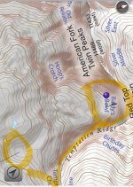
. What does the naming mean about the providence of the Baldy name in general? Since here it is possessive, does that mean Baldy was a Mormon pioneer or miner, rather than a generic name given to an alpine peak?
 
Baldy is about as generic a mountain name as you can get. There are 3 Mt. Baldy ski areas: California, B.C. and Ontario. I'm guessing that Alta and Sun Valley are not the only other places with peaks named "Mt. Baldy." I have no idea why that patrol map uses the possessive name for the bowl above Gad 2.
 
Many on this forum might have already skied this line, but for those who have not, I give two enthusiastic thumbs up. It can be accessed by a 25-45 minute boot pack to looker right when exiting gad 2; the ridge line is a relatively easy hike with minimal exposure and the line itself is likely 2x as long and wide as the scythe found on Wolverine cirque. It starts around 40 degrees? Then flows to a large apron which ultimately empties back into the base of little cloud. From the top of red stack there are lots of options for an extended tour to the west including the red and white baldy peaks.

I wonder if pipeline can be accessed from this side as well? Chime in if you know!
 
Back
Top