Vermont Snow Updates 2008-09

J.Spin":31xawo2o said:
Here are some of the latest snowfall updates I've seen from the area:

Jay Peak: 8” (5:30 P.M.)
Stowe: 7” (9:37 A.M.)
Mt. Mansfield Stake: 12” (5:47 P.M., ~3,700’)
Bolton Valley: 6” (9:40 A.M., 3,150’)
Mad River Glen: 3” (8:00 A.M.)
Sugarbush: 6” (8:48 A.M.)
Killington: 10” (Peak)
Okemo: 3” (9:28 A.M.)

It's pretty impressive to see that there's still a foot of snow at the stake even after some settling, although they may have gotten some additional snow through the day due to upslope. For those that would like to get some Mansfield visuals, Joshua Auerbach had some pictures from Mt. Mansfield along with his SkiVT-L trip report from today. There was a lot of talk about the Adirondacks getting hammered with this storm, and if the snow stuck around, we were thinking of heading across the lake to Whiteface with the boys for some turns. But, the latest news I've heard is that Whiteface received accumulations similar to Mt. Mansfield, so we would probably just stick around locally for skiing.

-J

Whiteface is reporting 14'' overnight, although it has been snowing all day and total accumulations are likely more at this point. Nice report here: http://forums.alpinezone.com/40063-whit ... -08-a.html
 
jasoncapecod":3bnp87r0 said:
How does Hunter come in with just over a foot, and Windham , which is around 3miles away as the crow flies. Comes in with 27... :bs:

To quote Sheffy:

After over 6,000 vertical of skinning/skiing, we can confirm, it's for real

IMGP3787.JPG


IMGP3788.JPG


IMGP3789.JPG


All photos: http://picasaweb.google.com/jshefftz/20081029Windham#
 
Thursday, October 30th, 2008: 6:00 A.M. update from Waterbury, VT

New Snow: 1.0 inches
Liquid Equivalent: 0.08 inches
Snow/Water Ratio: 12.5
Snow Density: 8.0% H2O
Temperature: 32.5 F
Humidity: 76%
Dew Point: N.D.
Barometer: 30.18 in. Hg
Wind: Calm
Sky: Light Snow
Cumulative storm snow total: 1.5 inches
Cumulative storm frozen liquid total: 0.27 inches
Cumulative storm liquid total: 1.13 inches
Season liquid total: 1.13 inches
Current snow at the stake: 1 inch
Season snowfall total: 1.5 inches


We picked up more snow overnight here in the valley, and in our location we’ve certainly got a more substantial coating on the ground than last night. The snow is also much drier in this round, as indicated by the water content (8% H2O). It must have all fallen into cold air because there wasn’t any slush on the bottom and it just slid right off the snowboard. We continue to have steady, light snowfall outside, and we’ve picked up another couple of tenths in the past half hour so the snowfall is running a bit under 0.5 inches/hour. It certainly looks like this is upslope snowfall so it will be interesting to see how the mountains are doing.

J.Spin
 
takeahike46er":3bzbz2nl said:
Whiteface is reporting 14'' overnight, although it has been snowing all day and total accumulations are likely more at this point. Nice report here: http://forums.alpinezone.com/40063-whit ... -08-a.html

My friends poached WF last night as well.

Shefftz emailed me about going to Windham the other day. I didn't think driving out from here would have been worth it, but his drive was about the same distance and from what you'll see, it seemed to be worth it. I could never keep up with him anyway...that guy is a power house (rando racer).

If I had a ready and willing partner to do the adventure with (AC has kids and a wife, so he's strapped) I might have been convincable, but people here just don't have that kind of desire or ability to just drop everything and go chase the snow and I won't do it alone. I've got time, and not much holding me back, but I need companionship to make it happen.
 
With 1.2 inches of additional snow at the house this morning that appeared to be upslope in nature, it seemed obvious that the mountains we be getting in on another good shot so I headed up to Stowe for a few turns. I skinned up Perry Merrill, and in terms of snow depth there is a lot more now than what I was hearing about in reports from yesterday. It’s certainly skin right from your car now if you want to. I’d say there had to be at least 6 inches of snow at the parking lot level (~1,600’), but probably more because as soon as I hit the bottom of Perry Merrill a few minutes after leaving the lot, I was getting snow depth measurements between 9 and 11 inches as I skinned up climbers left. That depth stayed pretty consistent until about 2,600’ when it started to increase. At that point I was getting pretty consistent measurements of 12 inches or so, however, the wind started at around that elevation so there were a few scoured areas, but lots of spots with depths in the mid teens of inches. I stopped at the gondola waterfall level because I looked up and saw that Perry Merrill above me was getting scoured. I pulled off into some trees to get out of the wind and prepare for my descent, and I sunk up to my waist in snow. I stuck my pole in and measured 33 inches of depth there (drifted of course). The first 600’ of the descent (3,200’-2,600’) was where the wind was, and the powder was wind affected so it was decent but not fabulous on my rock skis which are pretty long and skinny. Below that though, the powder hadn’t seen any wind and it was fantastic. I could have been on a pair of 2 x 4s at that point and it wouldn’t have mattered. The snow seemed to get a bit shallower in the last few hundred vertical, but it was still quite good. I touched down 2 or 3 times, but one could easily go without rock skis and it wouldn’t be much of a problem. I’m sure other parts of the mountain featured different conditions, but that’s the lowdown on Perry Merrill. Tomorrow should be fantastic, since it stayed rather cool and cloudy/snowy all day in the mountains and there might be some sun tomorrow.

A few pictures from the morning are inserted below.

J.Spin

30OCT08B.jpg


30OCT08C.jpg


30OCT08A.jpg


30OCT08D.jpg
 
We headed up to Mt. Mansfield this afternoon for some turns with the boys, so here’s a conditions update. Friday was warm with some sun, and that seemed to melt out the fairly minimal accumulations left in the lower valleys. We were in Burlington overnight until Saturday morning, and coming back to Waterbury around noon today temperatures were in the upper 30s F. There was no snow visible anywhere immediately along the route from Burlington to Waterbury, and I couldn’t even spot any snow up in the local hills as high as 2,000’. By mid afternoon the valley temperature was into the 40s F, but the air still seemed pleasantly cool. Driving to Stowe we didn’t find any snow through Waterbury Center, and I was worried that we weren’t going to find any snow at all when we looked up at the Worcester Range and couldn’t see any obvious snow up at the top of Mt. Hunger which is above 3,500’. From our first views of Mansfield we could see that the higher elevations certainly had a lot of white though, and our fears were allayed a bit more as we got into the Moscow/Stowe area and started to see patches of snow along the road in shaded areas, even below 1,000’. Once we approached the Mt. Mansfield area, we could see that Spruce Peak wasn’t going to be a practical option, as it was half melted out due to its southern exposure. Once we got up in the Toll House area though (a bit over 1,000’) it was obvious that there was going to be snow on the Mansfield side of the resort because event the trails at the bottom of the Toll House had skiable snow. It was getting rather patchy there, but up at the main mountain things looked a lot better. I’m always amazed at Mansfield’s ability to accumulate and retain snow. Grassy areas were appearing on the gondola trails which get more sun, so I decided that we’d head up above the Mansfield Base Lodge. We hiked up to the base of the Mountain Triple above the lodge, and then started skinning from there. There are still several inches of snow at that elevation, and although one doesn’t need to skin up as the snow is much more consolidated than Wednesday/Thursday, you can still safely skin from the bottom if you want to. E and I skinned up and the boys used snowshoes while we carried their skis so they could use them for the descent. We only went up a couple hundred vertical since we were limited by Dylan’s range, but the snow we encountered (all below 2,000’) was decent for skiing. There had certainly been some thaw/freeze, but we just encountered about the top inch of the snow being thick, without any real crust. Below that top layer of snow was snow of a dry sugar/granular consistency down to the ground. I think being in the lower elevations helped because based on Roger’s report from today it sounds like the higher elevations had frozen up to a great degree. There’s still plenty of snow on Mansfield for those that want to ski there, and more sun tomorrow might mean there will be some softened stuff if you choose the right aspect and elevation (mountain high temperatures are predicted to be in the 30s F). It looked like the mountain was actually making snow up near the top of the quad as we were driving up in the mid to late afternoon, but I couldn’t tell for sure. There’s also lift-served skiing at Killington tomorrow, so there are plenty of local options for getting out on the snow. I added one quick picture from today for a sense of the coverage on Lower Tyro.

01NOV08A.jpg


J.Spin
 
We headed up to Bolton Valley this morning to get our passes, and here’s the current snow situation up there. Ascending the access road, the first patches of snow along the edges appear at a bit over 1,000’, about the elevation of the V.A.S.T parking area. The trails at the Timberline base (rising from ~1,550’) had little snow, just some patchy coverage in the shaded areas. Small snowbanks were present along the access road above that point. The trails above the village (~2,150’+) on the main mountain have only about one to perhaps a few inches of snow, and it is fairly well distributed in terms of exposure, but patchy like we saw at Spruce Peak yesterday. Mansfield certainly has a lot more coverage than Bolton does right now, but there are at least some large enough areas up at Bolton for sledding, playing with the kids, etc.

J.Spin
 
We were running about 40 F at the house last night at our place in Waterbury (495’) and when I left this morning at around 6:00 A.M. we had just rain with no detectable snow mixing in. The situation was the same all the way to here on the hill in Burlington (380’) but it was definitely a cold rain. About mid morning, glimpses of the mountains began to appear and there is a nice white coating from about 1,000’ on up from the Sugarbush area continuously through to Mt. Mansfield.

I haven't seen any official reports from the resorts yet, but here are a few additional snow updates from SkiVT-L:

Underhill

Killington

Some VT Web Cams

J.Spin
 
Monday, November 10th, 2008: 6:00 P.M. update from Waterbury, VT

New Snow: 0.1 inches
Liquid Equivalent: N.D.
Snow/Water Ratio: N.D.
Snow Density: N.D.
Temperature: 32.9 F
Humidity: 98%
Dew Point: 32.2 F
Barometer: 30.00 in. Hg
Wind: Calm
Sky: Cloudy
Storm snow total: 0.1 inches
Storm frozen liquid total: N.D.
Season frozen liquid total: 1.13 inches
Current snow at the stake: 0 inches
Season snowfall total: 1.8 inches

Based on what I saw in Burlington today and a snow level that appeared to be in the 1,000’ range, I didn’t expect to have any accumulation to report this evening. But, when I got off the bus at the Waterbury park and ride (500’), I was surprised to see a touch of snow on the grass. There was a thick crusty coating of snow on all the cars in the parking lot, and it took me several minutes to scrape and defrost my car, even though the air temperature was reading 36 F. Back at the house (495’), I didn’t find any accumulation on the grass, but there was a tenth of an inch of refrozen snow on the snowboard and the temperature was in the 34-35 F range. It was just raining when I left this morning, but it must have changed over to snow even down at this elevation for a bit. From what I heard, it snowed rather intensely with huge flakes in some of the valleys when the changeover did occur, so I wonder what we accumulated before the melting. I checked the evening hydrologic observations and Mt. Mansfield picked up 8 inches today, which is fairly impressive for being not much of an event. Sugarbush was reporting a similar amount in their report from this morning.

I’ve only found a few ski areas reporting accumulations; I’m guessing Stowe/MRG must have taken theirs at low elevation in combination with the early hour?

Stowe: 0.5 inches (7:00 A.M.)
Mt. Mansfield Stake: 8 inches (5:21 P.M., ~3,700’)
Mad River Glen: 2 inches (8:00 A.M.)
Sugarbush: 8 inches (9:29 A.M.)
Killington: 1 inch

J.Spin
 
There’s no new snow accumulation to report from our house (495’) this morning, and the temperature, although dropping down close to 32 F yesterday evening, was sitting at around 34 F. However, there was a skiff of new snow on the ground and flurries in the air as I crossed over I-89 to get to the Waterbury Park and Ride (500’). There were cars around with a couple of inches of snow on them again, although not necessarily from last night. There was enough light this morning and the cloud deck was high enough (~2,000’ – 3,000’) that I could get a sense of where the more obvious snow line sat as I passed through the spine of the Greens. I could see snow down below 1,000’, generally down to about 750’ through the Waterbury area, although the lowest elevation accumulations were quite sparse there. As I passed by the Robbins Mountain area I could see snow all the way down to the bottom of the valley (~300’) on the north-facing aspects, and a consistent covering on the south side of a field at the base of the mountain. From what I can see of them, the higher peaks are looking really nice this morning; we’ve even got some flurries going on here in Burlington (380’) right now (~7:30 A.M.).

J.Spin
 
There was more snowfall in the area yesterday, and from my office I could see the clouds and snow backed up against the mountains a lot of the time. Scott Braaten sent us a Stowe snow update with some pictures at SkiVT-L, and the coverage on the trails was looking at least decent again. Christian T was up on the mountain for some turns and sent in a quick trip report to SkiVT-L; it sounds like the skiing was pretty good albeit not quite at the level of our previous storm. I heard there was snow for much of the day on the mountain, and when the stake report came out yesterday evening they were indicating 3.5 inches new, so I'd say Mansfield has probably seen a foot of snow or so up high from this little event. This morning, our temperature at the house (495') was in the upper 20s F and it stayed roughly in that range as I drove to Burlington. It sounds like those resorts that are making snow were able to go at it last night and supposedly they will again tonight. The weather was clear this morning and the views of the higher elevations were stupendous; passing through the spine of the Greens the snow accumulations were still down to around the 1,000' elevation on the north-facing slopes that I looked at. The latest I've heard is that Killington is not planning to run its lifts this weekend, but there should still be plenty of snow for some skiing at the resorts that built up their manmade depths.

J.Spin
 
Ty and I headed up to Mt. Mansfield for some turns today so here’s a weather and ski conditions update. We left the house (495’) at around 11:30 A.M. to a temperature of 47 F, mostly cloudy skies, and a few sprinkles. With no snow visible in any of the valleys, it was again one of those situations where I wondered if we were even going to be able to ski, but as soon as we were in Waterbury Center we got a glimpse of Mt. Mansfield and could see that there was plenty of white up high on the mountain. Aside from the few sprinkles we saw, there was little if any precipitation as we traveled through Waterbury Center, until we got to Moscow (680’). I thought my eyes were playing tricks on me, as I could have sworn I saw a few flakes as we passed through Moscow, but when I looked at the thermometers in my car, both of them were reading a steady 44 degrees F. That felt a little warm to be seeing real snow, but it was in fact snow I’d seen because within a few minutes those flakes were followed by countless others and it was legitimately snowing. The temperature remained steady at 44 F, and there was very light snow, until we started to gain elevation (>1,000’) during that last stretch to the mountain. By the time we’d reach the base area elevations (~1,500’) the temperature had dropped to around 40 F and the snow was coming down light and steady. We stopped over and parked briefly above the Stowe Mountain Lodge to get a view of the Mansfield trails and assess the snow situation. On Stowe’s website, they indicated that they had made snow down North Slope as low as Crossover (~2,000’), and from what we could see that was as low as the snow went. The snow in the 2,000’ – 2,400’ elevation range was only patches left over from snowmaking whales, although coverage was clearly more continuous as soon as one hit the ~2,400’ mark on North Slope and headed off to climber’s right.

16NOV08B.jpg


We hiked up North Slope among the snow patches, and the snow we encountered in the patches was all corn at that point. Snow continued to fall at a temperature of about 40 F as we ascended, and the falling snow was only sticking to the patches of old snow, not to the grass. Up above the ~2,400’ mark the patches started to become nearly continuous snow as it had appeared from afar, and we hiked up to ~2,700’ before making our descent. My thermometer was reading 31 F at that point and the snow was starting to firm up. Up at that elevation, the new snowfall was even accumulating on the grass in addition to the leftover snow on the trail. The snow hadn’t totally frozen up for our descent, but it was certainly getting hard due to the falling temperatures. Thus the skiing was nothing too spectacular, but it was at least decent for making some turns. Right around 2:00 P.M. during out descent, we could tell that they had pressurized the snowmaking lines because we heard them come on. On our way down the snow (a lot of graupel in there too) was sticking at all elevations down to the base, and the temperatures were in the mid 30s F. Back down near the Stowe Village it was still snowing, and when we got back to the house at around 3:30 P.M. it was roughly 40 F. My wife said that it had actually snowed at the house not too long after we’d left.

16NOV08C.jpg


J.Spin
 
I’m not sure how much snow Mt. Mansfield picked up from yesterday’s activity, but there is a newly-visible snow line at around 3,000’ this morning. In the valley we were mostly clear this morning so the most I’ve seen there were a few flurries when I was leaving the house in Waterbury.

J.Spin
 
It snowed all day yesterday at Jay... They must have picked up a trace to an inch... Coverage is a lot better for the 2 trails they fired guns on last week... Haynes is skiable from side to side all the way to "Mont L'intrepide". Jet has also great cover 2/3 down. They fired the guns back at 1-2PM yesterday and should keep them on for a while... Opening weekend is upon us!

I'll have a short TR of our weekend on the slopes... pics and vids as well.
 
Tuesday, November 18th, 2008: 6:00 A.M. update from Waterbury, VT

New Snow: 0.4 inches (snow/graupel)
Liquid Equivalent: 0.01 inches
Snow/Water Ratio: 40
Snow Density: 2.5%
Temperature: 28.0 F
Humidity: 74%
Dew Point: 18.6 F
Barometer: 30.15 in. Hg
Wind: Calm
Sky: Light Snow
Storm snow total: 0.4 inches
Storm liquid equivalent total: 0.01 inches
Current snow at the stake: Trace
Season snowfall total: 2.2 inches

Last night I was heading back from Burlington to Waterbury, noting the presence of stars and eventually the moon through broken clouds, so I was surprised when I was passing through the French Hill area in Williston and was hit by a brief period of snowfall. That’s all I saw for precipitation on that trip however. This morning I woke up to find that we’d accumulated some snow at the house though, so I took my usual collection of readings. I got a call from my wife at around 6:30 A.M. and she alerted me that the exit 7 through 10 region (Waterbury-Montpelier) of I-89 was closed to traffic due to snow/ice on the road and some accidents, and I soon heard the same news on the radio. There were no traffic problems on Route 2 in my direction toward Burlington, but there certainly was snowfall and accumulation. I left the house at around 7:00 A.M. amidst light snowfall composed of snowflakes in the 1-3 mm range and a lot of graupel, and as I passed through Bolton it intensified to moderate and the graupel on the windshield was making quite a racket. The road was really covered with snow and the visibility dropped, and these two factors together made the driving a little more difficult. Through Jonesville and Richmond the snowfall was generally light with occasional bursts of moderate intensity, and the composition of the snowfall had changed. There was no obvious graupel, and some of the snowflakes were notably larger, perhaps 5-7 mm in diameter at the high end. It appeared as though the snowfall was tapering off as I passed through the very center of Richmond, but as soon as I passed to the west of town the snowfall re-intensified to moderate. Visibility was again difficult with the heavier snowfall in the form of larger flakes, and it stayed this way onto I-89 and up to the top of French Hill where things finally started to taper off. In the Burlington area it’s been snowing lightly/flurrying, but not with the intensity that I saw out in the foothills and mountain areas. Throughout my route, I saw snow accumulations up to perhaps and inch, with generally just a skiff of snow in Burlington proper, and the temperatures were consistently in the 28-29 F range.

J.Spin

Wxsig.jpg
 
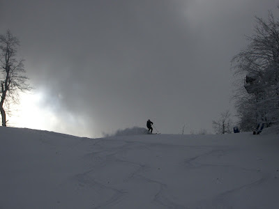
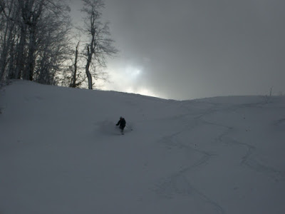
I just noticed that our snowfall had reintensified here in Burlington, and after a peek at the radar it appears as though Lake Champlain is going into effect with the more northerly wind. This won't likely affect the mountains much, but it should be fun for those that want to watch a bit of snow in Burlington.

Radar link:

http://tinyurl.com/ydo3c3

AREA FORECAST DISCUSSION
NATIONAL WEATHER SERVICE BURLINGTON VT
714 AM EST TUE NOV 18 2008

.SYNOPSIS...
COLDER AIR WILL CONTINUE FLOWING INTO THE REGION AND REMAIN OVER
THE REGION FOR THE REST OF THE WEEK. MEANWHILE...AN UPPER LEVEL
TROUGH WILL REMAIN OVER THE AREA...RESULTING IN QUITE A BIT OF
CLOUDS AND THE CONTINUED CHANCE FOR A FEW SNOW
SHOWERS...ESPECIALLY OVER THE HIGHER TERRAIN. THERE WILL ALSO BE
SOME SNOW SHOWERS IN THE VICINITY OF LAKE CHAMPLAIN THROUGH
WEDNESDAY.

&&

.NEAR TERM /UNTIL 6 PM THIS EVENING/...


-- Changed Discussion --
AS OF 710 AM EST TUESDAY...HAVE JUST ISSUED A ZONE UPDATE FOR
SNOW SHOWERS THIS MORNING...MAINLY ON THE NORTHERN WESTERN SLOPES
OF VERMONT. AROUND 1 TO 2 INCHES OF SNOW IS POSSIBLE IN LOCALIZED
AREAS WHERE MORE PERSISTENT SNOW FALLS THIS MORNING. THE FLOW
WILL TURN TO NORTH AND THE UPSLOPE SNOW SHOWERS WILL CHANGE TO
LAKE CHAMPLAIN LAKE EFFECT SNOW SOUTH OF THE LAKE.
PREVIOUS
DISCUSSION FOLLOWS.

UPPER LEVEL TROF CONTINUES TO MOVE ACROSS THE AREA TODAY...COLD
CANADIAN AIR CONTINUES TO STREAM INTO THE REGION. UPPER LEVEL LOW
GETS CUT OFF FROM TROF AND DROPS SOUTH AND OFF THE COAST OF THE
MID ATLANTIC STATES TODAY. NNW FLOW WILL CONTINUE ACROSS THE AREA
AND SOME UPSLOPE SNOW SHOWERS...ESPECIALLY ON THE NW FACING
SLOPES...ARE EXPECTED. ALSO...LAKE EFFECT SNOW SHOWERS SOUTH AND
JUST EAST OF SOUTH OF THE LAKE WILL DEVELOP ON STRONG NNW
WINDS....MAINLY ACROSS ADDISON AND CHITTENDEN COUNTIES IN VT.

LAKE TEMPERATURE STILL IN THE UPPER 40S AND MAX TEMPS TODAY ONLY
IN THE MID 30S WILL CREATE PLENTY OF INSTABILITY FOR SOME LAKE
ENHANCED SNOW SHOWERS. MAX TEMPERATURES WILL CONTINUE TO RUN
ABOUT 10 DEGREES BELOW NORMAL FOR THIS TIME OF YEAR.

-- End Changed Discussion --

.SHORT TERM /6 PM THIS EVENING THROUGH THURSDAY/...
AS OF 415 AM EST TUESDAY...NORTHERLY FLOW CONTINUES INTO TONIGHT.
THE LAKE EFFECT SNOW BAND WILL BECOME MORE CONFINED TO WESTERN
ADDISON AND SW CHITTENDEN COUNTIES...WITH THE BAND EXTENDING
SOUTH INTO RUTLAND COUNTY. SOME LOCALIZED ACCUMULATING SNOWS CAN
BE EXPECTED WITH THIS EVENT.
CONDITIONS WILL BECOME LESS
FAVORABLE FOR LAKE EFFECT SNOW ON WEDNESDAY AS TROF MOVES EAST OF
THE AREA AND WEAK RIDGING DEVELOPS...SO EXPECT ANY SNOW SHOWER
ACTIVITY TO DIMINISH. SURFACE HIGH PRESSURE WILL TRY TO RIDGE
INTO THE AREA FROM THE SOUTHWEST. NEXT SHORTWAVE APPROACHES FROM
THE GREAT LAKES REGION WED NITE...SO ANY CLEARING WILL BE SHORT
LIVED.
 
Tuesday, November 18th, 2008: 8:30 P.M. update from Waterbury, VT

New Snow: 0.1 inches
Liquid Equivalent: N.D.
Snow/Water Ratio: N.D.
Snow Density: N.D.
Temperature: 21.0 F
Humidity: 73%
Dew Point: 11.3 F
Barometer: 30.24 in. Hg
Wind: Calm
Sky: Clear
Storm snow total: 0.5 inches
Storm liquid equivalent total: 0.01 inches
Current snow at the stake: Trace
Season snowfall total: 2.3 inches

It snowed much of the day in Burlington, at least some of it due to the Lake Champlain effect, and when I left in the evening the accumulations appeared to be around an inch. I stopped in at Taft Corners in Williston, where I’d say they had a more substantial coating that was probably close to 2 inches. The consistent covering of snow was retained until about the center of Richmond, where it really started to taper off quickly. By the time I got to Waterbury there was almost no accumulation, with just a dusting left on our lawn and 1/10 of an inch on the snowboard. Coming from the north, my wife said that there was an inch or two of accumulation in Morrisville, and it tapered off around Waterbury, so it appears as though the Waterbury/Bolton/Jonesville area was in between some of the more substantial upslope and lake effect snows. Below, I’ve added a few of the mountain accumulations I’ve seen reported.

Jay Peak: 6 inches (12:15 P.M.)
Stowe: 3 inches (11:00 A.M.)
Mt. Mansfield Stake: 3 inches (5:21 P.M.)
Bolton Valley: 3 inches
Mad River Glen: 1 inch (8:00 A.M.)
Sugarbush: 3 inches (7:55 A.M.)
Killington: 6 inches
Okemo: 3 inches (2:24 P.M.)

J.Spin
 
The "snow comes from snowguns" variety at Killington was the fairly firm base building variety today. I went out expecting chalky talcum powder after all this cold weather and got mostly hardpack. Still... it's better than NOT skiing.
 
Back
Top