A
Anonymous
Guest
Its not important enough to publish a full blown weather forecast although this came pretty close to being one. But for the east coast weather watchers here's my forecast/ideas on Mon-Wed:
We have an extremely tricky forecast for the next 72 hours. The first 24
hours isn't that difficult. Cold. Temps should be below zero in most
mountain valleys with everywhere else in the single digits.
Clouds will increase on Monday with snow breaking out across central NY
early in the day and progressing into the Capital District of Albany,
Catskills, Berkshires, and Southern Greens by afternoon. Snow will also
reach into the Adirondacks and then into the northern Greens at night.
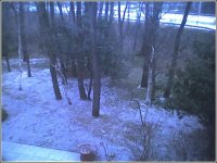
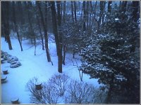
Snowfall by Monday evening will be 1-3 inches across the Catskills,
Adirondacks, Berkshires, and southern Greens. Snow will continue lightly
overnight on Monday. Precip will take a break in the south as first batch
moves northward into the northern Greens. Look for 1-3 inches by Tuesday
morning in the northern 'dacks and Greens from the first batch of
precipitation.
Then the real show gets going. Strong lift and moisture inflow from the
Gulf and Atlantic will result in the main batch of precip moving in during
Tuesday morning. This strong high pressure system over us now bringing
the cold air will be key to preventing plain rain for the majority of this
storm system. Look for sleet/freezing rain in the Catskills and
Berkshires to change to plain rain early on Tuesday after some minor icing
on top of the few inches of snow on Monday. As precipitation moves into
the north country of NY and VT it will start in the form of snow. It will
change to sleet and freezing rain first in the lower Champlain Valley,
then northern Champlain Valley and Adirondacks by noon on Tuesday. Snow
mixed with sleet will continue over the Central and Northern Green
Mountains through Tuesday afternoon with the chance for 2-6 inches of
snow/sleet depending on how much falls as sleet vs. snow. As far as
snowfall goes the real winner will probably be in northern NH or Maine
with 4-8 possible total there (See forecast below).
By the time darkness comes on Tuesday, all precip will have changed over
to sleet/freezing rain or rain. Sleet and Freezing rain will hang on in
the Green Mountains much longer than in the Adirondacks and Champlain
Valley based on the movement of the low pressure system and associated
warm low level winds. The Northeast Kingdom of Vermont could see some
significant icing Tuesday night on top of the snowfall. Precipitation
will change to all rain by 8pm on Tuesday eveywhere but the northeast
kingdom. Rain shouldn't be too destructive as temps shouldn't get above
35-40.
Basic Forecast:
Catskills,Berkshires,Southern VT:
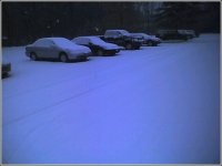
Monday: Light snow. Accumulations 1-3 inches.
Monday Night: Light snow changing to sleet and freezing rain.
Tuesday: Sleet/Freezing rain changing to rain by 8am in Catskills and 11am
in southern VT. Light Icing possible.
Adirondacks:
Monday: Light snow in the afternoon and evening. 1-2 inches accumulations.
Monday Night: Light snow tapers off late. Another inch or so accumulation.
Tuesday: Snow and Sleet breaking out again. Mixing with and changing to
freezing rain and rain by 1pm then all rain by 3pm. Accumulations of 1-2
inches followed by light icing.
Green Mountains from Killington North:
Monday: Cloudy with light snow possible by evening. Up to an inch near
Killington.
Monday Night: Light Snow. Accumulations of another 1-2 inches with the
most in the south.
Tuesday: Snow. Changing to Sleet and Freezing rain in the afternoon.
Accumulations of 2-6 inches depending on how early sleet mixes in.
Changing to rain by evening.
White Mountains and Sunday River/Sugarloaf region:
Monday: Becoming cloudy.
Monday Night: Light Snow possible late. A dusting to an inch possible.
Tuesday: Snow breaking out by noon. Snow and Sleet in the afternoon
possibly changing to freezing rain late. Accumulations of 3-6 inches.
Tuesday Night: Snow, Sleet, Freezing rain changing to rain after
midnight. Another 1-2 inches possible.
-Scott Braaten
ps: As a note, I might be a little high on the snow forecasts across the
north on Monday and Monday night as you'll notice the NWS does not have
any accums and only a chance of snow for the Adirondacks and Green
Mountains. I'm worried that this cold airmass might be too dry to support
accumulating snows and only flurries...however, with that said, looking at
latest model guidance I'm inclined to go with slightly more snow with the
first batch of precip than the NWS has in their forecasts.
We have an extremely tricky forecast for the next 72 hours. The first 24
hours isn't that difficult. Cold. Temps should be below zero in most
mountain valleys with everywhere else in the single digits.
Clouds will increase on Monday with snow breaking out across central NY
early in the day and progressing into the Capital District of Albany,
Catskills, Berkshires, and Southern Greens by afternoon. Snow will also
reach into the Adirondacks and then into the northern Greens at night.
Snowfall by Monday evening will be 1-3 inches across the Catskills,
Adirondacks, Berkshires, and southern Greens. Snow will continue lightly
overnight on Monday. Precip will take a break in the south as first batch
moves northward into the northern Greens. Look for 1-3 inches by Tuesday
morning in the northern 'dacks and Greens from the first batch of
precipitation.
Then the real show gets going. Strong lift and moisture inflow from the
Gulf and Atlantic will result in the main batch of precip moving in during
Tuesday morning. This strong high pressure system over us now bringing
the cold air will be key to preventing plain rain for the majority of this
storm system. Look for sleet/freezing rain in the Catskills and
Berkshires to change to plain rain early on Tuesday after some minor icing
on top of the few inches of snow on Monday. As precipitation moves into
the north country of NY and VT it will start in the form of snow. It will
change to sleet and freezing rain first in the lower Champlain Valley,
then northern Champlain Valley and Adirondacks by noon on Tuesday. Snow
mixed with sleet will continue over the Central and Northern Green
Mountains through Tuesday afternoon with the chance for 2-6 inches of
snow/sleet depending on how much falls as sleet vs. snow. As far as
snowfall goes the real winner will probably be in northern NH or Maine
with 4-8 possible total there (See forecast below).
By the time darkness comes on Tuesday, all precip will have changed over
to sleet/freezing rain or rain. Sleet and Freezing rain will hang on in
the Green Mountains much longer than in the Adirondacks and Champlain
Valley based on the movement of the low pressure system and associated
warm low level winds. The Northeast Kingdom of Vermont could see some
significant icing Tuesday night on top of the snowfall. Precipitation
will change to all rain by 8pm on Tuesday eveywhere but the northeast
kingdom. Rain shouldn't be too destructive as temps shouldn't get above
35-40.
Basic Forecast:
Catskills,Berkshires,Southern VT:
Monday: Light snow. Accumulations 1-3 inches.
Monday Night: Light snow changing to sleet and freezing rain.
Tuesday: Sleet/Freezing rain changing to rain by 8am in Catskills and 11am
in southern VT. Light Icing possible.
Adirondacks:
Monday: Light snow in the afternoon and evening. 1-2 inches accumulations.
Monday Night: Light snow tapers off late. Another inch or so accumulation.
Tuesday: Snow and Sleet breaking out again. Mixing with and changing to
freezing rain and rain by 1pm then all rain by 3pm. Accumulations of 1-2
inches followed by light icing.
Green Mountains from Killington North:
Monday: Cloudy with light snow possible by evening. Up to an inch near
Killington.
Monday Night: Light Snow. Accumulations of another 1-2 inches with the
most in the south.
Tuesday: Snow. Changing to Sleet and Freezing rain in the afternoon.
Accumulations of 2-6 inches depending on how early sleet mixes in.
Changing to rain by evening.
White Mountains and Sunday River/Sugarloaf region:
Monday: Becoming cloudy.
Monday Night: Light Snow possible late. A dusting to an inch possible.
Tuesday: Snow breaking out by noon. Snow and Sleet in the afternoon
possibly changing to freezing rain late. Accumulations of 3-6 inches.
Tuesday Night: Snow, Sleet, Freezing rain changing to rain after
midnight. Another 1-2 inches possible.
-Scott Braaten
ps: As a note, I might be a little high on the snow forecasts across the
north on Monday and Monday night as you'll notice the NWS does not have
any accums and only a chance of snow for the Adirondacks and Green
Mountains. I'm worried that this cold airmass might be too dry to support
accumulating snows and only flurries...however, with that said, looking at
latest model guidance I'm inclined to go with slightly more snow with the
first batch of precip than the NWS has in their forecasts.